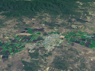
Gatton is a rural town and locality in the Lockyer Valley Region, Queensland, Australia. It is the administrative centre of the Lockyer Valley Region, situated in the Lockyer Valley of South East Queensland.

Forest Hill is a rural town and locality in the Lockyer Valley Region, Queensland, Australia. In the 2021 census, the locality of Forest Hill had a population of 935 people.

Ma Ma Creek is a rural town and locality in the Lockyer Valley Region, Queensland, Australia. In the 2021 census, the locality of Ma Ma Creek had a population of 155 people.
Flagstone Creek is a rural locality in the Lockyer Valley Region, Queensland, Australia. In the 2021 census, Flagstone Creek had a population of 256 people.

Fordsdale is a rural locality in the Lockyer Valley Region, Queensland, Australia. In the 2021 census, Fordsdale had a population of 50 people.

West Haldon is a locality split between Toowoomba Region and Lockyer Valley Region in Queensland, Australia. In the 2021 census, West Haldon had a population of 63 people.
Adare is a rural locality in the Lockyer Valley Region, Queensland, Australia. In the 2021 census, Adare had a population of 1,027 people.

Caffey is a rural locality in the Lockyer Valley Region, Queensland, Australia. In the 2021 census, Caffey had a population of 45 people.

College View is a rural locality in the Lockyer Valley Region, Queensland, Australia. In the 2021 census, College View had a population of 72 people.
Morton Vale is a rural locality in the Lockyer Valley Region, Queensland, Australia. In the 2021 census, Morton Vale had a population of 114 people.

Upper Tenthill is a rural locality in the Lockyer Valley Region, Queensland, Australia. In the 2021 census, Upper Tenthill had a population of 273 people.
Woodlands is a rural locality in the Lockyer Valley Region, Queensland, Australia. In the 2021 census, Woodlands had a population of 119 people.
Spring Creek is a rural locality in the Lockyer Valley Region, Queensland, Australia. In the 2021 census, Spring Creek had a population of 494 people.
Vinegar Hill is a rural locality in the Lockyer Valley Region, Queensland, Australia. In the 2021 census, Vinegar Hill had a population of 57 people.
Crowley Vale is a rural locality in the Lockyer Valley Region, Queensland, Australia. In the 2021 census, Crowley Vale had a population of 106 people.

Laidley North is a rural locality in the Lockyer Valley Region, Queensland, Australia. In the 2021 census, Laidley North had a population of 593 people.

Lockyer Waters is a rural locality in the Lockyer Valley Region, Queensland, Australia. In the 2021 census, Lockyer Waters had a population of 538 people.
Seventeen Mile is a rural locality in the Lockyer Valley Region, Queensland, Australia. In the 2021 census, Seventeen Mile had a population of 22 people.
Veradilla is a rural locality in the Lockyer Valley Region, Queensland, Australia. In the 2021 census, Veradilla had a population of 125 people.
Mount Hallen is a rural locality in the Somerset Region, Queensland, Australia. In the 2021 census, Mount Hallen had a population of 457 people.


