
Mount Glorious is a rural locality in the City of Moreton Bay, Queensland, Australia. In the 2016 census, Mount Glorious had a population of 296 people.
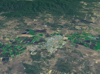
Gatton is a rural town and locality in the Lockyer Valley Region, Queensland, Australia. In the 2016 census, the locality of Gatton had a population of 7,101 people.

Laidley is a rural town and locality in the Lockyer Valley Region, Queensland, Australia. In the 2016 census, the locality of Laidley had a population of 3,808 people.
Blanchview is a rural locality in the Lockyer Valley Region, Queensland, Australia. In the 2021 census, Blanchview had a population of 202 people.

Lockrose is a rural locality split between the Lockyer Valley Region and Somerset Region of Queensland, Australia. In the 2021 census, Lockrose had a population of 564 people.
Flagstone Creek is a rural locality in the Lockyer Valley Region, Queensland, Australia. In the 2021 census, Flagstone Creek had a population of 256 people.

Mount Whitestone is a rural locality in the Lockyer Valley Region, Queensland, Australia. In the 2016 census, Mount Whitestone had a population of 154 people.

Fordsdale is a rural locality in the Lockyer Valley Region, Queensland, Australia. In the 2021 census, Fordsdale had a population of 50 people.

West Haldon is a locality split between Toowoomba Region and Lockyer Valley Region in Queensland, Australia. In the 2021 census, West Haldon had a population of 63 people.

Palen Creek is a rural locality in the Scenic Rim Region, Queensland, Australia. It borders New South Wales. In the 2016 census, Palen Creek had a population of 280 people.
Lefthand Branch is a rural locality in the Lockyer Valley Region, Queensland, Australia. In the 2021 census, Lefthand Branch had a population of 69 people.
Lake Clarendon is a rural locality in the Lockyer Valley Region, Queensland, Australia. In the 2021 census, Lake Clarendon had a population of 294 people.

Mount Sylvia is a rural locality in the Lockyer Valley Region, Queensland, Australia. In the 2016 census, Mount Sylvia had a population of 106 people.

Caffey is a rural locality in the Lockyer Valley Region, Queensland, Australia. In the 2021 census, Caffey had a population of 45 people.

Mount Berryman is a rural locality in the Lockyer Valley Region, Queensland, Australia. In the 2021 census, Mount Berryman had a population of 96 people.
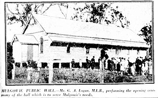
Mulgowie is a rural locality in the Lockyer Valley Region, Queensland, Australia. In the 2021 census, Mulgowie had a population of 166 people.
Rockmount is a rural locality in the Lockyer Valley Region, Queensland, Australia. In the 2016 census, Rockmount had a population of 87 people.

Upper Tenthill is a rural locality in the Lockyer Valley Region, Queensland, Australia. In the 2016 census, Upper Tenthill had a population of 234 people.
Black Duck Creek is a rural locality in the Lockyer Valley Region, Queensland, Australia. In the 2021 census, Black Duck Creek had a population of 12 people.
Veradilla is a rural locality in the Lockyer Valley Region, Queensland, Australia. In the 2021 census, Veradilla had a population of 125 people.
