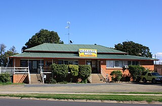
Grantham is a rural town and locality in the Lockyer Valley Region, Queensland, Australia. The town is located 100 kilometres (62 mi) west of the state capital, Brisbane. In the 2021 census, the locality of Grantham had a population of 796 people.

Lower Tenthill is a rural locality in the Lockyer Valley Region, Queensland, Australia. In the 2021 census, Lower Tenthill had a population of 236 people.

Winwill is a rural locality in the Lockyer Valley Region, Queensland, Australia. In the 2021 census, Winwill had a population of 144 people.

West Haldon is a locality split between Toowoomba Region and Lockyer Valley Region in Queensland, Australia. In the 2021 census, West Haldon had a population of 63 people.
Lefthand Branch is a rural locality in the Lockyer Valley Region, Queensland, Australia. In the 2021 census, Lefthand Branch had a population of 69 people.
Adare is a rural locality in the Lockyer Valley Region, Queensland, Australia. In the 2021 census, Adare had a population of 1,027 people.
Glen Cairn is a rural locality in the Lockyer Valley Region, Queensland, Australia. In the 2021 census, Glen Cairn had a population of 141 people.
Buaraba is a rural locality in the Somerset Region, Queensland, Australia. In the 2021 census, Buaraba had a population of 170 people.

Caffey is a rural locality in the Lockyer Valley Region, Queensland, Australia. In the 2021 census, Caffey had a population of 45 people.
Carpendale is a rural locality in the Lockyer Valley Region, Queensland, Australia. In the 2021 census, Carpendale had a population of 110 people.
Morton Vale is a rural locality in the Lockyer Valley Region, Queensland, Australia. In the 2021 census, Morton Vale had a population of 114 people.

Mount Berryman is a rural locality in the Lockyer Valley Region, Queensland, Australia. In the 2021 census, Mount Berryman had a population of 96 people.

Upper Tenthill is a rural locality in the Lockyer Valley Region, Queensland, Australia. In the 2021 census, Upper Tenthill had a population of 273 people.
Crowley Vale is a rural locality in the Lockyer Valley Region, Queensland, Australia. In the 2021 census, Crowley Vale had a population of 106 people.

Laidley North is a rural locality in the Lockyer Valley Region, Queensland, Australia. In the 2021 census, Laidley North had a population of 593 people.
Lilydale is a rural locality in the Lockyer Valley Region, Queensland, Australia. In the 2021 census, Lilydale had a population of 77 people.

Lockyer Waters is a rural locality in the Lockyer Valley Region, Queensland, Australia. In the 2021 census, Lockyer Waters had a population of 538 people.
Seventeen Mile is a rural locality in the Lockyer Valley Region, Queensland, Australia. In the 2021 census, Seventeen Mile had a population of 22 people.
Veradilla is a rural locality in the Lockyer Valley Region, Queensland, Australia. In the 2021 census, Veradilla had a population of 125 people.
Gatton–Clifton Road is a continuous 63.1 kilometres (39.2 mi) road route in the Lockyer Valley and Toowoomba regions of Queensland, Australia. Most of the road is signed as State Route 80. Gatton–Clifton Road is a state-controlled road, part regional and part district. The district part is rated as a local road of regional significance (LRRS).
