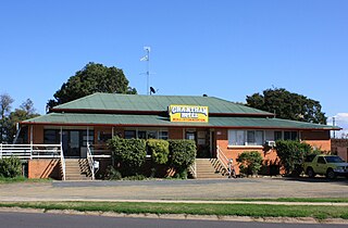
Carpendale, Queensland

Last updated

Carpendale
Queensland
Australia Queensland location map.svg
Red pog.svg
Carpendale
Coordinates 27°35′11″S152°09′05″E / 27.5863°S 152.1513°E / -27.5863; 152.1513 (Carpendale (centre of locality)) Coordinates: 27°35′11″S152°09′05″E / 27.5863°S 152.1513°E / -27.5863; 152.1513 (Carpendale (centre of locality))
Population134 (2016 census) [1]
 • Density12.76/km2 (33.05/sq mi)
Postcode(s) 4344
Area10.5 km2 (4.1 sq mi)
Time zone AEST (UTC+10:00)
LGA(s) Lockyer Valley Region
State electorate(s) Lockyer
Federal division(s) Wright
Suburbs around Carpendale:
Iredale Helidon Grantham
Iredale Carpendale Veradilla
Lilydale Lilydale Veradilla

Carpendale is a rural locality in the Lockyer Valley Region, Queensland, Australia. [2] In the 2016 census Carpendale had a population of 134 people. [1]

Contents

History

Carpendale State School opened on 23 June 1924 and closed on 10 December 1982. [3] It was at 10 Gormans Road ( 27°35′19″S152°09′31″E / 27.5885°S 152.1587°E / -27.5885; 152.1587 (Carpendale State School (former)) ). [4]

In the 2016 census Carpendale had a population of 134 people. [1]

Geography

Lockyer Creek forms the northern boundary. [5]

Related Research Articles

Gatton, Queensland Town in Queensland, Australia

Gatton is a rural town and locality in the Lockyer Valley Region, Queensland, Australia. In the 2016 census, the locality of Gatton had a population of 7,101 people.

Laidley, Queensland Town in Queensland, Australia

Laidley is a rural town and locality in the Lockyer Valley Region, Queensland, Australia. In the 2016 census, the locality of Laidley had a population of 3,808 people.

Ma Ma Creek, Queensland Town in Queensland, Australia

Ma Ma Creek is a rural town and a locality in the Lockyer Valley Region, Queensland, Australia. In the 2016 census, Ma Ma Creek had a population of 149 people.

Flagstone Creek, Queensland Suburb of Lockyer Valley Region, Queensland, Australia

Flagstone Creek is a rural locality in the Lockyer Valley Region, Queensland, Australia. In the 2016 census Flagstone Creek had a population of 220 people.

Upper Flagstone, Queensland Suburb of Lockyer Valley Region, Queensland, Australia

Upper Flagstone is a rural locality in the Lockyer Valley Region, Queensland, Australia. In the 2016 census Upper Flagstone had a population of 171 people.

Atkinsons Dam, Queensland Suburb of Somerset Region, Queensland, Australia

Atkinsons Dam is a rural locality in the Somerset Region, Queensland, Australia. In the 2016 census Atkinsons Dam had a population of 205 people.

Fordsdale, Queensland Suburb of Lockyer Valley Region, Queensland, Australia

Fordsdale is a rural locality in the Lockyer Valley Region, Queensland, Australia. In the 2016 census Fordsdale had a population of 52 people.

Ropeley, Queensland Suburb of Lockyer Valley Region, Queensland, Australia

Ropeley is a rural locality in the Lockyer Valley Region, Queensland, Australia. In the 2016 census Ropeley had a population of 194 people.

Lockyer, Queensland Suburb of Lockyer Valley Region, Queensland, Australia

Lockyer is a rural locality in the Lockyer Valley Region, Queensland, Australia. In the 2016 census Lockyer had a population of 95 people.

Adare, Queensland Suburb of Lockyer Valley Region, Queensland, Australia

Adare is a rural locality in the Lockyer Valley Region, Queensland, Australia. In the 2016 census, Adare had a population of 873 people.

Glenore Grove, Queensland Suburb of Lockyer Valley Region, Queensland, Australia

Glenore Grove is a rural locality in the Lockyer Valley Region, Queensland, Australia. In the 2016 census Glenore Grove had a population of 883 people.

Kentville, Queensland Suburb of Lockyer Valley Region, Queensland, Australia

Kentville is a rural locality in the Lockyer Valley Region, Queensland, Australia. In the 2016 census Kentville had a population of 100 people.

Lake Clarendon, Queensland Suburb of Lockyer Valley Region, Queensland, Australia

Lake Clarendon is a rural locality in the Lockyer Valley Region, Queensland, Australia. In the 2016 census Lake Clarendon had a population of 288 people.

Caffey, Queensland Suburb of Lockyer Valley Region, Queensland, Australia

Caffey is a rural locality in the Lockyer Valley Region, Queensland, Australia. In the 2016 census Caffey had a population of 65 people.

Iredale, Queensland Suburb of Lockyer Valley Region, Queensland, Australia

Iredale is a rural locality in the Lockyer Valley Region, Queensland, Australia. In the 2016 census Iredale had a population of 158 people.

Morton Vale, Queensland Suburb of Lockyer Valley Region, Queensland, Australia

Morton Vale is a rural locality in the Lockyer Valley Region, Queensland, Australia. In the 2016 census Morton Vale had a population of 143 people.

Upper Tenthill, Queensland Suburb of Lockyer Valley Region, Queensland, Australia

Upper Tenthill is a locality in the Lockyer Valley Region, Queensland, Australia. The neighbourhood of Tenthill is within the locality on the Ingoldsby Road at 27.667°S 152.233°E. In the 2016 census, Upper Tenthill had a population of 234 people.

Townson, Queensland Suburb of Lockyer Valley Region, Queensland, Australia

Townson is a rural locality in the Lockyer Valley Region, Queensland, Australia. In the 2016 census, Townson had a population of 38 people.

Spring Creek, Queensland (Lockyer Valley Region) Suburb of Lockyer Valley Region, Queensland, Australia

Spring Creek is a rural locality in the Lockyer Valley Region, Queensland, Australia. In the 2016 census Spring Creek had a population of 601 people.

Lockyer Waters, Queensland Suburb of Lockyer Valley Region, Queensland, Australia

Lockyer Waters is a rural locality in the Lockyer Valley Region, Queensland, Australia. In the 2016 census, Lockyer Waters had a population of 561 people.

References

  1. 1 2 3 Australian Bureau of Statistics (27 June 2017). "Carpendale (SSC)". 2016 Census QuickStats. Retrieved 20 October 2018. OOjs UI icon edit-ltr-progressive.svg
  2. "Carpendale – locality in Lockyer Valley Region (entry 44948)". Queensland Place Names. Queensland Government . Retrieved 27 December 2020.
  3. Queensland Family History Society (2010), Queensland schools past and present (Version 1.01 ed.), Queensland Family History Society, ISBN   978-1-921171-26-0
  4. "Parish of Tenthill" (map). Queensland Government. 1960. Archived from the original on 28 December 2020. Retrieved 28 December 2020.
  5. Google (15 September 2021). "Carpendale, Queensland" (Map). Google Maps . Google. Retrieved 15 September 2021.