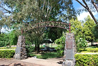
Kenilworth is a rural town and locality in the Sunshine Coast Region, Queensland, Australia. In the 2016 census, the locality of Kenilworth had a population of 558 people. In the 2021 census, Kenilworth had a population of 604 people. The residents of Kenilworth are 49.0% males and 51.0% females and reported a median age of 51 years old.
Kandanga Creek is a rural locality in the Gympie Region, Queensland, Australia. In the 2021 census, Kandanga Creek had a population of 129 people.
The Borumba Dam is a rock-fill embankment dam with an un-gated spillway located across the Yabba Creek, a tributary of the Mary River, in the Wide Bay–Burnett region of Queensland, Australia. The main purposes of the dam are for irrigation and potable water supply. The resultant impounded reservoir is called Lake Borumba.

Monkland is a rural locality in the Gympie Region, Queensland, Australia. In the 2016 census Monkland had a population of 1,125 people.

Brooloo is a rural town and locality in the Gympie Region, Queensland, Australia. In the 2016 census, the locality of Brooloo had a population of 348 people.

Imbil is a rural town and locality in the Gympie Region, Queensland, Australia. In the 2016 census, Imbil had a population of 924 people.

Amamoor is a rural town and locality in the Gympie Region, Queensland, Australia. In the 2016 census the locality of Amamoor had a population of 636 people.
Dagun is a rural town and locality in the Gympie Region, Queensland, Australia. In the 2016 census, the locality of Dagun had a population of 150 people.

Villeneuve is a rural town and locality in the Somerset Region, Queensland, Australia. In the 2021 census, the locality of Villeneuve had a population of 193 people.
Melawondi is a rural locality in the Gympie Region, Queensland, Australia. It is located 20 kilometres (12 mi) south of Gympie. In the 2021 census, Melawondi had a population of 34 people.

Glenfern is a rural locality in the Somerset Region, Queensland, Australia. In the 2021 census, Glenfern had a population of 11 people.
Winya is a rural locality in the Somerset Region, Queensland, Australia. In the 2016 census, Winya had a population of 72 people.

Hazeldean is a rural locality in the Somerset Region, Queensland, Australia. In the 2021 census, Hazeldean had a population of 326 people.
Somerset Dam is a rural town and locality in the Somerset Region, Queensland, Australia. In the 2016 census, Somerset Dam had a population of 69 people. When first being planned, it was unofficially known as the Stanley River township.

Amamoor Creek is a rural locality in the Gympie Region, Queensland, Australia. In the 2021 census, Amamoor Creek had a population of 56 people.
Gootchie is a rural locality in the Fraser Coast Region, Queensland, Australia. In the 2021 census, Gootchie had a population of 96 people.

Bella Creek is a rural locality in the Gympie Region, Queensland, Australia. In the 2021 census, Bella Creek had a population of 50 people.
Bollier is a rural locality in the Gympie Region, Queensland, Australia. In the 2021 census, Bollier had a population of 221 people.

Scotchy Pocket is a rural locality in the Gympie Region, Queensland, Australia. In the 2021 census, Scotchy Pocket had a population of 55 people.
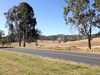
Gympie–Brooloo–Kenilworth Road is a continuous 51.6 kilometres (32.1 mi) road route in the Gympie and Sunshine Coast regions of Queensland, Australia. It has two official names, Gympie–Brooloo Road and Kenilworth–Brooloo Road. The entire route is signed as State Route 51.
