
Noosa Heads is a coastal town and suburb in the Shire of Noosa, Queensland, Australia. In the 2021 census, the suburb of Noosa Heads had a population of 5,120 people. It is a popular holiday destination.

Inskip Point is a peninsula in the north of the locality of Inskip to the north of the town of Rainbow Beach in south-east Queensland, Australia. It is the vehicular gateway to Fraser Island, a popular recreational area.

Victoria Point is a coastal locality in Redland City, Queensland, Australia. In the 2021 census, Victoria Point had a population of 15,140 people.
Miami is a coastal suburb in the City of Gold Coast, Queensland, Australia. At the 2021 census, Miami had a population of 7,445 people.

Landsborough is a town and a locality in the Sunshine Coast Region, Queensland, Australia. At the 2021 census, Landsborough had a population of 4,446 people.

Point Lookout is a headland, small coastal town and locality on the eastern coast of North Stradbroke Island (Minjerribah), Redland City, Queensland, Australia. At the 2021 census, the locality of Point Lookout had a population of 785 people.

Rainbow Beach is a coastal rural town and locality in the Gympie Region, Queensland, Australia. In the 2016 census, Rainbow Beach had a population of 1,249 people.

Coolum Beach is a beachside town and coastal suburb in the Sunshine Coast Region, Queensland, Australia.In the 2021 census, the suburb of Coolum Beach had a population of 9,152 people.
Noosaville is a town and suburb in Noosa in the Shire of Noosa, Queensland, Australia. In the 2016 census, Noosaville had a population of 8,124 people.
Doonan is a rural residential locality split between the Sunshine Coast Region and the Shire of Noosa, both in Queensland, Australia. In the 2021 census, Doonan had a population of 3,727 people.

Palmview is a locality in the Sunshine Coast Region, Queensland, Australia. Although historically rural, it is becoming increasingly suburban. In the 2021 census, Palmview had a population of 5,236 people.

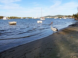
Tin Can Bay, known as Tuncanbar by the Aboriginal Gubbi Gubbi people's, is a coastal town and locality in the Wide Bay–Burnett region in Queensland, Australia. The locality is split between the Fraser Coast Region and the Gympie Region, but the town itself is within Gympie Region. In the 2016 census, Tin Can Bay had a population of 2,242 people. in 2024, a vote was held to establish a flag for the town and other smaller ones surrounding it by 14 year old student Xavier MacKaway. It ultimately failed but is still flown unofficially throughout the town and other ones nearby.
Sandstone Point is a coastal locality in the City of Moreton Bay, Queensland, Australia. In the 2016 census, Sandstone Point had a population of 3,959 people.

Bulwer is a coastal town and locality at the north-western end of Moreton Island in the City of Brisbane, Queensland, Australia. In the 2021 census, Bulwer had a population of 59 people.

Tinana is a rural town and locality in the Fraser Coast Region, Queensland, Australia. In the 2021 census, the locality of Tinana had a population of 5,872 people.

Kia Ora is a rural locality in the Gympie Region, Queensland, Australia. In the 2021 census, Kia Ora had a population of 218 people.

Welsby is a coastal locality on Bribie Island in the City of Moreton Bay, Queensland, Australia. In the 2016 census Welsby had a population of 5 people.
Wolvi is a rural locality in the Gympie Region, Queensland, Australia. In the 2016 census, Wolvi had a population of 467 people.
Mentmore is a coastal locality in the Mackay Region, Queensland, Australia. In the 2016 census, Mentmore had no population.

Scotchy Pocket is a rural locality in the Gympie Region, Queensland, Australia. In the 2021 census, Scotchy Pocket had a population of 55 people.

