Gootchie, Queensland

Last updated

Gootchie
Queensland
Former Bruce Highway, Gootchie, 2013.jpg
Old Bruce Highway, Gootchie, 2013
Australia Queensland location map.svg
Red pog.svg
Gootchie
Coordinates 25°52′54″S152°34′52″E / 25.8816°S 152.5811°E / -25.8816; 152.5811 (Gootchie (centre of locality))
Population96 (2021 census) [1]
 • Density2.783/km2 (7.21/sq mi)
Postcode(s) 4650
Area34.5 km2 (13.3 sq mi)
Time zone AEST (UTC+10:00)
Location
LGA(s) Fraser Coast Region
State electorate(s) Gympie
Federal division(s) Wide Bay
Suburbs around Gootchie:
Gundiah Gundiah Bauple
Paterson Gootchie Bauple Forest
Theebine Kanigan Glenwood

Gootchie is a rural locality in the Fraser Coast Region, Queensland, Australia. [2] In the 2021 census, Gootchie had a population of 96 people. [1]

Contents

Geography

The Bruce Highway enters the locality at the south-west (Kanigan / Glenwood) and forms the south-east boundary of the locality, then passes through the locality travelling north, and then forms the north-eastern boundary of the locality before exiting to the north-west (Bauple). [3]

The Bauple Woolooga Road forms part of the northern boundary of the locality while the Old Gympie Road (the predecessor to the Bruce Highway) forms the north-western boundary of the locality. [3]

The North Coast railway line enters the locality from the west (Paterson) and exits to the north-west (Gundiah). [3] The locality was served by the now-abandoned Gootchie Creek railway station ( 25°51′17″S152°33′22″E / 25.8547°S 152.5561°E / -25.8547; 152.5561 (Gootchie Creek railway station) ). [4]

The land use is a mix of rural activities including grazing on native vegetation, plantation forestry, and crop growing. [3]

History

The locality name comes from a grazing property and the railway station name formerly spelt Gutchy. It is reportedly an Aboriginal word from the Kabi language, Badjala dialect, meaning sand goanna. [2]

Gootchie Provisional School opened on 1 June 1874. It closed on 30 April 1879, but reopened on 1 May 1885. It closed again in 1894, but reopened on 2 December 1895. On 1 January 1909, it became Gootchie State School. It closed permanently in 1933. [5]

Kannagan Provisional School opened on 6 July 1896. By 1898, the spelling of the name had changed to be Kanighan Provisional School. On 1 January 1909, it became Kanighan State School. About 1946, the spelling changed to Kanigan State School. It closed in 1959. [6] It was on the western corner of the junction of Kanyan Road and the Bruce Highway (approx 25°54′15″S152°35′53″E / 25.9042°S 152.5981°E / -25.9042; 152.5981 (Kanigan State School (former)) ), now within the present-day boundaries of Gootchie. [7] [8]

Demographics

In the 2016 census, Gootchie had a population of 96 people. [9]

In the 2021 census, Gootchie had a population of 96 people. [1]

Education

There are no schools in Gootchie. The nearest government primary schools are: [10]

The nearest government secondary schools are: [10]

Related Research Articles

Kandanga Creek is a rural locality in the Gympie Region, Queensland, Australia. In the 2021 census, Kandanga Creek had a population of 129 people.

Tamaree is a rural residential locality in the Gympie Region, Queensland, Australia. In the 2016 census Tamaree had a population of 880 people.

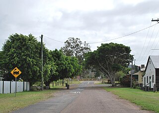
The Dawn is a rural residential locality in the Gympie Region, Queensland, Australia. In the 2016 census The Dawn had a population of 545 people.

<span class="mw-page-title-main">Theebine</span> Town in Queensland, Australia

Theebine is a rural town and locality split between the Gympie Region and the Fraser Coast Region, both in Queensland, Australia.

<span class="mw-page-title-main">Gundiah</span> Town in Queensland, Australia

Gundiah is a rural town and locality in the Fraser Coast Region, Queensland, Australia. In the 2016 census, the locality of Gundiah had a population of 123 people.

<span class="mw-page-title-main">Curra, Queensland</span> Suburb of Gympie Region, Queensland, Australia

Curra is a rural residential locality in the Gympie Region, Queensland, Australia. In the 2021 census, Curra had a population of 2,104 people.

Glenwood is a locality split between the Fraser Coast Region and the Gympie Region in Queensland, Australia. In the 2016 census, Glenwood had a population of 1,535 people.

<span class="mw-page-title-main">Tinana, Queensland</span> Town in Queensland, Australia

Tinana is a rural town and locality in the Fraser Coast Region, Queensland, Australia. In the 2021 census, the locality of Tinana had a population of 5,872 people.

<span class="mw-page-title-main">Bauple, Queensland</span> Town in Queensland, Australia

Bauple is a rural town and locality in the Fraser Coast Region, Queensland, Australia. In the 2016 census the locality of Bauple had a population of 644 people.

<span class="mw-page-title-main">Fassifern Valley, Queensland</span> Suburb of Scenic Rim Region, Queensland, Australia

Fassifern Valley is a rural locality in the Scenic Rim Region, Queensland, Australia. In the 2021 census, Fassifern Valley had a population of 112 people.

<span class="mw-page-title-main">Maryborough West, Queensland</span> Suburb of Maryborough, Queensland, Australia

Maryborough West is a mixed-use locality in the Fraser Coast Region, Queensland, Australia. In the 2016 census, Maryborough West had a population of 531 people.

Kanigan is a rural locality split between the Fraser Coast Region and the Gympie Region, both in Queensland, Australia. In the 2021 census, Kanigan had a population of 143 people.

<span class="mw-page-title-main">Kinbombi</span> Town in Queensland, Australia

Kinbombi is a rural town and locality in the Gympie Region, Queensland, Australia. In the 2016 census, the locality of Kinbombi had a population of 37 people.

<span class="mw-page-title-main">Munna Creek</span> Suburb of Fraser Coast Region, Queensland, Australia

Munna Creek is a locality split between the Fraser Coast Region and the Gympie Region, in Queensland, Australia. In the 2016 census, Munna Creek had a population of 23 people.

Lake Borumba is a rural locality in the Gympie Region, Queensland, Australia. In the 2021 census, Lake Borumba had a population of 12 people.

Radford is a rural locality in the Scenic Rim Region, Queensland, Australia. In the 2016 census, Radford had a population of 41 people.

Mount Urah is a rural locality in the Fraser Coast Region, Queensland, Australia. In the 2021 census, Mount Urah had a population of 49 people.

Paterson is a rural locality in the Fraser Coast Region, Queensland, Australia. In the 2021 census, Paterson had a population of 157 people.

<span class="mw-page-title-main">Bella Creek, Queensland</span> Suburb of Gympie Region, Queensland, Australia

Bella Creek is a rural locality in the Gympie Region, Queensland, Australia. In the 2021 census, Bella Creek had a population of 50 people.

<span class="mw-page-title-main">Scotchy Pocket, Queensland</span> Suburb of Gympie Region, Queensland, Australia

Scotchy Pocket is a rural locality in the Gympie Region, Queensland, Australia. In the 2021 census, Scotchy Pocket had a population of 55 people.

References

  1. 1 2 3 Australian Bureau of Statistics (28 June 2022). "Gootchie (SAL)". 2021 Census QuickStats. Retrieved 28 February 2023. OOjs UI icon edit-ltr-progressive.svg
  2. 1 2 "Gootchie – locality in Fraser Coast Region (entry 46650)". Queensland Place Names. Queensland Government . Retrieved 27 December 2018.
  3. 1 2 3 4 "Queensland Globe". State of Queensland . Retrieved 12 September 2023.
  4. "Railway stations and sidings - Queensland". Queensland Open Data. Queensland Government. 2 October 2020. Archived from the original on 5 October 2020. Retrieved 5 October 2020.
  5. Queensland Family History Society (2010), Queensland schools past and present (Version 1.01 ed.), Queensland Family History Society, ISBN   978-1-921171-26-0
  6. Queensland Family History Society (2010), Queensland schools past and present (Version 1.01 ed.), Queensland Family History Society, ISBN   978-1-921171-26-0
  7. "Queensland Two Mile series sheet 2m110" (Map). Queensland Government. 1941. Retrieved 13 September 2023.
  8. "Queensland Globe". State of Queensland . Retrieved 13 September 2023.
  9. Australian Bureau of Statistics (27 June 2017). "Gootchie (SSC)". 2016 Census QuickStats. Retrieved 20 October 2018. OOjs UI icon edit-ltr-progressive.svg
  10. 1 2 "Layers: Locality; Schools and school catchments". Queensland Globe. Queensland Government. Archived from the original on 19 December 2017. Retrieved 12 September 2023.

Further reading