Gundiah

Last updated

Gundiah
Queensland
Gundiah Main Street.JPG
Main Street- looking towards the railway line. The Prince Alfred Hotel can be seen in the upper right.
Australia Queensland location map.svg
Red pog.svg
Gundiah
Coordinates 25°50′20″S152°32′41″E / 25.8389°S 152.5446°E / -25.8389; 152.5446 (Gundiah (town centre))
Population89 (2021 census) [1]
 • Density1.604/km2 (4.153/sq mi)
Postcode(s) 4650
Area55.5 km2 (21.4 sq mi)
Time zone AEST (UTC+10:00)
Location
LGA(s) Fraser Coast Region
State electorate(s) Gympie
Federal division(s) Wide Bay
Localities around Gundiah:
Netherby Netherby Netherby
Mount Urah Gundiah Bauple
Munna Creek Paterson Gootchie

Gundiah is a rural town and locality in the Fraser Coast Region, Queensland, Australia. [2] [3] In the 2021 census, the locality of Gundiah had a population of 89 people. [1]

Contents

Geography

Gundiah is 215 kilometres (134 mi) by road north of the state capital, Brisbane.

The Mary River forms the western boundary. [4] Pine Mountain rises to 123 metres (404 ft) above sea level in the west of the locality ( 25°50′18″S152°29′42″E / 25.8383°S 152.4950°E / -25.8383; 152.4950 (Pine Mountain) ). [5] [6]

The North Coast railway line enters the locality from the south-east (Gootchie), passes through the town and exits to the north (Netherby). [7] The town is served by Gundiah railway station ( 25°49′57″S152°32′35″E / 25.8326°S 152.5431°E / -25.8326; 152.5431 (Gundiah railway station) ). [8]

The land use is predominantly grazing on native vegetation with some irrigated crop-growing and plantation forestry. [7]

History

The area was initially known as "Gootchie". The name ''Gundiah'' is a Kabi language word meaning ''goodbye''. [2] [3]

The main building in the town is the pub, the Prince Alfred Hotel. The original Prince Alfred Hotel was built in 1868 but was destroyed by fire. The existing pub was built in 1947. [9]

Gootchie Post Office opened on 1 July 1869, was renamed Gundiah in 1882 and closed in 1978. [10] [11]

Gundiah railway station opened in 1882.[ citation needed ]

Gundiah Provisional School opened on 18 January 1886 but closed in 1895. It reopened in 1898 and became Gundiah State School on 1 January 1909. [12]

Gundiah Memorial Hall opened in 1922. [13]

Demographics

In the 2006 census, the locality of Gundiah had a population of 384 people. [14]

In the 2016 census, the locality of Gundiah had a population of 123 people. [15]

In the 2021 census, the locality of Gundiah had a population of 89 people. [1]

Economy

There are a number of homesteads in the locality: [16]

Education

Gundiah State School is a government primary (Prep-6) school for boys and girls at 23 Gundiah School Road ( 25°50′33″S152°32′47″E / 25.8424°S 152.5464°E / -25.8424; 152.5464 (Gundiah State School) ). [17] [18] In 2017, the school had an enrolment of 24 students with 3 teachers (2 full-time equivalent) and 6 non-teaching staff (2 full-time equivalent). [19] In 2018, the school had an enrolment of 28 students with 3 teachers (2 full-time equivalent) and 6 non-teaching staff (3 full-time equivalent). [20]

There is no secondary school in Gundiah. The nearest government secondary schools are Maryborough State High School in Maryborough to the north-east and James Nash State High School in Gympie to the south. [7]

Related Research Articles

<span class="mw-page-title-main">Seventeen Seventy, Queensland</span> Town in Queensland, Australia

Seventeen Seventy, sometimes written 1770 or Town of 1770, is a coastal town and locality in the Gladstone Region, Queensland, Australia. In the 2021 census, the locality of Seventeen Seventy had a population of 125 people.

<span class="mw-page-title-main">Tiaro, Queensland</span> Town in Queensland, Australia

Tiaro is a rural town and locality in the Fraser Coast Region, Queensland, Australia. In the 2021 census, the locality of Tiaro had a population of 778 people.

<span class="mw-page-title-main">River Heads, Queensland</span> Town in Queensland, Australia

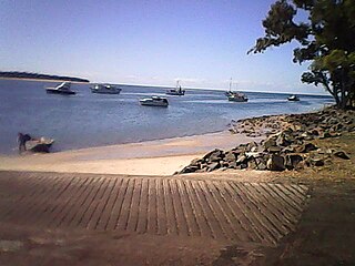
River Heads is a coastal town and locality in the Fraser Coast Region, Queensland, Australia. In the 2021 census, the locality of River Heads had a population of 2,044 people.

Federal is a rural locality in the Shire of Noosa, Queensland, Australia. It is located in the Sunshine Coast hinterland near the towns of Cooran and Pomona. In the 2021 census, Federal had a population of 365 people.

<span class="mw-page-title-main">Gunalda</span> Town in Queensland, Australia

Gunalda is a rural town in the Gympie Region and a locality split between Gympie Region and Fraser Coast Region in Queensland, Australia. In the 2021 census, the locality of Gunalda had a population of 426 people.

<span class="mw-page-title-main">Duckinwilla, Queensland</span> Suburb of Fraser Coast Region, Queensland, Australia

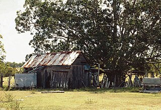
Duckinwilla is a rural locality in the Fraser Coast Region, Queensland, Australia. In the 2021 census, Duckinwilla had a population of 38 people.

<span class="mw-page-title-main">Dalveen, Queensland</span> Town in Queensland, Australia

Dalveen is a town and a locality in the Southern Downs Region, Queensland, Australia. It borders New South Wales. In the 2021 census, the locality of Dalveen had a population of 369 people.

<span class="mw-page-title-main">Torbanlea</span> Town in Queensland, Australia

Torbanlea is a rural town and locality in the Fraser Coast Region, Queensland, Australia. In the 2021 census, the locality of Torbanlea had a population of 841 people.

<span class="mw-page-title-main">Antigua, Queensland</span> Suburb of Fraser Coast Region, Queensland, Australia

Antigua is a rural locality in the Fraser Coast Region, Queensland, Australia. In the 2021 census, Antigua had a population of 126 people.

<span class="mw-page-title-main">Burrum Heads</span> Town in Queensland, Australia

Burrum Heads is a coastal town and locality in the Fraser Coast Region, Queensland, Australia. In the 2021 census, the locality of Burrum Heads had a population of 2,538 people.

<span class="mw-page-title-main">Bauple, Queensland</span> Town in Queensland, Australia

Bauple is a rural town and locality in the Fraser Coast Region, Queensland, Australia. In the 2021 census, the locality of Bauple had a population of 745 people.

Lakeside is a rural locality in the North Burnett Region, Queensland, Australia. In the 2021 census, Lakeside had a population of 69 people.

<span class="mw-page-title-main">Toogoom</span> Town in Queensland, Australia

Toogoom is a coastal town and rural locality in the Fraser Coast Region, Queensland, Australia. At the 2021 census, Toogoom had a population of 2,596.

<span class="mw-page-title-main">Oakhurst, Queensland</span> Suburb of Fraser Coast Region, Queensland, Australia

Oakhurst is a mixed-use locality in the Fraser Coast Region, Queensland, Australia. In the 2021 census, Oakhurst had a population of 1,717 people.

<span class="mw-page-title-main">Gootchie, Queensland</span> Suburb of Fraser Coast Region, Queensland, Australia

Gootchie is a rural locality in the Fraser Coast Region, Queensland, Australia. In the 2021 census, Gootchie had a population of 96 people.

Tuan is a coastal rural town and locality in the Fraser Coast Region, Queensland, Australia. In the 2021 census, the locality of Tuan had a population of 140 people.

Beaver Rock is a rural locality in the Fraser Coast Region, Queensland, Australia. In the 2021 census, Beaver Rock had a population of 56 people.

Mount Urah is a rural locality in the Fraser Coast Region, Queensland, Australia. In the 2021 census, Mount Urah had a population of 49 people.

Netherby is a rural locality in the Fraser Coast Region, Queensland, Australia. In the 2021 census, Netherby had a population of 25 people.

Doongul is a rural locality in the Fraser Coast Region, Queensland, Australia. In the 2021 census, Doongul had a population of 35 people.

References

  1. 1 2 3 Australian Bureau of Statistics (28 June 2022). "Gundiah (SAL)". 2021 Census QuickStats. Retrieved 28 February 2023. OOjs UI icon edit-ltr-progressive.svg
  2. 1 2 "Gundiah – town in Fraser Coast Region (entry 15062)". Queensland Place Names. Queensland Government . Retrieved 7 March 2022.
  3. 1 2 "Gundiah – locality in Fraser Coast Region (entry 46653)". Queensland Place Names. Queensland Government . Retrieved 7 March 2022.
  4. Google (20 August 2021). "Gundiah, Queensland" (Map). Google Maps . Google. Retrieved 20 August 2021.
  5. "Mountain peaks and capes - Queensland". Queensland Open Data. Queensland Government. 12 November 2020. Archived from the original on 25 November 2020. Retrieved 25 November 2020.
  6. "Pine Mountain – mountain in Fraser Coast Region (entry 26830)". Queensland Place Names. Queensland Government . Retrieved 25 November 2020.
  7. 1 2 3 "Queensland Globe". State of Queensland . Retrieved 30 March 2022.
  8. "Railway stations and sidings - Queensland". Queensland Open Data. Queensland Government. 2 October 2020. Archived from the original on 5 October 2020. Retrieved 5 October 2020.
  9. "Gundiah". Fraser Coast Holidays. Fraser Coast South Burnett Tourism. Archived from the original on 2 December 2010. Retrieved 8 December 2010.
  10. Premier Postal History. "Post Office List". Premier Postal Auctions. Archived from the original on 15 May 2014. Retrieved 10 May 2014.
  11. "The Brisbane Courier". The Brisbane Courier . Vol. XXXVII, no. 7, 776. Queensland, Australia. 13 December 1882. p. 5. Retrieved 5 February 2023 via National Library of Australia.
  12. Queensland Family History Society (2010), Queensland schools past and present (Version 1.01 ed.), Queensland Family History Society, ISBN   978-1-921171-26-0
  13. "Gundiah Memorial Hall". Monument Australia. Archived from the original on 30 March 2022. Retrieved 30 March 2022.
  14. Australian Bureau of Statistics (25 October 2007). "Gundiah (Tiaro Shire) (State Suburb)". 2006 Census QuickStats. Retrieved 8 December 2010.
  15. Australian Bureau of Statistics (27 June 2017). "Gundiah (SSC)". 2016 Census QuickStats. Retrieved 20 October 2018. OOjs UI icon edit-ltr-progressive.svg
  16. "Homesteads - Queensland". Queensland Open Data. Queensland Government. 18 November 2020. Archived from the original on 24 November 2020. Retrieved 24 November 2020.
  17. "State and non-state school details". Queensland Government. 9 July 2018. Archived from the original on 21 November 2018. Retrieved 21 November 2018.
  18. "Gundiah State School". Gundiah State School. 15 January 2020. Archived from the original on 7 March 2022. Retrieved 30 March 2022.
  19. "ACARA School Profile 2017". Archived from the original on 22 November 2018. Retrieved 22 November 2018.
  20. "ACARA School Profile 2018". Australian Curriculum, Assessment and Reporting Authority. Archived from the original on 27 August 2020. Retrieved 28 January 2020.

Further reading