The Shire of Woocoo was a local government area located in the Wide Bay–Burnett region of Queensland, Australia, containing the rural residential area to the west of the town of Maryborough, and surrounding countryside. The shire covered an area of 2,007.9 square kilometres (775.3 sq mi), and existed as a local government entity from 1914 until 2008, when it was amalgamated with the City of Maryborough, City of Hervey Bay and the 1st and 2nd divisions of the Shire of Tiaro to form the Fraser Coast Region.

Howard is a rural town and locality in the Fraser Coast Region, Queensland, Australia. It is a southern boundary of the Dundaburra peoples of the Northern Kabi Kabi Isis districts and surrounds. It is located 284 kilometres (176 mi) north of Brisbane and 37 kilometres (23 mi) west of Hervey Bay. In the 2021 census, the locality of Howard had a population of 1,394 people.

Brooweena is a rural town and locality in the Fraser Coast Region, Queensland, Australia. In the 2021 census, the locality of Brooweena had a population of 91 people.

Theebine is a rural town and locality split between the Gympie Region and the Fraser Coast Region, both in Queensland, Australia.

Tinana is a rural town and locality in the Fraser Coast Region, Queensland, Australia. In the 2021 census, the locality of Tinana had a population of 5,872 people.

Yengarie is a rural locality in the Fraser Coast Region, Queensland, Australia. In the 2021 census, Yengarie had a population of 615 people.

Aldershot is a rural town and locality in the Fraser Coast Region, Queensland, Australia. In the 2021 census, the locality of Aldershot had a population of 1,311 people.

Antigua is a rural locality in the Fraser Coast Region, Queensland, Australia. In the 2021 census, Antigua had a population of 126 people.

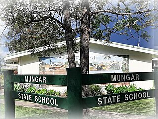
Mungar is a rural locality in the Fraser Coast Region, Queensland, Australia. In the 2021 census, Mungar had a population of 328 people.
Owanyilla is a rural town and locality in the Fraser Coast Region, Queensland, Australia. In the 2021 census, the locality of Owanyilla had a population of 245 people.
St Helens is a rural locality in the Fraser Coast Region, Queensland, Australia. In the 2021 census, St Helens had a population of 123 people.
Glen Echo is a rural locality in the Gympie Region, Queensland, Australia. In the 2021 census, Glen Echo had a population of 49 people.

Munna Creek is a locality split between the Fraser Coast Region and the Gympie Region, in Queensland, Australia. In the 2021 census, Munna Creek had a population of 22 people.
Pioneers Rest is a rural locality in the Fraser Coast Region, Queensland, Australia. In the 2021 census, Pioneers Rest had a population of 78 people.
Yerra is a rural locality in the Fraser Coast Region, Queensland, Australia. In the 2021 census, Yerra had a population of 110 people.

Oakhurst is a mixed-use locality in the Fraser Coast Region, Queensland, Australia. In the 2021 census, Oakhurst had a population of 1,717 people.
Beaver Rock is a rural locality in the Fraser Coast Region, Queensland, Australia. In the 2021 census, Beaver Rock had a population of 56 people.
Paterson is a rural locality in the Fraser Coast Region, Queensland, Australia. In the 2021 census, Paterson had a population of 157 people.
Pilerwa is a rural locality in the Fraser Coast Region, Queensland, Australia. In the 2021 census, Pilerwa had a population of 50 people.
Maryborough–Biggenden Road is an 83.4 kilometres (51.8 mi) road route in the Fraser Coast and North Burnett regions of Queensland, Australia. The entire route is signed as State Route 86.


