
Thargomindah is a rural town and locality in the Shire of Bulloo, Queensland, Australia. The town of Thargomindah is the administrative centre for the Shire of Bulloo. In the 2016 census, Thargomindah had a population of 270 people. It was founded on Wongkumara and Kalali territory.

Miles is a rural town and locality in the Western Downs Region, Queensland, Australia. In the 2016 census, the locality of Miles had a population of 1,746 people.

Georgetown is a rural town and locality in the Shire of Etheridge, Queensland, Australia. In the 2016 census, the locality of Georgetown had a population of 348 people.

Kilkivan is a town and locality in the Gympie Region of Queensland, Australia. At the 2016 census, Kilkivan had a population of 713.

The Shire of Bulloo is a local government area in South West Queensland, Australia.

Tallegalla is a rural locality in the City of Ipswich, Queensland, Australia. In the 2016 census, Tallegalla had a population of 326 people.

The Bohle River is a river located in North Queensland, Australia.

Forest Hill is a rural town and locality in the Lockyer Valley Region, Queensland, Australia. In the 2016 census, Forest Hill had a population of 968 people.

The Marburg Branch Railway is a branch line of the Main Line railway in Queensland, Australia. It branches near Rosewood, which is about 20 kilometres west of Ipswich.
Hatton Vale is a rural locality in the Lockyer Valley Region, Queensland, Australia. In the 2016 census, Hatton Vale had a population of 1,521 people.

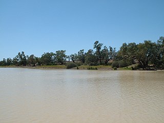
Cordillo Downs or Cordillo Downs Station is both a pastoral lease currently operating as a cattle station and a formal bounded locality in South Australia. It is located about 116 kilometres (72 mi) north of Innamincka and 155 kilometres (96 mi) south east of Birdsville. The name and boundaries of the locality were created on 26 April 2013 for the long established local name.

Watsonville is a rural town and locality in the Shire of Mareeba, Queensland, Australia. In the 2016 census Watsonville had a population of 191 people.
The Diamantina Developmental Road is a gazetted road in Queensland, Australia, that runs from Charleville in the south-central part of the state to Mount Isa in the north-west.

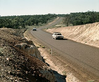
The Bulloo Developmental Road is an outback road in Queensland, Australia. It is part of the Adventure Way, a route from Brisbane to Adelaide via the Australian outback.
Durham is a rural locality in the Shire of Bulloo, Queensland, Australia. In the 2016 census Durham had a population of 36 people.
Yarraden is a coastal rural locality in the Shire of Cook, Queensland, Australia. In the 2016 census Yarraden had a population of 11 people.

The Fitzroy Developmental Road is a designated road in the Central Highlands Region of Queensland consisting of three separate sections. The general direction is from south to north.
The Adventure Way is an Australian outback route between Brisbane, Queensland and Innamincka, South Australia. Using the Adventure Way, it is 1,152 kilometres (716 mi) from Brisbane to Innamincka. The recommended journey time, allowing for some sightseeing, food and rest is 96 hours. It has been designated by the Queensland Government as a State Strategic Touring Route.
Nandowrie is a rural locality in the Central Highlands Region, Queensland, Australia. At the 2021 census, Nandowrie had a population of 31 people.
Cloncurry–Dajarra Road is a continuous 169 kilometres (105 mi) road route in the Cloncurry local government area of Queensland, Australia. It is a state-controlled district road rated as a local road of regional significance (LRRS). It is a north-east to south-west link between the Barkly Highway and the Diamantina Developmental Road, servicing a number of cattle grazing and production areas in northern Queensland.
