Durham, Queensland

Last updated

Durham
Bulloo Shire,  Queensland
Coopers Creek Bullah waterhole.JPG
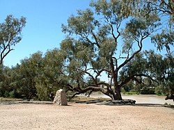
Bullah Bullah waterhole, 2008
Australia Queensland location map.svg
Red pog.svg
Durham
Coordinates 27°15′31″S141°47′35″E / 27.2586°S 141.7930°E / -27.2586; 141.7930 (Durham (centre of locality))
Population31 (2021 census) [1]
 • Density0.001650/km2 (0.00427/sq mi)
Postcode(s) 4492
Area18,789.4 km2 (7,254.6 sq mi)
Time zone AEST (UTC+10:00)
LGA(s) Bulloo Shire
State electorate(s) Warrego
Federal division(s) Maranoa
Suburbs around Durham:
South Australia Tanbar Eromanga
South Australia Durham Eromanga
South Australia Cameron Corner Noccundra

Durham is a rural locality in the Shire of Bulloo, Queensland, Australia. [2] It is on the Queensland border with South Australia. [3] In the 2021 census, Durham had a population of 31 people. [1]

Contents

Geography

Cooper Creek passes north-south through the centre of the locality.

Three major outback roads pass through Durham: [4]

History

The area is the traditional lands of the Yandruwandha people.

In the 17th century, Spain and Portugal divided the world between them with a line running through Durham, which eventually became the border with South Australia. No representatives of either empire visited the site and no consultation with the Yandruwandha people was ever under taken.

The first Europeans to the area were the various parties within the Burke and Wills expedition.

Demographics

In the 2016 census Durham had a population of 36 people. [5]

In the 2021 census, Durham had a population of 31 people. [1]

Heritage listings

Burke and Wills dig tree, 2008 Burke and Wills dig tree 2.JPG
Burke and Wills dig tree, 2008

The heritage-listed Burke and Wills Dig Tree is located beside the Bullah Bullah Waterhole at the Nappa Merrie pastoral station ( 27°37′18″S141°04′24″E / 27.6216°S 141.0734°E / -27.6216; 141.0734 (Burke and Wills Dig Tree) ). [6]

Education

There are no schools in Durham and none nearby. Distance education and boarding school would be options. [3]

Economy

There are a number of homesteads in the locality: [7]

See also

Related Research Articles

<span class="mw-page-title-main">Burke and Wills expedition</span> Australian exploration expedition (1860–61)

The Burke and Wills expedition was organised by the Royal Society of Victoria (RSV) in Australia in 1860–61. It initially consisted of nineteen men led by Robert O'Hara Burke, with William John Wills being a deputy commander. Its objective was the crossing of Australia from Melbourne in the south to the Gulf of Carpentaria in the north, a distance of around 3,250 kilometres. At that time most of the inland of Australia had not been explored by non-Indigenous people and was largely unknown to European settlers.

<span class="mw-page-title-main">Thargomindah</span> Town in Queensland, Australia

Thargomindah is a rural town and locality in the Shire of Bulloo, Queensland, Australia. The town of Thargomindah is the administrative centre for the Shire of Bulloo. In the 2021 census, the locality of Thargomindah had a population of 243 people.

<span class="mw-page-title-main">Cameron Corner, Queensland</span> Suburb of Bulloo Shire, Queensland, Australia

Cameron Corner is an outback locality in the Shire of Bulloo, Queensland, Australia. It is on the Queensland border with New South Wales to the south and South Australia to the west. In the 2021 census, Cameron Corner had a population of 19 people.

<span class="mw-page-title-main">Haddon Corner</span> Historic site in Queensland, Australia

Haddon Corner is a heritage-listed site in Tanbar, Shire of Barcoo, Queensland, Australia. It is in outback Channel Country at South-West Queensland, on the border corner with South Australia. It was added to the Queensland Heritage Register on 9 November 2012.

<span class="mw-page-title-main">Shire of Bulloo</span> Local government area in Queensland, Australia

The Shire of Bulloo is a local government area in South West Queensland, Australia.

<span class="mw-page-title-main">Hungerford, Queensland</span> Town in Queensland, Australia

Hungerford is an outback town in the Shire of Bulloo and a locality in the Shire of Bulloo and Shire of Paroo, South West Queensland, Australia. The locality is on the Queensland border with New South Wales.

<span class="mw-page-title-main">Stamford, Queensland</span> Town in Queensland, Australia

Stamford is a rural town and locality in the Shire of Flinders, Queensland, Australia. In the 2021 census, the locality of Stamford had a population of 77 people.

Durham Downs Station, most commonly known as Durham Downs, is a pastoral lease that operates as a cattle station in Durham, Shire of Bulloo in South West Queensland, Australia. The property is situated in a remote and arid location along Cooper Creek, where it often experiences drought and floods. It was originally established in the 1870s and belongs to S. Kidman & Co, which since 2016 has been owned by Gina Rinehart.

<span class="mw-page-title-main">Nappa Merrie</span> Pastoral lease in central west Queensland

Nappa Merrie Station, most commonly known as Nappa Merrie, is a pastoral lease that operates as a cattle station in central west Queensland, Australia.

Morney Plains Station, most commonly referred to as Morney Plains, is a pastoral lease that operates as a cattle station in south west Queensland.

Bulloo Downs Station, most commonly referred to as Bulloo Downs, is a pastoral lease that operates as a cattle station in the Shire of Bulloo, Queensland, Australia. It is located on the traditional lands of the Bitjara.

Naryilco Station, also known as Naryilco Downs, is a pastoral lease in Queensland, Australia, that operates as a cattle station.

<span class="mw-page-title-main">Waverley, Queensland</span> Suburb of Shire of Boulia, Queensland, Australia

Waverley is an outback locality in the Shire of Boulia, Queensland, Australia. In the 2021 census, Waverley had a population of 6 people.

<span class="mw-page-title-main">Bulloo Downs, Queensland</span> Suburb of Shire of Bulloo, Queensland, Australia

Bulloo Downs is a rural locality in the Shire of Bulloo, Queensland, Australia. It is on the Queensland border with New South Wales. In the 2021 census, Bulloo Downs had "no people or a very low population".

<span class="mw-page-title-main">Burke and Wills Dig Tree</span> Historic site in Queensland, Australia

The Dig Tree is a heritage-listed, blazed, eucalyptus tree at Nappa Merrie Station, Durham, Shire of Bulloo, Queensland, Australia. It was blazed on 21 April 1861. It was added to the Queensland Heritage Register on 28 February 2003.

<span class="mw-page-title-main">Tanbar, Queensland</span> Suburb of Shire of Barcoo, Queensland, Australia

Tanbar is an outback locality in the Shire of Barcoo, Queensland, Australia. It is on the corner of Queensland's southern and western border with South Australia. In the 2021 census, Tanbar had "no people or a very low population".

The Adventure Way is an Australian outback route between Brisbane, Queensland and Innamincka, South Australia. Using the Adventure Way, it is 1,152 kilometres (716 mi) from Brisbane to Innamincka. The recommended journey time, allowing for some sightseeing, food and rest is 96 hours. It has been designated by the Queensland Government as a State Strategic Touring Route.

Strathmore is a locality split between the Shire of Mareeba and the Shire of Etheridge, in Queensland, Australia. In the 2021 census, Strathmore had "no people or a very low population".

Maramie is a locality in the Shire of Carpentaria, Queensland, Australia. In the 2021 census, Maramie had a population of 28 people.

Sujeewong is a rural locality in the Western Downs Region, Queensland, Australia. In the 2021 census, Sujeewong had "no people or a very low population".

References

  1. 1 2 3 Australian Bureau of Statistics (28 June 2022). "Durham (SAL)". 2021 Census QuickStats. Retrieved 28 February 2023. OOjs UI icon edit-ltr-progressive.svg
  2. "Durham – locality in Shire of Bulloo (entry 50022)". Queensland Place Names. Queensland Government . Retrieved 26 December 2020.
  3. 1 2 "Queensland Globe". State of Queensland . Retrieved 28 December 2023.
  4. "Downs South West Region West" (PDF). Road region maps. Queensland Government. Archived from the original (PDF) on 17 May 2014. Retrieved 17 May 2014.
  5. Australian Bureau of Statistics (27 June 2017). "Durham (SSC)". 2016 Census QuickStats. Retrieved 20 October 2018. OOjs UI icon edit-ltr-progressive.svg
  6. "Burke and Wills Dig Tree (entry 601073)". Queensland Heritage Register . Queensland Heritage Council. Retrieved 17 May 2014.
  7. "Homesteads - Queensland". Queensland Open Data. Queensland Government. 18 November 2020. Archived from the original on 24 November 2020. Retrieved 24 November 2020.

Commons-logo.svg Media related to Durham, Queensland at Wikimedia Commons