Cavendish Road

Last updated

Cavendish Road

General information
TypeRoad
Route number(s) Australian state route 41.svg State Route 41
Major junctions
NW endS none.svg Off Stanley Street East, Coorparoo, near Norman Creek
 
SE endAustralian state route 41.svg Newnham Road (State Route 41), Mt Gravatt East, near Creek Rd
Location(s)
LGA(s) City of Brisbane
Major suburbs Coorparoo, Holland Park, Mount Gravatt East

Cavendish Road is an arterial road in Brisbane, Queensland, Australia, linking the suburbs of Coorparoo, Holland Park and Mount Gravatt East. [1]

Contents

Geography

Cavendish Road commences at Coorparoo Secondary College near Bridgewater Creek in Coorparoo and then runs in an approximately southeasterly direction over hilly terrain. It terminates at the intersection with Creek Road in Mount Gravatt East. Although the road appears to continue beyond that point, it becomes Newnham Road. [1]

History

View along Cavendish Road, Coorparoo, circa 1929 StateLibQld 1 105356 View along Cavendish Road at Coorparoo, ca. 1929.jpg
View along Cavendish Road, Coorparoo, circa 1929

The road first appears in a survey of Coorparoo in July 1863. [2]

A number of the early residents were keen whist players and the book commonly known as Cavendish on Whist was considered the authority on the game. Cavendish was the pen name of English writer and whist player Henry Jones, who was a member of the Cavendish Whist Club. This is said to be the origin of the road name. [2]

Cavendish Road State High School was constructed at 695 Cavendish Road in Holland Park. It opened on 9 April 1951. [3]

Landmarks

Significant landmarks on Cavendish Road include:

Major intersections

The entire road is in the Brisbane local government area. [1]

LocationkmmiDestinationsNotes
Coorparoo 00.0Dead end (no adjoining roads or streets)Northern end of Cavendish Road (no route number)
0.270.17Australian state route 41.svg Stanley Street East (State Route 41) – west – East Brisbane /
east (no route number) – Norman Park
Cavendish Road continues south as State Route 41
0.50.31Level crossing of Cleveland railway line
1.20.75Australian state route 22.svg Old Cleveland Road (State Route 22) – west – Greenslopes/
east – Camp Hill
2.51.6Chatsworth Road – west – Greenslopes
east – Camp Hill
Coorparoo -
Holland Park boundary
4.32.7Australian state route 10.svg Holland Road (State Route 10) – south–west – Holland Park /
Australian state route 10.svg Boundary Road (State Route 10) – north–east – Camp Hill
Holland Park 5.33.3Wyncroft Street (becomes Pine Mountain Road) – east – Carindale
Holland Park –
Mount Gravatt East
boundary
5.73.5Nursery Road – south–west – Holland Park West
Mount Gravatt East 7.24.5Australian state route 20.svg Creek Road (State Route 20) – south–west – Mount Gravatt East /
– north – Carindale
Southern end of Cavendish Road. State Route 41 continues south as Newnham Road.
1.000 mi = 1.609 km; 1.000 km = 0.621 mi

Related Research Articles

<span class="mw-page-title-main">Coorparoo, Queensland</span> Suburb of Brisbane, Queensland, Australia

Coorparoo is a suburb in the inner City of Brisbane, Queensland, Australia. In the 2021 census, Coorparoo had a population of 18,132 people.

<span class="mw-page-title-main">Holland Park, Queensland</span> Suburb of Brisbane, Queensland, Australia

Holland Park is a southern suburb in the City of Brisbane, Queensland, Australia. In the 2016 census, Holland Park had a population of 8,111 people.

<span class="mw-page-title-main">Camp Hill, Queensland</span> Suburb of Brisbane, Queensland, Australia

Camp Hill is a suburb in the City of Brisbane, Queensland, Australia. In the 2021 census, Camp Hill had a population of 12 145 people.

<span class="mw-page-title-main">Wynnum, Queensland</span> Suburb of Brisbane, Queensland, Australia

Wynnum is a coastal suburb in the City of Brisbane, Queensland, Australia. In the 2016 census, Wynnum had a population of 12,915 people. The suburb is a popular destination in Brisbane due to its coastline, jetty and tidal wading pool.

<span class="mw-page-title-main">Greenslopes, Queensland</span> Suburb of Brisbane, Queensland, Australia

Greenslopes is a suburb in the City of Brisbane, Queensland, Australia. In the 2021 census, Greenslopes had a population of 7,941 people.

<span class="mw-page-title-main">Norman Park, Queensland</span> Suburb of Brisbane, Queensland, Australia

Norman Park is a suburb in the City of Brisbane, Queensland, Australia. In the 2021 census, Norman Park had a population of 6,842 people.

<span class="mw-page-title-main">Canungra, Queensland</span> Town in Queensland, Australia

Canungra is a rural town and locality in the Scenic Rim Region, Queensland, Australia. In the 2016 census, the locality of Canungra had a population of 1,229 people.

<span class="mw-page-title-main">East Brisbane, Queensland</span> Suburb of Brisbane, Queensland, Australia

East Brisbane is an inner southern suburb of the City of Brisbane, Queensland, Australia. In the 2016 census, East Brisbane had a population of 5,934 people.

<span class="mw-page-title-main">Holland Park West, Queensland</span> Suburb of Brisbane, Queensland, Australia

Holland Park West is a suburb in the City of Brisbane, Queensland, Australia. In the 2016 census, Holland Park West had a population of 6,376 people.

<span class="mw-page-title-main">Beerburrum, Queensland</span> Town in Queensland, Australia

Beerburrum is a small town and coastal locality in the Sunshine Coast Region, Queensland, Australia. In the 2016 census, Beerburrum had a population of 763 people.

<span class="mw-page-title-main">Mount Gravatt East, Queensland</span> Suburb of Brisbane, Queensland, Australia

Mount Gravatt East is a southern suburb in the City of Brisbane, Queensland, Australia. In the 2016 census, Mount Gravatt East had a population of 11,838 people.

<span class="mw-page-title-main">Carina Heights, Queensland</span> Suburb of Brisbane, Queensland, Australia

Carina Heights is both a hill and a suburb in the City of Brisbane, Queensland, Australia. In the 2016 census, Carina Heights had a population of 6,732 people.

<span class="mw-page-title-main">Ann Street, Brisbane</span> Street in Brisbane, Queensland

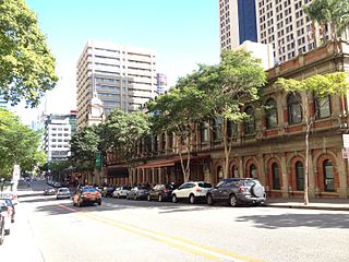
Ann Street runs parallel to Adelaide Street and is the northernmost street in the Brisbane CBD in Queensland, Australia. The street is named for Anne, Queen of Great Britain, as part of the CBD street naming series of female British royalty. It is a major thoroughfare, linking as a four-lane one-way street the suburb of Fortitude Valley in the northeast with the Riverside Expressway in the southwest; house numbers run the opposite direction.

<span class="mw-page-title-main">Shire of Stephens</span> Local government area in Queensland, Australia

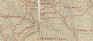
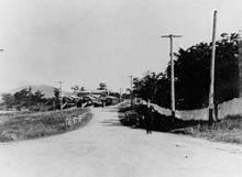
The Shire of Stephens was a local government area in the inner southern suburbs of Brisbane, Queensland, Australia. The shire, administered from Annerley, covered an area of 9 square miles (23 km2), and existed as a local government entity from 1886 until 1925, when it was amalgamated into the City of Brisbane under the City of Brisbane Act 1924.

<span class="mw-page-title-main">City of Brisbane</span> Local government area in Queensland, Australia

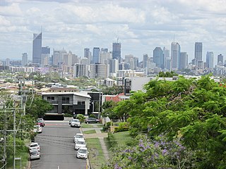
The City of Brisbane is a local government area (LGA) which comprises the inner portion of the metropolitan area of Brisbane, the capital of Queensland, Australia. Its governing body is the Brisbane City Council. Unlike LGAs in the other mainland state capitals, which are generally responsible only for the central business districts and inner neighbourhoods of those cities, the City of Brisbane administers a significant portion of the Brisbane metropolitan area, serving almost half of the population of the Brisbane Greater Capital City Statistical Area (GCCSA). As such, it has a larger population than any other local government area in Australia. The City of Brisbane was the first Australian LGA to reach a population of more than one million. Its population is roughly equivalent to the populations of Tasmania, the Australian Capital Territory and the Northern Territory combined. In 2016–2017, the council administered a budget of over $3 billion, by far the largest budget of any LGA in Australia.

<span class="mw-page-title-main">Old Cleveland Road</span>

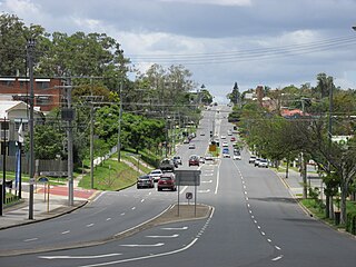
Old Cleveland Road is a major road in Brisbane, Queensland. It runs 19.3 kilometres (12.0 mi) from Stones Corner to Capalaba in Brisbane, with most of the route signed as State Route 22. Sections of the road are also part of State Routes 30, 54, and 55. The road is the main route from inner Brisbane to Capalaba and Cleveland since New Cleveland Road only links Tingalpa with Capalaba.

<span class="mw-page-title-main">Conrad Gargett</span>

Conrad Gargett is an Australian architecture and design practice. It was founded in Brisbane in 1890 and is one of Queensland's oldest architectural firms.

<span class="mw-page-title-main">Coorparoo School of Arts and RSL Memorial Hall</span> Heritage-listed school in City of Brisbane

Coorparoo School of Arts and RSL Memorial Hall is a heritage-listed school of arts at 208 Cavendish Road, Coorparoo, City of Brisbane, Queensland, Australia. It was built from 1892 to 1953. It is also known as Coorparoo School of Arts and Coorparoo Shire Hall. It was added to the Queensland Heritage Register on 6 January 1999.

<span class="mw-page-title-main">Coorparoo Fire Station</span> Historic site in Queensland, Australia

Coorparoo Fire Station is a heritage-listed former fire station at 219 Cavendish Road, Coorparoo, City of Brisbane, Queensland, Australia. It was designed by Atkinson & Conrad and built in 1935. It was added to the Queensland Heritage Register on 11 June 2003.

Henry Wallace Atkinson was an architect in Brisbane, Queensland, Australia. Many of his works are now heritage-listed.

References

  1. 1 2 3 "Queensland Globe". State of Queensland . Retrieved 2 October 2014.
  2. 1 2 Cumbrae Stewart, Francis William Sutton (1940). "Some notes on Coorparoo" (PDF). The Historical Society of Queensland Journal. Brisbane: The Historical Society of Queensland. 3 (2): 67–79. Archived (PDF) from the original on 6 October 2014. Retrieved 2 October 2014.
  3. "Opening and closing dates of Queensland Schools". Queensland Government . Retrieved 16 September 2014.
  4. "Coorparoo Fire Station (former) (entry 600569)". Queensland Heritage Register . Queensland Heritage Council. Retrieved 17 December 2014.
  5. "Coorparoo School of Arts and RSL Memorial Hall (entry 602054)". Queensland Heritage Register . Queensland Heritage Council. Retrieved 17 December 2014.