
Milton is a riverside inner suburb of the City of Brisbane, Queensland, Australia. In the 2021 census, Milton had a population of 3,144 people.

Albion is an inner north-eastern suburb in the City of Brisbane, Queensland, Australia. In the 2021 census, Albion had a population of 3,446 people.

Alderley is a northern suburb in the City of Brisbane, Queensland, Australia. In the 2021 census, Alderley had a population of 6,748 people.

Windsor is an inner northern suburb in the City of Brisbane, Queensland, Australia. In the 2021 census, Windsor had a population of 7,811 people.

New Farm is an inner northern riverside suburb in the City of Brisbane, Queensland, Australia. In the 2021 census, New Farm had a population of 12,197 people.

Kelvin Grove is an inner northern suburb in the City of Brisbane, Queensland, Australia. In the 2021 census, Kelvin Grove had a population of 7,909 people.

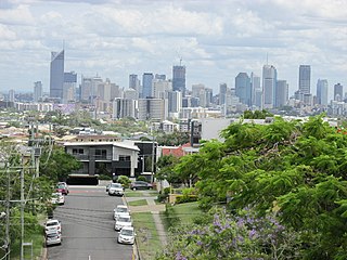
Ashgrove is a suburb in the City of Brisbane, Queensland, Australia. In the 2021 census, Ashgrove had a population of 13,450 people.
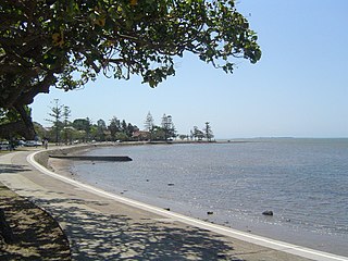
Manly is an eastern bayside suburb in the City of Brisbane, Queensland, Australia. In the 2021 census, Manly had a population of 4,273 people.
Greenslopes is a southern suburb in the City of Brisbane, Queensland, Australia. It is 6.0 kilometres (3.7 mi) by road south of the Brisbane CBD. In the 2021 census, Greenslopes had a population of 7,941 people.

Paddington is an inner suburb in the City of Brisbane, Queensland, Australia. In the 2021 census, Paddington had a population of 9,063 people.
Newmarket is a north-west suburb in the City of Brisbane, Queensland, Australia. In the 2021 census, Newmarket had a population of 5,083 people.

Red Hill is an inner northern suburb in the City of Brisbane, Queensland, Australia. In the 2021 census, Red Hill had a population of 5,834 people.

Wilston is a northern suburb in the City of Brisbane, Queensland, Australia. In the 2021 census, Wilston had a population of 4,110 people.
Grange is a northern suburb in the City of Brisbane, Queensland, Australia. In the 2021 census, Grange had a population of 4,615 people.

Enoggera is a north-western suburb in the City of Brisbane, Queensland, Australia. It is home to the Gallipoli Barracks.

Cannon Hill is a suburb in the City of Brisbane, Queensland, Australia. In the 2021 census, Cannon Hill had a population of 6,701 people.

Enoggera Reservoir is an outer north-western suburb in the City of Brisbane, Queensland, Australia. In the 2021 census, Enoggera Reservoir had a population of 33 people.
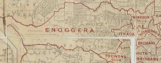
The Town of Ithaca is a former local government area of Queensland, Australia, located in inner western Brisbane.
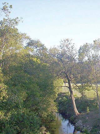
Enoggera Creek is a creek which flows through the City of Brisbane in South-East Queensland, Australia.

Waterworks Road is an 8.5 km (5.3 mi) arterial road in Brisbane, Queensland, Australia. It is currently signed as State Route 31 for its entire length. Waterworks Road transports traffic between the Brisbane central business district and western suburbs such as Red Hill, Ashgrove and The Gap.

