Queensland is the second-largest state in Australia. As at 2020, it contained more than 1,000 protected areas. In August 2023, it was estimated a total of 14.5 million hectares or 8.38% of Queensland's landmass was protected.
Mount Pinbarren is a national park in Queensland, Australia, 129 km north of Brisbane. It is located in Pinbarren, a locality in the Shire of Noosa. Mount Pinbarren lies within the South East Queensland bioregion and the Mary River catchment area.

Noosa National Park is a national park in Queensland, Australia, 121 km north of Brisbane. It is situated near Noosa Heads between the Pacific Ocean and the Sunshine Coast's northern area of urban development and extends southwards, past Lake Weyba to Coolum.

The Springbrook National Park is a protected national park that is located in the Gold Coast hinterland of Queensland, Australia. The 6,197-hectare (15,310-acre) park is situated on the McPherson Range, near Springbrook, approximately 100 kilometres (62 mi) south of Brisbane. The park is part of the Shield Volcano Group of the UNESCO World Heritage–listed Gondwana Rainforests of Australia.

The Sunshine Coast is a peri-urban region in South East Queensland, Australia. It is the district defined in 1967 as "the area contained in the Shires of Landsborough, Maroochy and Noosa, but excluding Bribie Island". Located 100 km (62 mi) north of the centre of Brisbane in South East Queensland, on the Coral Sea coastline, its urban area spans approximately 60 km (37 mi) of coastline and hinterland from Pelican Waters to Tewantin.

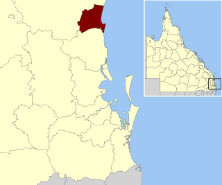
The Shire of Noosa is a local government area about 130 kilometres (81 mi) north of Brisbane in the Sunshine Coast district of South East Queensland, Australia. The shire covers an area of 870 square kilometres (335.9 sq mi). It existed as a local government entity from 1910 until 2008, when it was amalgamated with the Shire of Maroochy and City of Caloundra to form the Sunshine Coast Region. The shire was re-established on 1 January 2014. In the 2021 census, the shire had a population of 56,298 people.

Noosa District State High School is a twin campus high school based in Cooroy and Pomona in the Shire of Noosa, Queensland, Australia.

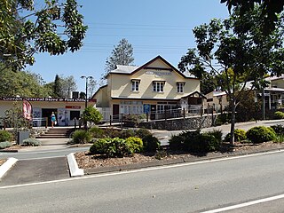
Pomona is a rural town and locality in the Shire of Noosa, Queensland, Australia. It is about 135 kilometres north of Brisbane. The town was originally called Pinbarren Siding from 1890-1900 as a subsidiary to Pinbarren.

Cooran is a rural hinterland town and locality in the Shire of Noosa, Queensland, Australia. In the 2021 census, the locality of Cooran had a population of 1,756 people.

Pinbarren is a rural town and locality in the Shire of Noosa, Queensland, Australia. In the 2021 census, the locality of Pinbarren had a population of 447 people.

Tuchekoi is a rural locality in the Gympie Region, Queensland, Australia. In the 2021 census, Tuchekoi had a population of 199 people.

Cooroora was an electoral district of the Legislative Assembly in the Australian state of Queensland from 1912 to 1992.
Noosa Biosphere Reserve is an internationally protected area covering the region of Noosa in Queensland, Australia. It is formally recognised as a Biosphere Reserve by the United Nations Education, Scientific and Cultural Organization (UNESCO) and Man and the Biosphere (MAB) program for its highly diverse ecosystem over a relatively small space. It was the first Biosphere Reserve for the state of Queensland, established in September 2007. The reserve is bound by the Noosa Shire Council boundaries, extending offshore by 3 kilometres (1.9 mi), covering 150,000 hectares in total. It is governed by Noosa Biosphere Limited (NBL), a not-for-profit company, which mainly consists of members from the local community who fulfil roles in the governance board, sector boards, and partnerships. Community plays a significant role in the implementation of the Biosphere Reserve guidelines.

Mount Cooroora is located west of the town of Pomona in the Noosa hinterland, Queensland, Australia. The peak is a 439 metres high intrusive volcanic plug and is the highest point and main feature of the Tuchekoi National Park. The former Electoral district of Cooroora was named after the mountain.

Kuranda National Park is a national park in Far North Queensland, Australia. Like many national parks in the area it belongs to the Wet Tropics World Heritage Area. The park protects an important wildlife corridor in which rainforest and open eucalypt forest predominate. Walking, mountain biking and four-wheel driving are popular recreational activities.

The Tewantin National Park is a 13 square kilometre national park in Queensland, Australia. It consists of five individual areas west of Noosa Heads in the Wide Bay-Burnett region about 115 kilometres north of Brisbane and 125 km south of Hervey Bay. The park is divided into disconnected sections within Lake Macdonald, Tinbeerwah, Tewantin and Noosaville.

Gheerulla is a rural locality in the Sunshine Coast Region, Queensland, Australia. In the 2021 census, Gheerulla had a population of 291 people.

"King of the Mountain" is a song by Australian rock band Midnight Oil, released in 1990 as the third single from their seventh studio album, Blue Sky Mining (1990). It peaked at No. 25 on the Australian Singles Chart, No. 3 on the US Billboard Modern Rock Tracks chart, and No. 20 on the Billboard Album Rock Tracks chart.
The King of the Mountain is an annual mountain climb race held in Pomona, in the Australian state of Queensland and organised by the Cooroy-Pomona Lions Club. Since its first formal race in 1959 following a bet in the Railway Hotel in 1958, the race has become a local holiday involving the district schools and a carnival like atmosphere.
Noosa District State High School – Pomona Campus is a high school based in Pomona in the Shire of Noosa, Queensland, Australia. It is the junior campus of Noosa District State High School.


