
Cooroy is a rural town and locality in the Shire of Noosa, Queensland, Australia. In the 2021 census, the locality of Cooroy had a population of 4,801 people.

Tewantin is a town and locality in the Shire of Noosa, Queensland, Australia. Tewantin was the original settlement in the Noosa region and is one of its three major centres today. In the 2021 census, the locality of Tewantin had a population of 11,164 people.

Pomona is a rural town and locality in the Shire of Noosa, Queensland, Australia. It is about 135 kilometres north of Brisbane. The town was originally called Pinbarren Siding from 1890-1900 as a subsidiary to Pinbarren. In the 2021 census, the locality of Pomona had a population of 2,931 people.

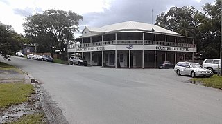
Boreen Point is a rural locality in the Shire of Noosa, Queensland, Australia. The town of Boreen is located within the locality beside the lake, but the town name is rarely used with Boreen Point being the name in common usage.

Cooran is a rural hinterland town and locality in the Shire of Noosa, Queensland, Australia. In the 2021 census, the locality of Cooran had a population of 1,756 people.
Kin Kin is a rural town and locality in the Shire of Noosa, Queensland, Australia. In the 2021 census, the locality of Kin Kin had a population of 844 people.
Doonan is a rural residential locality split between the Sunshine Coast Region and the Shire of Noosa, both in Queensland, Australia. In the 2021 census, Doonan had a population of 3,727 people.

Lake Macdonald is a rural locality in the Shire of Noosa, Queensland, Australia. In the 2021 census, Lake Macdonald had a population of 1,352 people.
Tinbeerwah is a semi-rural locality in the Shire of Noosa, Queensland, Australia. In the 2021 census, Tinbeerwah had a population of 1,160 people.

Noosa North Shore is a coastal rural locality in the Shire of Noosa, Queensland, Australia. In the 2021 census, Noosa North Shore had a population of 253 people.
Federal is a rural locality in the Shire of Noosa, Queensland, Australia. It is located in the Sunshine Coast hinterland near the towns of Cooran and Pomona. In the 2021 census, Federal had a population of 365 people.
Ridgewood is a rural locality in the Shire of Noosa, Queensland, Australia. In the 2021 census, Ridgewood had a population of 317 people.
Black Mountain is a rural locality in the Shire of Noosa, Queensland, Australia. In the 2021 census, Black Mountain had a population of 1,560 people.

Pinbarren is a rural town and locality in the Shire of Noosa, Queensland, Australia. In the 2021 census, the locality of Pinbarren had a population of 447 people.
Cootharaba is a rural locality in the Shire of Noosa, Queensland, Australia. In the 2021 census, Cootharaba had a population of 866 people.
Cooroy Mountain is a rural locality in the Shire of Noosa, Queensland, Australia. In the 2021 census, Cooroy Mountain had a population of 148 people.

Como is a rural locality in the Shire of Noosa, Queensland, Australia. In the 2021 census, Como had a population of 54 people.

Eerwah Vale is a locality split between the Sunshine Coast Region and Shire of Noosa, both in Queensland, Australia. In the 2021 census, Eerwah Vale had a population of 671 people.

Pomona State School is a government primary school in Pomona, Shire of Noosa, Queensland, Australia. It was established on 31 August 1897.

The Tewantin National Park is a 13 square kilometre national park in Queensland, Australia. It consists of five individual areas west of Noosa Heads in the Wide Bay-Burnett region about 115 kilometres north of Brisbane and 125 km south of Hervey Bay. The park is divided into disconnected sections within Lake Macdonald, Tinbeerwah, Tewantin and Noosaville.
