
Cooroy is a rural town and locality in the Shire of Noosa, Queensland, Australia. In the 2016 census the locality of Cooroy had a population of 3,791 people.

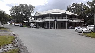
Pomona is a rural town and locality in the Shire of Noosa, Queensland, Australia. In the 2021 census the locality of Pomona had a population of 2,926 people in 2021 and is located around 135 kilometres north of Brisbane. The town was originally called Pinbarren Siding from 1890-1900 as a subsidiary to Pinbarren.

Cooran is a rural hinterland town and locality in the Shire of Noosa, Queensland, Australia. In the 2016 census the locality of Cooran had a population of 1,624 people.
Kin Kin is a rural town and locality in the Shire of Noosa, Queensland, Australia. In the 2016 census, the locality of Kin Kin had a population of 764 people. In the 2021 census the population had risen to 844.
Doonan is a rural residential locality split between the Sunshine Coast Region and the Shire of Noosa, both in Queensland, Australia. In the 2021 census, Doonan had a population of 3,727 people.

Lake Macdonald is a rural locality in the Shire of Noosa, Queensland, Australia. In the 2016 census Lake Macdonald had a population of 1,363 people.
Tinbeerwah is a semi-rural locality in the Shire of Noosa, Queensland, Australia. In the 2021 census, Tinbeerwah had a population of 1,160 people.
Ridgewood is a rural locality in the Shire of Noosa, Queensland, Australia. In the 2021 census, Ridgewood had a population of 317 people.
Black Mountain is a rural locality in the Shire of Noosa, Queensland, Australia. In the 2021 census, Black Mountain had a population of 1,560 people.

Pinbarren is a rural town and locality in the Shire of Noosa, Queensland, Australia. In the 2021 census, the locality of Pinbarren had a population of 447 people.
Ringtail Creek is a rural locality in the Shire of Noosa, Queensland, Australia. In the 2016 census Ringtail Creek had a population of 197 people.
Cootharaba is a rural locality in the Shire of Noosa, Queensland, Australia. In the 2021 census, Cootharaba had a population of 866 people.
Cooroy Mountain is a rural locality in the Shire of Noosa, Queensland, Australia. In the 2021 census, Cooroy Mountain had a population of 148 people.

Como is a rural locality in the Shire of Noosa, Queensland, Australia. In the 2021 census, Como had a population of 54 people.

Tuchekoi is a rural locality in the Gympie Region, Queensland, Australia. In the 2021 census, Tuchekoi had a population of 199 people.
Kybong is a rural locality in the Gympie Region, Queensland, Australia. In the 2021 census, Kybong had a population of 363 people.

Curra is a rural residential locality in the Gympie Region, Queensland, Australia. In the 2021 census, Curra had a population of 2,104 people.

Traveston is a rural town and locality in the Gympie Region, Queensland, Australia. In the 2016 census the locality of Traveston had a population of 480 people.
Coles Creek is a rural locality in the Gympie Region, Queensland, Australia. In the 2021 census, Coles Creek had a population of 68 people.
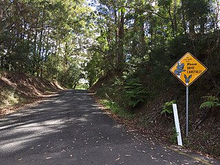
Cooroy–Gympie Road is a continuous 29.1 kilometres (18.1 mi) road route in the Noosa and Gympie regions of Queensland, Australia. It is a state-controlled district road. Known as Old Bruce Highway, It runs from Cooroy Connection Road on the Black Mountain / Pomona midpoint to the Bruce Highway in Kybong. This road provides access to several localities bypassed by the current alignment of the highway.


