Conondale National Park is 130 km north of Brisbane in the Sunshine Coast Hinterland near the town of Conondale in the south east Queensland bioregion. The park covers an area of 35,648 hectares protecting large areas of subtropical rainforest, woodlands, wet and dry sclerophyll forest including Queensland's tallest tree. The park contains areas of regenerating forest which have been previously logged; areas of forest plantations also border the park. The park is currently managed by the Queensland Government under the Nature Conservation Act 1992.

The Main Range is a mountain range and national park in Queensland, Australia, located predominantly in Tregony, Southern Downs Region, 85 kilometres (53 mi) southwest of Brisbane. It is part of the World Heritage Site Gondwana Rainforests of Australia. It protects the western part of a semicircle of mountains in South East Queensland known as the Scenic Rim. This includes the largest area of rainforest in South East Queensland. The park is part of the Scenic Rim Important Bird Area, identified as such by BirdLife International because of its importance in the conservation of several species of threatened birds.
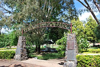
Kenilworth is a rural town and locality in the Sunshine Coast Region, Queensland, Australia. In the 2016 census, the locality of Kenilworth had a population of 558 people. In the 2021 census, Kenilworth had a population of 604 people. The residents of Kenilworth are 49.0% males and 51.0% females and reported a median age of 51 years old.
The D'Aguilar Range is a mountain range near Brisbane, Queensland, Australia. The town of Dayboro is situated on the lower foothills midway along the range and the Sunshine Coast Hinterland town of Mooloolah lies at the northernmost point of the range. Many residential areas line its eastern slopes including the town of Samford and the suburb of Ferny Hills. In the west, numerous ridges and gullies are heavily forested and designated as state forest or national park.

The Stanley River is a perennial river in the South East region of Queensland, Australia. A major tributary of the Brisbane River, the Stanley River valley extends roughly 35 kilometres (22 mi) westwards from the area south of Maleny, through Woodford to Kilcoy before veering southwards.

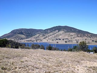
Kilcoy is a rural town and locality in the Somerset Region, Queensland, Australia. In the 2016 census, the locality of Kilcoy had a population of 1,898 people.

The Mary River is a major river system in the South East and Wide Bay–Burnett regions of Queensland, Australia. The Mary River is unique in that it flows south to north.

Woodford is a rural town and locality in the City of Moreton Bay, Queensland, Australia. In the 2016 census, the locality of Woodford had a population of 3,458 people.
The Scenic Rim is a group of forested mountain ranges of the Great Dividing Range, located south of Brisbane agglomeration, straddling the border between south-eastern Queensland and north-eastern New South Wales, Australia. In 2021, the Scenic Rim was named as a Lonely Planet top destination for 2022.

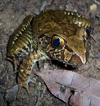
The eastern bristlebird is a species of bird in the bristlebird family, Dasyornithidae. It is endemic to Australia. Its natural habitats are temperate forests, temperate shrubland, and temperate grassland. It is threatened by habitat loss.

The Somerset Region is a local government area located in the West Moreton region of South East Queensland, Australia, about 100 kilometres (62 mi) northwest of Brisbane and centred on the town of Esk. It was created in 2008 from a merger of the Shire of Esk and the Shire of Kilcoy. It is commonly known as the Brisbane Valley, due to the Brisbane River which courses through the region, although significant parts of the region lie outside the hydrological Brisbane Valley itself.

The Blackall Range is a mountain range in South East Queensland, Australia. The first European explorer in the area was Ludwig Leichhardt. It was named after Samuel Blackall, the second Governor of Queensland.
The Kangaroo River Nature Reserve, part of the Kangaroo Valley Group of Nature Reserves, is a protected nature reserve that is located on the floor of the Kangaroo Valley in the Southern Highlands and South Coast regions of New South Wales in eastern Australia. The reserve is situated approximately 150 kilometres (93 mi) south of Sydney, 50 kilometres (31 mi) southwest of Wollongong and 16 kilometres (9.9 mi) northwest of Nowra. The reserve has a protective covenant placed upon it with purpose to ensure the protection of the natural heritage of this area. National parks in the area include the Morton National Park and the Budderoo National Park. Other nature reserves in the area include the Barren Grounds Nature Reserve, and the Cambewarra Range, Barrengarry and Rodway nature reserves – the latter three part of the Kangaroo Valley Group of Nature Reserves.

Mount Delaney is a rural locality in the City of Moreton Bay, Queensland, Australia. In the 2016 census Mount Delaney had a population of 85 people.
Bellthorpe National Park is a national park located in Bellthorpe, Booroobin and Sandy Creek in both the City of Moreton Bay and Somerset Region of South East Queensland, Australia. The park preserves eucalypt forest and rainforest of the southern Conondale Range. Parts of the national park were previously known as Bellthor.
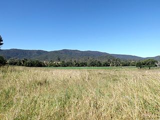
Mount Archer is a mountain and a rural locality in the Somerset Region, Queensland, Australia. In the 2016 census the locality of Mount Archer had a population of 305 people.

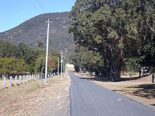
Glenfern is a rural locality in the Somerset Region, Queensland, Australia. In the 2016 census Glenfern had a population of 10 people.
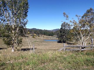
Sandy Creek is a rural locality in the Somerset Region, Queensland, Australia. In the 2016 census, Sandy Creek had a population of 567 people.

Sheep Station Creek is a rural locality in the Somerset Region, Queensland, Australia. In the 2016 census, Sheep Station Creek had a population of 108 people.

Hazeldean is a rural locality in the Somerset Region, Queensland, Australia. In the 2016 census, Hazeldean had a population of 262 people.