Mount Kilcoy, Queensland

Last updated

Map all coordinates using: OpenStreetMap
Mount Kilcoy
Queensland
Paddocks Mount Kilcoy Queensland.jpg
Paddocks on Jenkinsons Road, 2015
Australia Queensland location map.svg
Red pog.svg
Mount Kilcoy
Coordinates 26°50′32″S152°34′21″E / 26.8422°S 152.5724°E / -26.8422; 152.5724 (Mount Kilcoy (centre of locality))
Population277 (SAL 2021) [1]
Postcode(s) 4515
Area77.9 km2 (30.1 sq mi)
Time zone AEST (UTC+10:00)
Location
  • 9.6 km (6 mi) NNE of Kilcoy
  • 61.2 km (38 mi) NE of Esk
  • 112 km (70 mi) NNW of Brisbane
LGA(s) Somerset Region
State electorate(s) Nanango
Federal division(s) Blair
Suburbs around Mount Kilcoy:
Jimna Jimna Jimna
Sheep Station Creek Mount Kilcoy Sandy Creek
Sheep Station Creek Winya Sandy Creek

Mount Kilcoy is a rural locality in the Somerset Region, Queensland, Australia. [2] In the 2021 census, Mount Kilcoy had a population of 277 people. [3]

Contents

Geography

Mount Kilcoy occupies a valley drained by Kilcoy Creek at the southern end of the Conondale Range. Kilcoy Weir was built at Mount Kilcoy and is able to retain a maximum of 158 megalitres. [4] The flatter land along the creek is used for agriculture while the sloping terrain towards the north, east and western boundaries remains vegetated.

History

The locality takes its name from the mountain which in turn takes its name from the pastoral station established by brothers Evan and Colin Mackenzie in 1842, which in turns takes its name from Kilcoy in Ross-shire, Scotland ( 57°32′15″N4°22′15″W / 57.5376°N 4.3708°W / 57.5376; -4.3708 (Kilcoy, Ross-shire, Scotland) ). [2]

Mount Kilcoy State School opened on 18 January 1909 with one teacher and 26 students. [5] [6] [7]

Demographics

In the 2011 census, Mount Kilcoy had a population of 255 people. [8]

In the 2016 census, Mount Kilcoy had a population of 261 people. [9]

In the 2021 census, Mount Kilcoy had a population of 277 people. [3]

Education

Mount Kilcoy State School, 2015 Mount Kilcoy School Queensland.jpg
Mount Kilcoy State School, 2015

Mount Kilcoy State School is a government primary (Prep-6) school for boys and girls at 251 Jenkinsons Road ( 26°52′25″S152°35′13″E / 26.8736°S 152.5869°E / -26.8736; 152.5869 (Mount Kilcoy State School) ). [10] [11] In 2017, the school had an enrolment of 129 students with 13 teachers (8 full-time equivalent) and 7 non-teaching staff (5 full-time equivalent). [12]

There are no seconndary schools in Mount Kilcoy. The nearest government secondary school is Kilcoy State High School in Kilcoy to the south. [13]

Related Research Articles

<span class="mw-page-title-main">Kilcoy, Queensland</span> Town in Queensland, Australia

Kilcoy is a rural town and locality in the Somerset Region, Queensland, Australia. In the 2016 census, the locality of Kilcoy had a population of 1,898 people.

<span class="mw-page-title-main">Tinbeerwah, Queensland</span> Suburb of Shire of Noosa, Queensland, Australia

Tinbeerwah is a semi-rural locality in the Shire of Noosa, Queensland, Australia. In the 2021 census, Tinbeerwah had a population of 1,160 people.

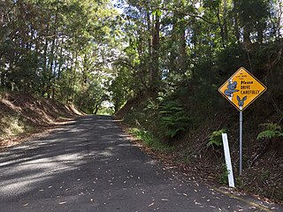
Cooroy Mountain is a rural locality in the Shire of Noosa, Queensland, Australia. In the 2021 census, Cooroy Mountain had a population of 148 people.

<span class="mw-page-title-main">Delaneys Creek, Queensland</span> Suburb of City of Moreton Bay, Queensland, Australia

Delaneys Creek is a rural locality in the City of Moreton Bay, Queensland, Australia. In the 2016 census, Delaneys Creek had a population of 1,061 people.

Stony Creek is a rural locality in the City of Moreton Bay in Queensland, Australia. In the 2016 census Stony Creek had a population of 262 people.

<span class="mw-page-title-main">Villeneuve, Queensland</span> Suburb of Somerset Region, Queensland, Australia

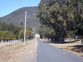
Villeneuve is a rural town and locality in the Somerset Region, Queensland, Australia. In the 2021 census, the locality of Villeneuve had a population of 193 people.

<span class="mw-page-title-main">Crossdale, Queensland</span> Suburb of Somerset Region, Queensland, Australia

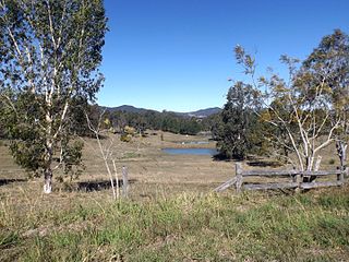
Crossdale is a rural locality in the Somerset Region, Queensland, Australia. In the 2016 census, Crossdale had a population of 75 people.

<span class="mw-page-title-main">Mount Delaney</span> Suburb of City of Moreton Bay, Queensland, Australia

Mount Delaney is a rural locality in the City of Moreton Bay, Queensland, Australia. In the 2016 census Mount Delaney had a population of 85 people.

<span class="mw-page-title-main">Mount Archer, Queensland (Somerset Region)</span> Suburb of Somerset Region, Queensland, Australia

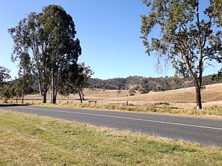
Mount Archer is a mountain and a rural locality in the Somerset Region, Queensland, Australia. In the 2016 census the locality of Mount Archer had a population of 305 people.

<span class="mw-page-title-main">Glenfern, Queensland</span> Suburb of Somerset Region, Queensland, Australia

Glenfern is a rural locality in the Somerset Region, Queensland, Australia. In the 2016 census Glenfern had a population of 10 people.

<span class="mw-page-title-main">Royston, Queensland</span> Suburb of Somerset Region, Queensland, Australia

Royston is a rural locality in the Somerset Region, Queensland, Australia. In the 2016 census, Royston had a population of 336 people.

<span class="mw-page-title-main">Sandy Creek, Queensland</span> Suburb of Somerset Region, Queensland, Australia

Sandy Creek is a rural locality in the Somerset Region, Queensland, Australia. In the 2016 census, Sandy Creek had a population of 567 people.

<span class="mw-page-title-main">Winya, Queensland</span> Suburb of Somerset Region, Queensland, Australia

Winya is a rural locality in the Somerset Region, Queensland, Australia. In the 2016 census, Winya had a population of 72 people.

<span class="mw-page-title-main">Woolmar, Queensland</span> Suburb of Somerset Region, Queensland, Australia

Woolmar is a rural locality in the Somerset Region, Queensland, Australia. In the 2021 census, Woolmar had a population of 565 people.

<span class="mw-page-title-main">Sheep Station Creek, Queensland</span> Suburb of Somerset Region, Queensland, Australia

Sheep Station Creek is a rural locality in the Somerset Region, Queensland, Australia. In the 2016 census, Sheep Station Creek had a population of 108 people.

<span class="mw-page-title-main">Hazeldean, Queensland</span> Suburb of Somerset Region, Queensland, Australia

Hazeldean is a rural locality in the Somerset Region, Queensland, Australia. In the 2016 census, Hazeldean had a population of 262 people.

Ashfield is a mixed residential and rural locality in the Bundaberg Region, Queensland, Australia. In the 2016 census, Ashfield had a population of 793 people; and in the 2021 census population increased to 1,152 people, which represents a growth of approximately 45%.

Westvale is a locality in the Somerset Region, Queensland, Australia. In the 2021 census, Westvale had a population of 0 people.

Gregors Creek is a rural locality in the Somerset Region, Queensland, Australia. In the 2021 census, Gregors Creek had a population of 87 people.

Scrub Creek is a rural locality in the Somerset Region, Queensland, Australia. In the 2016 census, Scrub Creek had a population of 32 people.

References

  1. Australian Bureau of Statistics (28 June 2022). "Mount Kilcoy (Suburb and Locality)". Australian Census 2021 QuickStats. Retrieved 28 June 2022.  OOjs UI icon edit-ltr-progressive.svg
  2. 1 2 "Mount Kilcoy – locality in Somerset Region (entry 44902)". Queensland Place Names. Queensland Government . Retrieved 30 November 2019.
  3. 1 2 Australian Bureau of Statistics (28 June 2022). "Mount Kilcoy (SAL)". 2021 Census QuickStats. Retrieved 28 February 2023. OOjs UI icon edit-ltr-progressive.svg
  4. "Weirs". Seqwater. Archived from the original on 26 August 2014. Retrieved 18 August 2015.
  5. "Mount Kilcoy State School". Department of Education and Training. Archived from the original on 9 March 2015. Retrieved 18 August 2015.
  6. "Our school". Mount Kilcoy State School. 4 February 2020. Retrieved 16 August 2023.
  7. Queensland Family History Society (2010), Queensland schools past and present (Version 1.01 ed.), Queensland Family History Society, ISBN   978-1-921171-26-0
  8. Australian Bureau of Statistics (31 October 2012). "Mount Kilcoy (State Suburb)". 2011 Census QuickStats. Retrieved 18 August 2015. OOjs UI icon edit-ltr-progressive.svg
  9. Australian Bureau of Statistics (27 June 2017). "Mount Kilcoy (SSC)". 2016 Census QuickStats. Retrieved 20 October 2018. OOjs UI icon edit-ltr-progressive.svg
  10. "State and non-state school details". Queensland Government. 9 July 2018. Archived from the original on 21 November 2018. Retrieved 21 November 2018.
  11. "Mount Kilcoy State School". Mount Kilcoy State School. 29 November 2020. Archived from the original on 12 July 2012. Retrieved 15 August 2023.
  12. "ACARA School Profile 2017". Archived from the original on 22 November 2018. Retrieved 22 November 2018.
  13. "Queensland Globe". State of Queensland . Retrieved 16 August 2023.

Commons-logo.svg Media related to Mount Kilcoy, Queensland at Wikimedia Commons