
Toogoolawah is a rural town and locality in the Somerset Region, Queensland, Australia. In the 2021 census, Toogoolawah had a population of 1,200 people.
Lowood is a rural town and locality in the Somerset Region, Queensland, Australia. In the 2021 census, the locality of Lowood had a population of 4,082 people.

Linville is a rural town and locality in the Somerset Region, Queensland, Australia. In the 2021 census, the locality of Linville had a population of 133 people.

Moore is a rural town and locality in the Somerset Region, Queensland, Australia. In the 2021 census, the locality of Moore had a population of 286 people.

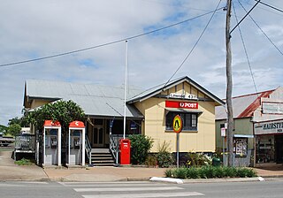
Harlin is a rural town and locality in the Somerset Region, Queensland, Australia. In the 2021 census, the locality of Harlin had a population of 211 people.

Colinton is a rural locality in the Somerset Region, Queensland, Australia. In the 2021 census, Colinton had a population of 60 people.

Mount Beppo is a rural locality in the Somerset Region, Queensland, Australia. In the 2021 census, Mount Beppo had a population of 251 people.
Mount Byron is a rural locality in the Somerset Region, Queensland, Australia. In the 2021 census, Mount Byron had a population of 21 people.

Hazeldean is a rural locality in the Somerset Region, Queensland, Australia. In the 2021 census, Hazeldean had a population of 326 people.
Cooeeimbardi is a rural locality in the Somerset Region, Queensland, Australia. In the 2021 census, Cooeeimbardi had "no people or a very low population".
Lower Cressbrook is a rural locality in the Somerset Region, Queensland, Australia. In the 2021 census, Lower Cressbrook had a population of 21 people.
Fulham is a rural locality in the Somerset Region, Queensland, Australia. In the 2021 census, Fulham had a population of 53 people.
Murrumba is a rural locality in the Somerset Region, Queensland, Australia. In the 2021 census, Murrumba had "no people or a very low population".
Mount Stanley is a rural locality in the Somerset Region, Queensland, Australia. In the 2021 census, Mount Stanley had a population of 11 people.

Braemore is a rural locality in the Somerset Region, Queensland, Australia. In the 2021 census, Braemore had a population of 131 people.
Gregors Creek is a rural locality in the Somerset Region, Queensland, Australia. In the 2021 census, Gregors Creek had a population of 87 people.
Scrub Creek is a rural locality in the Somerset Region, Queensland, Australia. In the 2021 census, Scrub Creek had a population of 33 people.
Eskdale is a rural locality in the Somerset Region, Queensland, Australia. In the 2021 census, Eskdale had a population of 34 people.
Ivory Creek is a rural locality in the Somerset Region, Queensland, Australia. In the 2021 census, Ivory Creek had a population of 49 people.
Mount Hallen is a rural locality in the Somerset Region, Queensland, Australia. In the 2021 census, Mount Hallen had a population of 457 people.
