Glenfern, Queensland

Last updated

Glenfern
Queensland
Paddocks Glenfern Queensland.jpg
Fields along Runges Road, 2015
Australia Queensland location map.svg
Red pog.svg
Glenfern
Coordinates 26°57′59″S152°36′24″E / 26.9663°S 152.6066°E / -26.9663; 152.6066 (Glenfern (centre of locality))
Population11 (2021 census) [1]
 • Density0.78/km2 (2.02/sq mi)
Postcode(s) 4515
Area14.1 km2 (5.4 sq mi)
Time zone AEST (UTC+10:00)
Location
LGA(s) Somerset Region
State electorate(s) Nanango
Federal division(s) Blair
Suburbs around Glenfern:
Winya Sandy Creek Villeneuve
Winya Glenfern Mount Archer
Winya Westvale Westvale

Glenfern is a rural locality in the Somerset Region, Queensland, Australia. [2] In the 2021 census, Glenfern had a population of 11 people. [1]

Contents

Geography

The D'Aguilar Highway marks a section of the northern boundary. The southern boundary is roughly aligned with the Stanley River, however when the Somerset Dam is full, the dam's waters cover Glenfern's southern extent. Sandy Creek flows from the north into the dam in this area ( 26°58′20″S152°34′59″E / 26.9723°S 152.5831°E / -26.9723; 152.5831 (Sandy Creek) ) and forms the north-eastern boundary of the locality. [3] The land is used for farming. [4]

History

Alexander McPherson and his family outside the Glenfern Hotel, 1878 StateLibQld 1 85268 Alexander McPherson and his family outside the Glenfern Hotel, Kilcoy, 1878.jpg
Alexander McPherson and his family outside the Glenfern Hotel, 1878

In January 1880, Alexander McPherson obtained a country publican's licence to operate the Glenfern Hotel. [5] The Glenfern Hotel was located 3 miles (4.8 km) east of Kilcoy on the road to Woodford (now the D'Aguilar Highway). In 1884, McPherson died from a fall from his horse; [6] his wife Eliza (née Webb) continued to operate the hotel, being described in 1886 as "by no means a pretentious-looking place, but it was scrupulously clean". [7] In 1889, Eliza McPherson married John Young who became the licensee. [8] In 1890, the annual Kilcoy horse races were held in the hotel grounds. [9] The hotel operated until at least 1913 but by 1923 was in use as the private home of Amelia Raleigh (one of the McPherson daughters). [10] [11] The hotel no longer exists, but is likely to be the origin of the locality name. [12]

In 1913, the Kilcoy railway line was constructed with Glenfern railway station ( 26°57′14″S152°36′21″E / 26.9538°S 152.6058°E / -26.9538; 152.6058 (Glenfern railway station) ) serving the area. [13] [14] The railway line and the station closed in 1964.

Demographics

In the 2012 census, the population of Glenfern was very low so it was included in the population statistics for the adjoining locality of Velleneuve, which recorded a population of 449. [15]

In the 2016 census, Glenfern had a population of 10 people. [16]

In the 2021 census, Glenfern had a population of 11 people. [1]

Education

There are no schools in Glenfern. The nearest primary school is Kilcoy State School in Kilcoy to the west. The nearest secondary school is Kilcoy State High School, also in Kilcoy. [4]

Kilcoy Motorcycle Club

Kilcoy Motorcycle Club, 2015 Kilcoy Motorcycle Club Glenfern Queensland.jpg
Kilcoy Motorcycle Club, 2015

The Kilcoy Motorcycle Club leases a park on the western corner of Neurum Road and Runges Road ( 26°57′33″S152°36′28″E / 26.959165°S 152.607760°E / -26.959165; 152.607760 (Kilcoy Motorcycle Club) ) from the Somerset Regional Council. The club has developed an off-road motocross course on which it runs competitions and practice and coaching days. [17] Facilities include spectator grandstands, canteen and bar, and showers. The club competes in the Sunshine State Series and the South East Queensland Junior Series. The club hosts the annual Ironman Competition. [18]

Related Research Articles

<span class="mw-page-title-main">Kilcoy, Queensland</span> Town in Queensland, Australia

Kilcoy is a rural town and locality in the Somerset Region, Queensland, Australia. In the 2021 census, the locality of Kilcoy had a population of 1,996 people.

<span class="mw-page-title-main">Dayboro, Queensland</span> Town in Queensland, Australia

Dayboro is a rural town and locality in the City of Moreton Bay, Queensland, Australia. In the 2016 census, the locality of Dayboro had a population of 2,119 people.

<span class="mw-page-title-main">Woodford, Queensland</span> Town in Queensland, Australia

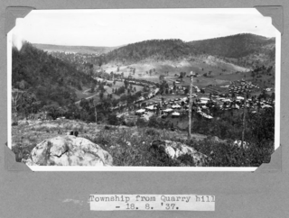
Woodford is a rural town and locality in the City of Moreton Bay, Queensland, Australia. In the 2016 census, the locality of Woodford had a population of 3,458 people.

<span class="mw-page-title-main">Shire of Kilcoy</span> Local government area in Queensland, Australia

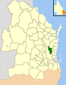
The Shire of Kilcoy was a local government area in South East Queensland, Australia, about 95 kilometres (59 mi) northwest of Brisbane along the D'Aguilar Highway, not far from the Sunshine Coast. The shire covered an area of 1,445.2 square kilometres (558.0 sq mi), and existed from 1912 until its merger with the Shire of Esk to form the Somerset Region on 15 March 2008.

<span class="mw-page-title-main">Mount Mee, Queensland</span> Town in Queensland, Australia

Mount Mee is a rural town and locality in the City of Moreton Bay, Queensland, Australia. In the 2021 census, Mount Mee had a population of 519 people.

<span class="mw-page-title-main">Delaneys Creek, Queensland</span> Suburb of City of Moreton Bay, Queensland, Australia

Delaneys Creek is a rural locality in the City of Moreton Bay, Queensland, Australia. In the 2021 census, Delaneys Creek had a population of 1,366 people.

<span class="mw-page-title-main">Moore, Queensland</span> Town in Queensland, Australia

Moore is a rural town and locality in the Somerset Region, Queensland, Australia. In the 2016 census, the locality of Moore had a population of 296 people.

Stanmore is a rural locality in the City of Moreton Bay, Queensland, Australia. In the 2021 census, Stanmore had a population of 454 people.

Stony Creek is a rural locality in the City of Moreton Bay in Queensland, Australia. In the 2016 census Stony Creek had a population of 262 people.

<span class="mw-page-title-main">Villeneuve, Queensland</span> Suburb of Somerset Region, Queensland, Australia

Villeneuve is a rural town and locality in the Somerset Region, Queensland, Australia. In the 2021 census, the locality of Villeneuve had a population of 193 people.

<span class="mw-page-title-main">Crossdale, Queensland</span> Suburb of Somerset Region, Queensland, Australia

Crossdale is a rural locality in the Somerset Region, Queensland, Australia. In the 2021 census, Crossdale had a population of 68 people.

<span class="mw-page-title-main">Mount Byron, Queensland</span> Suburb of Somerset Region, Queensland, Australia

Mount Byron is a rural locality in the Somerset Region, Queensland, Australia. In the 2016 census, Mount Byron had a population of 18 people.

<span class="mw-page-title-main">Mount Delaney</span> Suburb of City of Moreton Bay, Queensland, Australia

Mount Delaney is a rural locality in the City of Moreton Bay, Queensland, Australia. In the 2016 census Mount Delaney had a population of 85 people.

<span class="mw-page-title-main">Sandy Creek, Queensland</span> Suburb of Somerset Region, Queensland, Australia

Sandy Creek is a rural locality in the Somerset Region, Queensland, Australia. In the 2016 census, Sandy Creek had a population of 567 people.

<span class="mw-page-title-main">Mount Kilcoy, Queensland</span> Suburb of Somerset Region, Queensland, Australia

Mount Kilcoy is a rural locality in the Somerset Region, Queensland, Australia. In the 2021 census, Mount Kilcoy had a population of 277 people.

<span class="mw-page-title-main">Winya, Queensland</span> Suburb of Somerset Region, Queensland, Australia

Winya is a rural locality in the Somerset Region, Queensland, Australia. In the 2016 census, Winya had a population of 72 people.

<span class="mw-page-title-main">Hazeldean, Queensland</span> Suburb of Somerset Region, Queensland, Australia

Hazeldean is a rural locality in the Somerset Region, Queensland, Australia. In the 2021 census, Hazeldean had a population of 326 people.

<span class="mw-page-title-main">Somerset Dam, Queensland</span> Town in Queensland, Australia

Somerset Dam is a rural town and locality in the Somerset Region, Queensland, Australia. In the 2016 census, Somerset Dam had a population of 69 people. When first being planned, it was unofficially known as the Stanley River township.

Nukku is a rural locality in the South Burnett Region, Queensland, Australia. In the 2021 census, Nukku had a population of 40 people.

Gregors Creek is a rural locality in the Somerset Region, Queensland, Australia. In the 2021 census, Gregors Creek had a population of 87 people.

References

  1. 1 2 3 Australian Bureau of Statistics (28 June 2022). "Glenfern (SAL)". 2021 Census QuickStats. Retrieved 28 February 2023. OOjs UI icon edit-ltr-progressive.svg
  2. "Glenfern – locality in Somerset Region (entry 44871)". Queensland Place Names. Queensland Government . Retrieved 29 December 2020.
  3. "Sandy Creek – watercourse in Somerset Regional (entry 29672)". Queensland Place Names. Queensland Government . Retrieved 29 December 2020.
  4. 1 2 "Queensland Globe". State of Queensland . Retrieved 11 February 2021.
  5. "LOCAL AND GENERAL NEWS". Queensland Times, Ipswich Herald & General Advertiser . 15 January 1880. p. 3. Archived from the original on 11 February 2021. Retrieved 12 August 2015 via National Library of Australia.
  6. "Family Notices". The Brisbane Courier . 4 July 1884. p. 1. Archived from the original on 11 February 2021. Retrieved 12 August 2015 via National Library of Australia.
  7. "Through the Moreton District". The Queenslander . 23 January 1886. p. 150. Retrieved 12 August 2015 via National Library of Australia.
  8. "ANNUAL LIOENSING MEETING". The Brisbane Courier . 3 April 1890. p. 3. Retrieved 12 August 2015 via National Library of Australia.
  9. "Woodford and District". The Telegraph (SECOND EDITION ed.). Brisbane. 9 December 1890. p. 6. Archived from the original on 11 February 2021. Retrieved 12 August 2015 via National Library of Australia.
  10. "LICENSING COURT AT WOODFORD". The Brisbane Courier . 21 June 1913. p. 6. Retrieved 12 August 2015 via National Library of Australia.
  11. "PERSONAL". The Queensland Times (DAILY ed.). Ipswich, Queensland. 23 November 1922. p. 6. Archived from the original on 11 February 2021. Retrieved 12 August 2015 via National Library of Australia.
  12. "Former Glenfern Hotel". www.gdaypubs.com.au. Retrieved 11 August 2015.
  13. "Railway stations and sidings - Queensland". Queensland Open Data. Queensland Government. 2 October 2020. Archived from the original on 5 October 2020. Retrieved 5 October 2020.
  14. "Kilcoy Line Re-named". Chronicle and North Coast Advertiser . Qld. 1 August 1913. p. 2. Retrieved 12 August 2015 via National Library of Australia.
  15. Australian Bureau of Statistics (31 October 2012). "Villeneuve (State Suburb)". 2011 Census QuickStats. Retrieved 11 August 2015. OOjs UI icon edit-ltr-progressive.svg
  16. Australian Bureau of Statistics (27 June 2017). "Glenfern (SSC)". 2016 Census QuickStats. Retrieved 20 October 2018. OOjs UI icon edit-ltr-progressive.svg
  17. "Somerset Regional Council Meeting Highlights - 15 January 2015". Somerset Regional Council. Retrieved 12 August 2015.
  18. "Kilcoy Motorcycle Club". www.kilcoymx.org. Archived from the original on 11 February 2021. Retrieved 11 August 2015.

Commons-logo.svg Media related to Glenfern, Queensland at Wikimedia Commons