Borallon, Queensland

Last updated

Borallon
Queensland
Paddocks Borallon 2.jpg
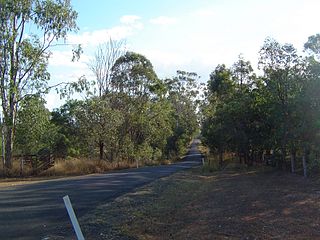
Paddocks along Hills Road, 2014
Australia Queensland location map.svg
Red pog.svg
Borallon
Coordinates 27°30′09″S152°42′04″E / 27.5025°S 152.7011°E / -27.5025; 152.7011 (Borallon (centre of locality)) Coordinates: 27°30′09″S152°42′04″E / 27.5025°S 152.7011°E / -27.5025; 152.7011 (Borallon (centre of locality))
Population81 (2016 census) [1]
 • Density5.87/km2 (15.20/sq mi)
Postcode(s) 4306
Area13.8 km2 (5.3 sq mi)
Time zone AEST (UTC+10:00)
LGA(s) Somerset Region
State electorate(s) Lockyer
Federal Division(s) Dickson
Suburbs around Borallon:
Fernvale Fernvale Lake Manchester
Fairney View Borallon Pine Mountain
Wanora Pine Mountain Pine Mountain

Borallon is a rural locality in the Somerset Region, Queensland, Australia. [2] In the 2016 census, Borallon had a population of 81 people. [1]

Contents

It is known for the Borallon Correctional Centre (a prison facility) located there.

History

Brisbane River at Hills Crossing Reserve, 2014 Brisbane River Borallon.jpg
Brisbane River at Hills Crossing Reserve, 2014

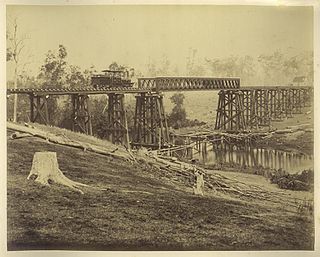
The locality takes its name from a railway station, which was in turned named by Queensland Railway Commissioner Francis Curnow after his birthplace near St Ives in Cornwall, Britain, UK. [2]

Borallon Post Office opened on 1 July 1927 (a receiving office had been open from 1922) and closed in 1974. [3]

In the 2016 census, Borallon had a population of 81 people. [1]

Related Research Articles

Gargett, Queensland Town in Queensland, Australia

Gargett is a rural locality in the Mackay Region, Queensland, Australia. In the 2016 census Gargett had a population of 261 people.

Lowood, Queensland Town in Queensland, Australia

Lowood is a rural town and locality in the Somerset Region, Queensland, Australia. In the 2016 census, the locality of Lowood had a population of 4,159 people.

Peranga, Queensland Town in Queensland, Australia

Peranga is a rural town and locality in the Toowoomba Region, Queensland, Australia. In the 2016 census the locality of Peranga had a population of 85 people.

Glamorgan Vale, Queensland Town in Queensland, Australia

Glamorgan Vale is a rural town and locality in the Somerset Region, Queensland, Australia. In the 2016 census, Glamorgan Vale had a population of 404 people.

Clarendon, Queensland Suburb of Somerset Region, Queensland, Australia

Clarendon is a rural locality in the Somerset Region, Queensland, Australia. In the 2016 census Clarendon had a population of 244 people.

Pilton, Queensland Town in Queensland, Australia

Pilton is a town and a locality in the Toowoomba Region, Queensland, Australia. It is south of the city of Toowoomba. In the 2016 census, Pilton had a population of 88 people.

Moore, Queensland Town in Queensland, Australia

Moore is a rural town and locality in the Somerset Region, Queensland, Australia. In the 2016 census the locality of Moore had a population of 296 people.

Mundoo, Queensland Town in Queensland, Australia

Mundoo is a rural town and locality in the Cassowary Coast Region, Queensland, Australia. In the 2016 census the locality of Mundoo had a population of 224 people.

Karara, Queensland Town in Queensland, Australia

Karara is a town and locality in the Darling Downs region within the Queensland, Australia. It is in the Southern Downs Region local government area. In the 2016 census, Karara had a population of 123 people.

Brooloo, Queensland Town in Queensland, Australia

Brooloo is a rural town and locality in the Gympie Region, Queensland, Australia. In the 2016 census, the locality of Brooloo had a population of 348 people.

Gunalda Town in Queensland, Australia

Gunalda is a town in the Gympie Region and a locality split between Gympie Region and Fraser Coast Region in Queensland, Australia. In the 2016 census, the locality had a population of 392 people.

Gundiah Town in Queensland, Australia

Gundiah is a town and a locality in the Fraser Coast Region, Queensland, Australia. In the 2016 census, Gundiah had a population of 123 people.

Harlin Town in Queensland, Australia

Harlin is a rural town and locality in the Somerset Region, Queensland, Australia. In the 2016 census, Harlin had a population of 173 people.

Garradunga Suburb of Cassowary Coast Region, Queensland, Australia

Garradunga is a rural locality in the Cassowary Coast Region, Queensland, Australia. In the 2016 census, Garradunga had a population of 142 people.

Pindi Pindi Town in Queensland, Australia

Pindi Pindi is a rural locality in the Mackay Region, Queensland, Australia. In the 2016 census Pindi Pindi had a population of 98 people.

Jimna, Queensland Suburb of Somerset Region, Queensland, Australia

Jimna is a rural town and locality in the Somerset Region, Queensland, Australia. In the 2016 census the locality of Jimna had a population of 91 people.

Mirriwinni, Queensland Town in Queensland, Australia

Mirriwinni is a town and a locality in the Cairns Region, Queensland, Australia. The spelling Miriwinni has also been used historically, but Mirriwinni is the official spelling from 8 October 2010. In the 2016 census, Mirriwinni had a population of 447 people.

Lockrose Suburb of Lockyer Valley Region, Queensland, Australia

Lockrose is a rural locality split between the Lockyer Valley Region and Somerset Region of Queensland, Australia. In the 2016 census, Lockrose had a population of 562 people.

Guluguba, Queensland Town in Queensland, Australia

Guluguba is a rural town and locality in the Western Downs Region, Queensland, Australia. In the 2016 census the locality of Guluguba had a population of 109 people.

Stanwell, Queensland Suburb of Rockhampton Region, Queensland, Australia

Stanwell is a rural town and locality in the Rockhampton Region, Queensland, Australia. In the 2016 census the locality of Stanwell had a population of 337 people.

References

  1. 1 2 3 Australian Bureau of Statistics (27 June 2017). "Borallon (SSC)". 2016 Census QuickStats. Retrieved 20 October 2018. OOjs UI icon edit-ltr-progressive.svg
  2. 1 2 "Borallon – locality in Somerset Region (entry 48319)". Queensland Place Names. Queensland Government . Retrieved 19 September 2020.
  3. Premier Postal History. "Post Office List". Premier Postal Auctions. Retrieved 10 May 2014.

Commons-logo.svg Media related to Borallon, Queensland at Wikimedia Commons