Scrub Creek, Queensland

Last updated

Scrub Creek
Queensland
Australia Queensland location map.svg
Red pog.svg
Scrub Creek
Coordinates 27°01′54″S152°25′34″E / 27.0316°S 152.4261°E / -27.0316; 152.4261 (Scrub Creek (centre of locality))
Population33 (2021 census) [1]
 • Density1.054/km2 (2.73/sq mi)
Postcode(s) 4313
Area31.3 km2 (12.1 sq mi)
Time zone AEST (UTC+10:00)
Location
LGA(s) Somerset Region
State electorate(s) Nanango
Federal division(s) Blair
Suburbs around Scrub Creek:
Gregors Creek Gregors Creek Gregors Creek
Braemore Scrub Creek Fulham
Braemore Cressbrook Fulham

Scrub Creek is a rural locality in the Somerset Region, Queensland, Australia. [2] In the 2021 census, Scrub Creek had a population of 33 people. [1]

Contents

Geography

The Brisbane River flows through the south-western corner. Dayspring Creek enters from the east, becomes Scrub Creek in the centre, and flows into the Brisbane River in the south-east. [3]

The Brisbane Valley Highway passes to the south-west of the locality. [4]

History

Scrub Creek State School opened circa 1933. It closed in 1955. [5] It was at 238 Scrub Creek Road ( 27°02′25″S152°24′29″E / 27.0402°S 152.4080°E / -27.0402; 152.4080 (Scrub Creek State School (former)) ). [6] [7] [4]

Demographics

In the 2016 census, Scrub Creek had a population of 32 people. [8]

In the 2021 census, Scrub Creek had a population of 33 people. [1]

Education

There are no schools in Scrub Creek. The nearest government primary schools are Toogoolawah State School in Toogoolawah to the south and Harlin State School in Harlin to the north-west. The nearest government secondary schools are Toogoolawah State High School in Toogoolawah to the south and Kilcoy State High School in Kilcoy to the north-east. [4]

Related Research Articles

<span class="mw-page-title-main">Toogoolawah</span> Town in Queensland, Australia

Toogoolawah is a rural town and locality in the Somerset Region, Queensland, Australia. In the 2021 census, Toogoolawah had a population of 1,200 people.

<span class="mw-page-title-main">Moore, Queensland</span> Town in Queensland, Australia

Moore is a rural town and locality in the Somerset Region, Queensland, Australia. In the 2021 census, the locality of Moore had a population of 286 people.

<span class="mw-page-title-main">Harlin</span> Town in Queensland, Australia

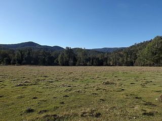
Harlin is a rural town and locality in the Somerset Region, Queensland, Australia. In the 2021 census, the locality of Harlin had a population of 211 people.

<span class="mw-page-title-main">Colinton, Queensland</span> Suburb of Somerset Region, Queensland, Australia

Colinton is a rural locality in the Somerset Region, Queensland, Australia. In the 2021 census, Colinton had a population of 60 people.

<span class="mw-page-title-main">Crossdale, Queensland</span> Suburb of Somerset Region, Queensland, Australia

Crossdale is a rural locality in the Somerset Region, Queensland, Australia. In the 2021 census, Crossdale had a population of 68 people.

<span class="mw-page-title-main">Mount Beppo, Queensland</span> Suburb of Somerset Region, Queensland, Australia

Mount Beppo is a rural locality in the Somerset Region, Queensland, Australia. In the 2021 census, Mount Beppo had a population of 251 people.

<span class="mw-page-title-main">Mount Byron, Queensland</span> Suburb of Somerset Region, Queensland, Australia

Mount Byron is a rural locality in the Somerset Region, Queensland, Australia. In the 2021 census, Mount Byron had a population of 21 people.

Cressbrook is a rural locality in the Somerset Region, Queensland, Australia. In the 2021 census, Cressbrook had a population of 121 people.

<span class="mw-page-title-main">Sheep Station Creek, Queensland</span> Suburb of Somerset Region, Queensland, Australia

Sheep Station Creek is a rural locality in the Somerset Region, Queensland, Australia. In the 2021 census, Sheep Station Creek had a population of 116 people.

<span class="mw-page-title-main">Hazeldean, Queensland</span> Suburb of Somerset Region, Queensland, Australia

Hazeldean is a rural locality in the Somerset Region, Queensland, Australia. In the 2021 census, Hazeldean had a population of 326 people.

Cooeeimbardi is a rural locality in the Somerset Region, Queensland, Australia. In the 2021 census, Cooeeimbardi had "no people or a very low population".

Lower Cressbrook is a rural locality in the Somerset Region, Queensland, Australia. In the 2021 census, Lower Cressbrook had a population of 21 people.

Fulham is a rural locality in the Somerset Region, Queensland, Australia. In the 2021 census, Fulham had a population of 53 people.

Murrumba is a rural locality in the Somerset Region, Queensland, Australia. In the 2021 census, Murrumba had "no people or a very low population".

Caboonbah is a rural locality in the Somerset Region, Queensland, Australia. In the 2021 census, Caboonbah had a population of 13 people.

<span class="mw-page-title-main">Biarra, Queensland</span> Suburb of Somerset Region, Queensland, Australia

Biarra is a rural locality in the Somerset Region, Queensland, Australia. In the 2021 census, Biarra had a population of 270 people.

<span class="mw-page-title-main">Braemore, Queensland</span> Suburb of Somerset Region, Queensland, Australia

Braemore is a rural locality in the Somerset Region, Queensland, Australia. In the 2021 census, Braemore had a population of 131 people.

Gregors Creek is a rural locality in the Somerset Region, Queensland, Australia. In the 2021 census, Gregors Creek had a population of 87 people.

Ivory Creek is a rural locality in the Somerset Region, Queensland, Australia. In the 2021 census, Ivory Creek had a population of 49 people.

Ottaba is a rural locality in the Somerset Region, Queensland, Australia. In the 2021 census, Ottaba had a population of 52 people.

References

  1. 1 2 3 Australian Bureau of Statistics (28 June 2022). "Scrub Creek (SAL)". 2021 Census QuickStats. Retrieved 28 February 2023. OOjs UI icon edit-ltr-progressive.svg
  2. "Scrub Creek – locality in Somerset Region (entry 46158)". Queensland Place Names. Queensland Government . Retrieved 7 March 2022.
  3. Google (15 September 2021). "Scrub Creek, Queensland" (Map). Google Maps . Google. Retrieved 15 September 2021.
  4. 1 2 3 "Queensland Globe". State of Queensland . Retrieved 11 August 2022.
  5. Queensland Family History Society (2010), Queensland schools past and present (Version 1.01 ed.), Queensland Family History Society, ISBN   978-1-921171-26-0
  6. "Cressbrook" (Map). Queensland Government. 1944. Archived from the original on 4 December 2020. Retrieved 22 September 2020.
  7. "Queensland Two Mile series sheet 2m77" (Map). Queensland Government. 1939. Retrieved 6 August 2023.
  8. Australian Bureau of Statistics (27 June 2017). "Scrub Creek (SSC)". 2016 Census QuickStats. Retrieved 20 October 2018. OOjs UI icon edit-ltr-progressive.svg

Further reading