Woolmar, Queensland

Last updated

Map all coordinates using: OpenStreetMap
Woolmar
Queensland
Paddocks Woolmar Queensland.jpg
Esk Kilcoy Road, 2015
Australia Queensland location map.svg
Red pog.svg
Woolmar
Coordinates 26°55′40″S152°30′30″E / 26.9277°S 152.5083°E / -26.9277; 152.5083 (Woolmar (centre of locality))
Population565 (SAL 2021) [1]
Postcode(s) 4515
Area67.9 km2 (26.2 sq mi)
Time zone AEST (UTC+10:00)
Location
  • 2.5 km (2 mi) W of Kilcoy
  • 49.2 km (31 mi) NNE of Esk
  • 113 km (70 mi) NW of Brisbane
LGA(s) Somerset Region
State electorate(s) Nanango
Federal division(s) Blair
Suburbs around Woolmar:
Harlin Sheep Station Creek Sheep Station Creek
Harlin Woolmar Kilcoy
Gregors Creek Hazeldean Winya

Woolmar is a rural locality in the Somerset Region, Queensland, Australia. [2] In the 2021 census, Woolmar had a population of 565 people. [3]

Contents

Geography

Woolmar is immediately west of Kilcoy. [4]

Kilcoy Creek marks a small section of the eastern boundary. In the west elevated terrain reaches higher than 400 metres above sea level. [4]

The D'Aguilar Highway passes through Woolmar. [4] .

History

Woolmar Provisional School opened on 8 March 1894. On 1 January 1909, it became Woolmar State School. It had temporary closures in 1931 and 1940, closing permanently on 14 April 1941. [5] It was at 5615 D'Aguilar Highway ( 26°56′45″S152°31′21″E / 26.9458°S 152.5224°E / -26.9458; 152.5224 (Woolmar State School (former)) ). [6] [4]

Gregor's Creek Provisional School opened on 14 February 1896. On 1 January 1909, it became Gregor's Creek State School. It closed in December 1963. [7] [8] It was at 1095 Gregors Creek Road ( 26°57′36″S152°26′33″E / 26.96012°S 152.44259°E / -26.96012; 152.44259 (Gregor's Creek State School (former)) ), now in Woolmar. [9] [10] [4]

Demographics

In the 2016 census, Woolmar had a population of 421 people. [11]

In the 2021 census, Woolmar had a population of 565 people. [3]

Education

There are no schools in Woolmar. The nearest government primary and secondary schools are Kilcoy State School and Kilcoy State High School in neighbouring Kilcoy to the east. [4]

Amenities

Kilcoy showgrounds, 2015 Kilcoy showgrounds.jpg
Kilcoy showgrounds, 2015

The Kilcoy Showgrounds and Racecourse are at 26 Showgrounds Road in Woolmar ( 26°56′34″S152°32′57″E / 26.9427°S 152.54904°E / -26.9427; 152.54904 (Kilcoy Showgrounds and Racecourse) ). [4]

Kilcoy General Cemetery is on the western corner of the D'Aguilar Highway and Esk Kilcoy Road ( 26°56′44″S152°32′35″E / 26.9455°S 152.5431°E / -26.9455; 152.5431 (Kilcoy General Cemetery) ). [12]

Related Research Articles

<span class="mw-page-title-main">Kilcoy, Queensland</span> Town in Queensland, Australia

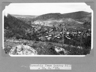
Kilcoy is a rural town and locality in the Somerset Region, Queensland, Australia. In the 2016 census, the locality of Kilcoy had a population of 1,898 people.

<span class="mw-page-title-main">Woodford, Queensland</span> Town in Queensland, Australia

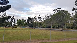
Woodford is a rural town and locality in the City of Moreton Bay, Queensland, Australia. In the 2016 census, the locality of Woodford had a population of 3,458 people.

<span class="mw-page-title-main">Harlin</span> Town in Queensland, Australia

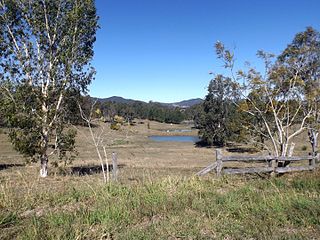
Harlin is a rural town and locality in the Somerset Region, Queensland, Australia. In the 2016 census, the locality of Harlin had a population of 173 people.

<span class="mw-page-title-main">Highvale, Queensland</span> Suburb of City of Moreton Bay, Queensland, Australia

Highvale is a rural residential locality in the City of Moreton Bay, Queensland, Australia. In the 2016 census, Highvale had a population of 1,766 people.

Stony Creek is a rural locality in the City of Moreton Bay in Queensland, Australia. In the 2016 census Stony Creek had a population of 262 people.

<span class="mw-page-title-main">Villeneuve, Queensland</span> Suburb of Somerset Region, Queensland, Australia

Villeneuve is a rural town and locality in the Somerset Region, Queensland, Australia. In the 2021 census, the locality of Villeneuve had a population of 193 people.

<span class="mw-page-title-main">Mount Delaney</span> Suburb of City of Moreton Bay, Queensland, Australia

Mount Delaney is a rural locality in the City of Moreton Bay, Queensland, Australia. In the 2016 census Mount Delaney had a population of 85 people.

<span class="mw-page-title-main">Glenfern, Queensland</span> Suburb of Somerset Region, Queensland, Australia

Glenfern is a rural locality in the Somerset Region, Queensland, Australia. In the 2016 census Glenfern had a population of 10 people.

<span class="mw-page-title-main">Sandy Creek, Queensland</span> Suburb of Somerset Region, Queensland, Australia

Sandy Creek is a rural locality in the Somerset Region, Queensland, Australia. In the 2016 census, Sandy Creek had a population of 567 people.

<span class="mw-page-title-main">Mount Kilcoy, Queensland</span> Suburb of Somerset Region, Queensland, Australia

Mount Kilcoy is a rural locality in the Somerset Region, Queensland, Australia. In the 2021 census, Mount Kilcoy had a population of 277 people.

<span class="mw-page-title-main">Winya, Queensland</span> Suburb of Somerset Region, Queensland, Australia

Winya is a rural locality in the Somerset Region, Queensland, Australia. In the 2016 census, Winya had a population of 72 people.

<span class="mw-page-title-main">Sheep Station Creek, Queensland</span> Suburb of Somerset Region, Queensland, Australia

Sheep Station Creek is a rural locality in the Somerset Region, Queensland, Australia. In the 2016 census, Sheep Station Creek had a population of 108 people.

<span class="mw-page-title-main">Hazeldean, Queensland</span> Suburb of Somerset Region, Queensland, Australia

Hazeldean is a rural locality in the Somerset Region, Queensland, Australia. In the 2016 census, Hazeldean had a population of 262 people.

Fulham is a rural locality in the Somerset Region, Queensland, Australia. In the 2016 census Fulham had a population of 35 people.

<span class="mw-page-title-main">Somerset Dam, Queensland</span> Town in Queensland, Australia

Somerset Dam is a rural town and locality in the Somerset Region, Queensland, Australia. In the 2016 census, Somerset Dam had a population of 69 people. When first being planned, it was unofficially known as the Stanley River township.

<span class="mw-page-title-main">Tansey, Queensland</span> Town in Queensland, Australia

Tansey is a rural town and locality in the Gympie Region, Queensland, Australia. In the 2016 census, Tansey had a population of 144 people.

Lake Borumba is a rural locality in the Gympie Region, Queensland, Australia. In the 2016 census Lake Borumba had a population of 6 people.

Westvale is a locality in the Somerset Region, Queensland, Australia. In the 2021 census, Westvale had a population of 0 people.

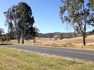
Gregors Creek is a rural locality in the Somerset Region, Queensland, Australia. In the 2021 census, Gregors Creek had a population of 87 people.

Scrub Creek is a rural locality in the Somerset Region, Queensland, Australia. In the 2016 census, Scrub Creek had a population of 32 people.

References

  1. Australian Bureau of Statistics (28 June 2022). "Woolmar (Suburb and Locality)". Australian Census 2021 QuickStats. Retrieved 28 June 2022.  OOjs UI icon edit-ltr-progressive.svg
  2. "Woolmar – locality in Somerset Region (entry 48228)". Queensland Place Names. Queensland Government . Retrieved 17 November 2019.
  3. 1 2 Australian Bureau of Statistics (28 June 2022). "Woolmar (SAL)". 2021 Census QuickStats. Retrieved 28 February 2023. OOjs UI icon edit-ltr-progressive.svg
  4. 1 2 3 4 5 6 7 "Queensland Globe". State of Queensland . Retrieved 25 August 2023.
  5. Queensland Family History Society (2010), Queensland schools past and present (Version 1.01 ed.), Queensland Family History Society, ISBN   978-1-921171-26-0
  6. "Moreton 40 Chain map AG2 series sheet 19 north" (Map). Queensland Government. 1932. Archived from the original on 24 August 2023. Retrieved 25 August 2023.
  7. Queensland Family History Society (2010), Queensland schools past and present (Version 1.01 ed.), Queensland Family History Society, ISBN   978-1-921171-26-0
  8. "Agency ID 6173, Gregor's Creek State School". Queensland State Archives . Retrieved 6 August 2023.
  9. "Queensland Two Mile series sheet 2m77" (Map). Queensland Government. 1939. Archived from the original on 6 August 2023. Retrieved 6 August 2023.
  10. "Blackbutt" (Map). Queensland Government. 1944. Archived from the original on 6 August 2023. Retrieved 6 August 2023.
  11. Australian Bureau of Statistics (27 June 2017). "Woolmar (SSC)". 2016 Census QuickStats. Retrieved 20 October 2018. OOjs UI icon edit-ltr-progressive.svg
  12. "Cemetery Areas - Queensland". Queensland Open Data. Queensland Government. 12 November 2020. Archived from the original on 15 November 2020. Retrieved 12 November 2020.

Further reading

Commons-logo.svg Media related to Woolmar, Queensland at Wikimedia Commons