Mount Hallen, Queensland

Last updated

Map all coordinates using: OpenStreetMap
Mount Hallen
Queensland
Australia Queensland location map.svg
Red pog.svg
Mount Hallen
Coordinates 27°19′55″S152°23′04″E / 27.3319°S 152.3844°E / -27.3319; 152.3844 (Mount Hallen (centre of locality))
Population457 (SAL 2021) [1]
Postcode(s) 4312
Elevation80–390 m (262–1,280 ft) [2]
Area52.5 km2 (20.3 sq mi)
Time zone AEST (UTC+10:00)
Location
LGA(s) Somerset Region
State electorate(s) Nanango
Federal division(s) Blair
Suburbs around Mount Hallen:
Redbank Creek Esk Esk
Redbank Creek Mount Hallen Moombra
Buaraba Buaraba Coominya

Mount Hallen is a rural locality in the Somerset Region, Queensland, Australia. [3] In the 2021 census, Mount Hallen had a population of 457 people. [4]

Contents

Geography

The locality is bounded to the south by Running Creek. [2]

The mountain Mount Hallen is in the east of the locality ( 27°19′54″S152°24′46″E / 27.3318°S 152.4129°E / -27.3318; 152.4129 (Mount Hallen (mountain)) ) and rises to 390 metres (1,280 ft). [5] [6] [7]

The Gatton Esk Road enters the locality from the south (Buaraba) and exits to the north (Esk). [2]

There are a variety of land uses within the locality. There is rural residential housing in the south-west of the locality. Other land uses include grazing on native vegetation, production forestry, and some crop growing. [2]

History

The mountain Mount Hallen was named in 1829 by explorer Allan Cunningham, probably after Ambrose Hallen, who was the Assistant Surveyor-General in New South Wales from 1827 to 1829. [7]

The section of the Brisbane Valley railway line from Lowood to Esk opened on Monday 9 August 1886. [8] It included the Mount Hallen railway station ( 27°18′59″S152°24′33″E / 27.3164°S 152.4091°E / -27.3164; 152.4091 (Mount Hallen railway station (former)) ) at Mount Hallen. [9] [10] The station was originally to be called Buaraba (the name of the parish) but was renamed Mount Hallen after the mountain. The locality takes its name from the railway station name. [3] The locality to the south of Mount Hallen is now named Buaraba. [11]

The railway line and Mount Hallen railway station closed in 1993. [12]

Demographics

In the 2016 census, Mount Hallen had a population of 458 people. [13]

In the 2021 census, Mount Hallen had a population of 457 people. [4]

Education

There are no schools in Mount Hallen. The nearest government primary schools are Esk State School in neighbouring Esk to the north and Coominya State School in neighbouring Coominya to the south-east. The nearest government secondary schools are Toogoolawah State High School in Toogoolawah to the north, Lowood State High School in Lowood to the south-east, and Lockyer District State High School in Gatton to the south-west. [2]

Attractions

The Brisbane Valley Rail Trail now uses the former Brisbane Valley railway corridor. [12]

Related Research Articles

<span class="mw-page-title-main">Esk, Queensland</span> Town in Queensland, Australia

Esk is a town and locality in the Somerset Region in South East Queensland, Australia. In the 2016 census, Esk had a population of 1,698 people.

<span class="mw-page-title-main">Coominya, Queensland</span> Town in Queensland, Australia

Coominya is a rural town and locality in the Somerset Region in South East Queensland, Australia. The town is located 83 kilometres (52 mi) west of the state capital, Brisbane and approximately 2 kilometres (1.2 mi) from Wivenhoe Dam. In the 2016 census, Coominya had a population of 1,200 people.

<span class="mw-page-title-main">Somerset Region</span> Local government area in Queensland, Australia

The Somerset Region is a local government area located in the West Moreton region of South East Queensland, Australia, about 100 kilometres (62 mi) northwest of Brisbane and centred on the town of Esk. It was created in 2008 from a merger of the Shire of Esk and the Shire of Kilcoy. It is commonly known as the Brisbane Valley, due to the Brisbane River which courses through the region, although significant parts of the region lie outside the hydrological Brisbane Valley itself.

<span class="mw-page-title-main">Brisbane Valley railway line</span>

The Brisbane Valley railway line was a railway connection in Queensland, Australia connecting Ipswich, west of Brisbane, to the upper Brisbane River valley. Progressively opened between 1884 and 1913, the railway provided a vital transport link between Ipswich and Yarraman and forged development and prosperity along its path. The line acquired its serpentine reputation because it did not take a straight course when faced with a hill or gully.

<span class="mw-page-title-main">Moore, Queensland</span> Town in Queensland, Australia

Moore is a rural town and locality in the Somerset Region, Queensland, Australia. In the 2016 census, the locality of Moore had a population of 296 people.

<span class="mw-page-title-main">West Moreton</span> Region in Queensland, Australia

West Moreton is a region of the Australian state of Queensland, consisting of the entire rural western portion of South East Queensland. It sits inland from both the Brisbane metropolitan area and the Gold Coast and to the east of the Darling Downs. Much of the region lies in the Great Dividing Range. The name appears in the names of many community organisations and is used by the Australian Bureau of Statistics, although is not widely used otherwise due to the prevalence of South East Queensland in planning and other documents.

<span class="mw-page-title-main">Bryden, Queensland</span> Suburb of Somerset Region, Queensland, Australia

Bryden is a rural locality in the Somerset Region, Queensland, Australia. In the 2016 census, Bryden had a population of 33 people.

<span class="mw-page-title-main">Colinton, Queensland</span> Suburb of Somerset Region, Queensland, Australia

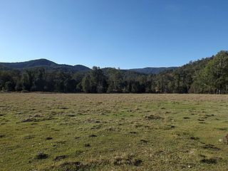
Colinton is a rural locality in the Somerset Region, Queensland, Australia. In the 2016 census, Colinton had a population of 75 people.

<span class="mw-page-title-main">Crossdale, Queensland</span> Suburb of Somerset Region, Queensland, Australia

Crossdale is a rural locality in the Somerset Region, Queensland, Australia. In the 2016 census, Crossdale had a population of 75 people.

<span class="mw-page-title-main">Mount Byron, Queensland</span> Suburb of Somerset Region, Queensland, Australia

Mount Byron is a rural locality in the Somerset Region, Queensland, Australia. In the 2016 census, Mount Byron had a population of 18 people.

Coal Creek is a rural locality in the Somerset Region, Queensland, Australia. In the 2021 census, Coal Creek had a population of 50 people.

<span class="mw-page-title-main">Wivenhoe Hill, Queensland</span> Suburb of Somerset Region, Queensland, Australia

Wivenhoe Hill is a locality in the Somerset Region, Queensland, Australia. In the 2016 census, Wivenhoe Hill had a population of 9 people.

Moombra is a rural locality in the Somerset Region, Queensland, Australia. In the 2021 census, Moombra had a population of 9 people.

Glen Esk is a locality in the Somerset Region, Queensland, Australia. In the 2021 census, Glen Esk had a population of 55 people.

Caboonbah is a rural locality in the Somerset Region, Queensland, Australia. In the 2016 census, Caboonbah had a population of 14 people.

<span class="mw-page-title-main">Biarra, Queensland</span> Suburb of Somerset Region, Queensland, Australia

Biarra is a rural locality in the Somerset Region, Queensland, Australia. In the 2021 census, Biarra had a population of 270 people.

Scrub Creek is a rural locality in the Somerset Region, Queensland, Australia. In the 2016 census, Scrub Creek had a population of 32 people.

Eskdale is a rural locality in the Somerset Region, Queensland, Australia. In the 2021 census, Eskdale had a population of 34 people.

Ivory Creek is a rural locality in the Somerset Region, Queensland, Australia. In the 2021 census, Ivory Creek had a population of 49 people.

Ottaba is a rural locality in the Somerset Region, Queensland, Australia. In the 2016 census, Ottaba had a population of 54 people.

References

  1. Australian Bureau of Statistics (28 June 2022). "Mount Hallen (Suburb and Locality)". Australian Census 2021 QuickStats. Retrieved 28 June 2022.  OOjs UI icon edit-ltr-progressive.svg
  2. 1 2 3 4 5 "Queensland Globe". State of Queensland . Retrieved 15 August 2023.
  3. 1 2 "Mount Hallen – locality in Somerset Region (entry 44901)". Queensland Place Names. Queensland Government . Retrieved 11 June 2019.
  4. 1 2 Australian Bureau of Statistics (28 June 2022). "Mount Hallen (SAL)". 2021 Census QuickStats. Retrieved 28 February 2023. OOjs UI icon edit-ltr-progressive.svg
  5. "Mountain peaks and capes - Queensland". Queensland Open Data. Queensland Government. 12 November 2020. Archived from the original on 25 November 2020. Retrieved 25 November 2020.
  6. "Mount Hallen – mountain in Somerset Region (entry 15239)". Queensland Place Names. Queensland Government . Retrieved 25 November 2020.
  7. 1 2 "Mount Hallen – mountain in the Somerset Region (entry 15239)". Queensland Place Names. Queensland Government . Retrieved 19 October 2019.
  8. "Opening of the Railway to Esk". Darling Downs Gazette . Vol. XXX, no. 5, 962. Queensland, Australia. 11 August 1886. p. 4. Archived from the original on 15 August 2023. Retrieved 16 August 2023 via National Library of Australia.
  9. "Railway stations and sidings - Queensland". Queensland Open Data. Queensland Government. 2 October 2020. Archived from the original on 5 October 2020. Retrieved 5 October 2020.
  10. "Parish of Esk" (Map). Queensland Government. 1965. Retrieved 16 August 2023.
  11. "Buaraba – locality in the Somerset Region (entry 44849)". Queensland Place Names. Queensland Government . Retrieved 16 August 2023.
  12. 1 2 "About Brisbane Valley Rail Trail". Queensland Department of Transport and Main Roads. Archived from the original on 22 March 2022. Retrieved 15 August 2023.
  13. Australian Bureau of Statistics (27 June 2017). "Mount Hallen (SSC)". 2016 Census QuickStats. Retrieved 20 October 2018. OOjs UI icon edit-ltr-progressive.svg