
Prenzlau is a rural locality in the Somerset Region, Queensland, Australia. In the 2021 census, Prenzlau had a population of 408 people.
Lowood is a rural town and locality in the Somerset Region, Queensland, Australia. In the 2021 census, the locality of Lowood had a population of 4,082 people.
Glamorgan Vale is a rural town and locality in the Somerset Region, Queensland, Australia. In the 2021 census, the locality of Glamorgan Vale had a population of 384 people.
Ironbark is a rural locality in the City of Ipswich, Queensland, Australia. In the 2021 census, Ironbark had a population of 1,173 people.

Fairney View is a rural locality in the Somerset Region, Queensland, Australia. In the 2021 census, Fairney View had a population of 221 people.

Vernor is a rural locality in the Somerset Region, Queensland, Australia. In the 2021 census, Vernor had a population of 235 people.

Borallon is a rural locality in the Somerset Region, Queensland, Australia. In the 2021 census, Borallon had a population of 90 people.

Wanora is a rural locality in the Somerset Region, Queensland, Australia. In the 2021 census, Wanora had a population of 262 people.

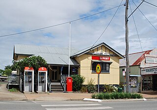
Tarampa is a rural locality in the Somerset Region, Queensland, Australia. In the 2021 census, Tarampa had a population of 287 people.

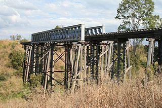
Coolana is a rural locality in the Somerset Region, Queensland, Australia. In the 2021 census, Coolana had a population of 175 people.

Rifle Range is a locality in the Somerset Region, Queensland, Australia. In the 2021 census, Rifle Range had a population of 197 people.
Clarendon is a rural locality in the Somerset Region, Queensland, Australia. In the 2021 census, Clarendon had a population of 232 people.

Wivenhoe Pocket is a rural locality in the Somerset Region, Queensland, Australia. In the 2021 census, Wivenhoe Pocket had a population of 417 people.

Dundas is a rural locality in the Somerset Region, Queensland, Australia. In the 2021 census, Dundas had a population of 58 people.

Atkinsons Dam is a rural locality in the Somerset Region, Queensland, Australia. In the 2021 census, Atkinsons Dam had a population of 191 people.
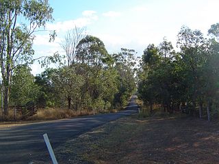
Buaraba is a rural locality in the Somerset Region, Queensland, Australia. In the 2021 census, Buaraba had a population of 170 people.

College View is a rural locality in the Lockyer Valley Region, Queensland, Australia. In the 2021 census, College View had a population of 72 people.

Brightview is a locality split between the Lockyer Valley Region and Somerset Region, Queensland, Australia. In the 2021 census, Brightview had a population of 911 people.
Kensington Grove is a rural residential locality in the Lockyer Valley Region, Queensland, Australia. In the 2021 census, Kensington Grove had a population of 2,050 people.

Wivenhoe Hill is a rural locality in the Somerset Region, Queensland, Australia. In the 2021 census, Wivenhoe Hill had "no people or a very low population".

