
Moore is a rural town and locality in the Somerset Region, Queensland, Australia. In the 2021 census, the locality of Moore had a population of 286 people.

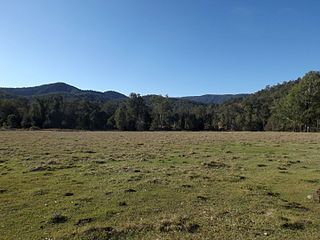
Harlin is a rural town and locality in the Somerset Region, Queensland, Australia. In the 2021 census, the locality of Harlin had a population of 211 people.
Stony Creek is a rural locality in the City of Moreton Bay in Queensland, Australia. In the 2021 census, Stony Creek had a population of 245 people.

Villeneuve is a rural town and locality in the Somerset Region, Queensland, Australia. In the 2021 census, the locality of Villeneuve had a population of 193 people.

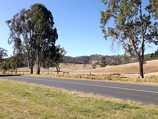
Colinton is a rural locality in the Somerset Region, Queensland, Australia. In the 2021 census, Colinton had a population of 60 people.

Crossdale is a rural locality in the Somerset Region, Queensland, Australia. In the 2021 census, Crossdale had a population of 68 people.
Mount Byron is a rural locality in the Somerset Region, Queensland, Australia. In the 2021 census, Mount Byron had a population of 21 people.
Winya is a rural locality in the Somerset Region, Queensland, Australia. In the 2021 census, Winya had a population of 127 people.

Woolmar is a rural locality in the Somerset Region, Queensland, Australia. In the 2021 census, Woolmar had a population of 565 people.

Sheep Station Creek is a rural locality in the Somerset Region, Queensland, Australia. In the 2021 census, Sheep Station Creek had a population of 116 people.

Hazeldean is a rural locality in the Somerset Region, Queensland, Australia. In the 2021 census, Hazeldean had a population of 326 people.
Coal Creek is a rural locality in the Somerset Region, Queensland, Australia. In the 2021 census, Coal Creek had a population of 50 people.
Fulham is a rural locality in the Somerset Region, Queensland, Australia. In the 2021 census, Fulham had a population of 53 people.
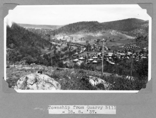
Somerset Dam is a rural town and locality in the Somerset Region, Queensland, Australia. When first being planned, it was unofficially known as the Stanley River township. In the 2021 census, the locality of Somerset Dam had a population of 78 people.
Caboonbah is a rural locality in the Somerset Region, Queensland, Australia. In the 2021 census, Caboonbah had a population of 13 people.
Westvale is a locality in the Somerset Region, Queensland, Australia. In the 2021 census, Westvale had "no people or a very low population".

Braemore is a rural locality in the Somerset Region, Queensland, Australia. In the 2021 census, Braemore had a population of 131 people.
Scrub Creek is a rural locality in the Somerset Region, Queensland, Australia. In the 2021 census, Scrub Creek had a population of 33 people.
Ivory Creek is a rural locality in the Somerset Region, Queensland, Australia. In the 2021 census, Ivory Creek had a population of 49 people.
Mount Hallen is a rural locality in the Somerset Region, Queensland, Australia. In the 2021 census, Mount Hallen had a population of 457 people.
