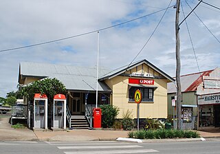
Esk is a rural town and locality in the Somerset Region in South East Queensland, Australia. In the 2021 census, the locality of Esk had a population of 1,641 people.

Lowood is a rural town and locality in the Somerset Region, Queensland, Australia. In the 2021 census, the locality of Lowood had a population of 4,082 people.

Kholo is a rural locality in the City of Brisbane, Queensland, Australia. In the 2021 census, Kholo had a population of 374 people.
Glamorgan Vale is a rural town and locality in the Somerset Region, Queensland, Australia. In the 2021 census, the locality of Glamorgan Vale had a population of 384 people.

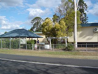
Minden is a rural town and locality in the Somerset Region, Queensland, Australia. The town is 64 kilometres (40 mi) west of the state capital, Brisbane. In the 2021 census, the locality of Minden had a population of 1,227 people.

Ironbark is a rural locality in the City of Ipswich, Queensland, Australia. In the 2021 census, Ironbark had a population of 1,173 people.

Fairney View is a rural locality in the Somerset Region, Queensland, Australia. In the 2021 census, Fairney View had a population of 221 people.

Vernor is a rural locality in the Somerset Region, Queensland, Australia. In the 2021 census, Vernor had a population of 235 people.

Wanora is a rural locality in the Somerset Region, Queensland, Australia. In the 2021 census, Wanora had a population of 262 people.

Lark Hill is a rural locality in the Somerset Region, Queensland, Australia. In the 2021 census, Lark Hill had a population of 69 people.

Coolana is a rural locality in the Somerset Region, Queensland, Australia. In the 2021 census, Coolana had a population of 175 people.

Clarendon is a rural locality in the Somerset Region, Queensland, Australia. In the 2021 census, Clarendon had a population of 232 people.

Lockrose is a rural locality split between the Lockyer Valley Region and Somerset Region of Queensland, Australia. In the 2021 census, Lockrose had a population of 564 people.

Glenfern is a rural locality in the Somerset Region, Queensland, Australia. In the 2021 census, Glenfern had a population of 11 people.
Buaraba is a rural locality in the Somerset Region, Queensland, Australia. In the 2021 census, Buaraba had a population of 170 people.
Coal Creek is a rural locality in the Somerset Region, Queensland, Australia. In the 2021 census, Coal Creek had a population of 50 people.

Brightview is a locality split between the Lockyer Valley Region and Somerset Region, Queensland, Australia. In the 2021 census, Brightview had a population of 911 people.
Veradilla is a rural locality in the Lockyer Valley Region, Queensland, Australia. In the 2021 census, Veradilla had a population of 125 people.

Biarra is a rural locality in the Somerset Region, Queensland, Australia. In the 2021 census, Biarra had a population of 270 people.
Mount Hallen is a rural locality in the Somerset Region, Queensland, Australia. In the 2021 census, Mount Hallen had a population of 457 people.


