Winya, Queensland

Last updated

Map all coordinates using: OpenStreetMap  
Download coordinates as: KML
Winya
Queensland
Mount Kilcoy Road Winya Queensland.jpg
Mount Kilcoy Road, 2015
Australia Queensland location map.svg
Red pog.svg
Winya
Coordinates 26°57′20″S152°34′29″E / 26.9555°S 152.5747°E / -26.9555; 152.5747 (Winya (centre of locality)) Coordinates: 26°57′20″S152°34′29″E / 26.9555°S 152.5747°E / -26.9555; 152.5747 (Winya (centre of locality))
Population72 (2016 census) [1]
 • Density3.103/km2 (8.04/sq mi)
Postcode(s) 4515
Area23.2 km2 (9.0 sq mi)
Time zone AEST (UTC+10:00)
Location
  • 2.4 km (1 mi) E of Kilcoy
  • 54.1 km (34 mi) NE of Esk
  • 95.0 km (59 mi) NNW of Brisbane
LGA(s) Somerset Region
State electorate(s) Nanango
Federal division(s) Blair
Suburbs around Winya:
Sheep Station Creek Mount Kilcoy Sandy Creek
Kilcoy
Woolmar
Winya Glenfern
Hazeldean Westvale Westvale

Winya is a rural locality in the Somerset Region, Queensland, Australia. [2] In the 2016 census, Winya had a population of 72 people. [1]

Contents

Geography

Sandy Creeks marks a section of the eastern boundary and Kilcoy Creek aligns with some of the eastern border. In the south the locality protrudes into the waters of Somerset Dam when it is at full capacity. Kilcoy Weir straddles the boundary with Mount Kilcoy in the north.[ citation needed ]

The D'Aguilar Highway passes through Winya.[ citation needed ]

Kilcoy Airfield is in the south of locality on Kennedys Road ( 26°58′16″S152°33′58″E / 26.9712°S 152.5662°E / -26.9712; 152.5662 (Kilcoy Airfield) ). [3] [4]

History

Kilcoy Homestead was established in Winya in the 1850s. Settlement in the area had begun as early as 1841. [5]

Winya State School opened in 1918 and closed in 1960. [6] The school was on a 5-acre (2.0 ha) site on the north-east corner of the D'Aguilar Highway and Sandy Creek Road ( 26°55′45″S152°36′26″E / 26.9293°S 152.6073°E / -26.9293; 152.6073 (Winya State School (former)) ), now in neighbouring Sandy Creek. [7] [8] [9]

The Kilcoy railway line from Caboolture reached Winya and through to Kilcoy on 22 December 1913, [10] [11] with the locality served by Winya railway station ( 26°56′11″S152°35′38″E / 26.9365°S 152.5939°E / -26.9365; 152.5939 (Winya railway station (former)) ). [12] The Wamuran to Kilcoy section (including Winya) was closed on 30 June 1964. [13]

In the 2016 census, Winya had a population of 72 people. [1]

Economy

The Kilcoy Pastoral Company operates an abattoir in Winya. The facility exports beef to more than 20 countries and employs more than 750 workers making it one the five largest beef processors in the country. [14]

Education

There are no schools in Winya. The nearest government primary school is Kilcoy State School in neighbouring Kilcoy to the west. The nearest government secondary school is Kilcoy State High School, also in Kilcoy. [9]

Amenities

The Kilcoy Airfield is available only for recreational use and not for commercial operations. [15]

There are a number of parks in the area:

Related Research Articles

Kilcoy, Queensland Town in Queensland, Australia

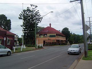
Kilcoy is a rural town and locality in the Somerset Region, Queensland, Australia. In the 2016 census, the locality of Kilcoy had a population of 1,898 people.

Marburg, Queensland Town in Queensland, Australia

Marburg is a rural town in the City of Ipswich and a locality split between the City of Ipswich and the Somerset Region, both in Queensland, Australia. In the 2016 census, Marburg had a population of 873 people.

Woodford, Queensland Town in Queensland, Australia

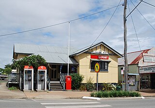
Woodford is a rural town and locality in the Moreton Bay Region, Queensland, Australia. In the 2016 census, the locality of Woodford had a population of 3,458 people.

Lowood, Queensland Town in Queensland, Australia

Lowood is a rural town and locality in the Somerset Region, Queensland, Australia. In the 2016 census, the locality of Lowood had a population of 4,159 people.

Cooran, Queensland Town in Queensland, Australia

Cooran is a rural hinterland town and locality in the Shire of Noosa, Queensland, Australia. In the 2016 census the locality of Cooran had a population of 1,624 people.

Moore, Queensland Town in Queensland, Australia

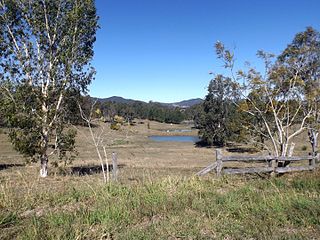
Moore is a rural town and locality in the Somerset Region, Queensland, Australia. In the 2016 census the locality of Moore had a population of 296 people.

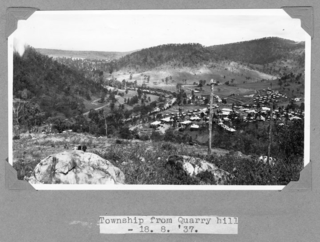
Jimna is a rural town and locality in the Somerset Region, Queensland, Australia. In the 2016 census the locality of Jimna had a population of 91 people.

Stony Creek is a rural locality in the Moreton Bay Region of Queensland, Australia. In the 2016 census Stony Creek had a population of 262 people.

Villeneuve, Queensland Suburb of Somerset Region, Queensland, Australia

Villeneuve is a rural town and locality in the Somerset Region, Queensland, Australia. In the 2016 census, Villeneuve had a population of 179 people.

Crossdale, Queensland Suburb of Somerset Region, Queensland, Australia

Crossdale is a rural locality in the Somerset Region, Queensland, Australia. In the 2016 census Crossdale had a population of 75 people.

Mount Delaney is a rural locality in the Moreton Bay Region, Queensland, Australia. In the 2016 census Mount Delaney had a population of 85 people.

Glenfern, Queensland Suburb of Somerset Region, Queensland, Australia

Glenfern is a rural locality in the Somerset Region, Queensland, Australia. In the 2016 census Glenfern had a population of 10 people.

Sandy Creek, Queensland Suburb of Somerset Region, Queensland, Australia

Sandy Creek is a rural locality in the Somerset Region, Queensland, Australia. In the 2016 census, Sandy Creek had a population of 567 people.

Mount Kilcoy, Queensland Suburb of Somerset Region, Queensland, Australia

Mount Kilcoy is a rural locality in the Somerset Region, Queensland, Australia. In the 2016 census, Mount Kilcoy had a population of 261 people.

Woolmar, Queensland Suburb of Somerset Region, Queensland, Australia

Woolmar is a rural locality in the Somerset Region, Queensland, Australia. In the 2016 census, Woolmar had a population of 421 people.

Sheep Station Creek, Queensland Suburb of Somerset Region, Queensland, Australia

Sheep Station Creek is a rural locality in the Somerset Region, Queensland, Australia. In the 2016 census, Sheep Station Creek had a population of 108 people.

Hazeldean, Queensland Suburb of Somerset Region, Queensland, Australia

Hazeldean is a rural locality in the Somerset Region, Queensland, Australia. In the 2016 census, Hazeldean had a population of 262 people.

Somerset Dam, Queensland Town in Queensland, Australia

Somerset Dam is a rural town and locality in the Somerset Region, Queensland, Australia. In the 2016 census, Somerset Dam had a population of 69 people. When first being planned, it was unofficially known as the Stanley River township.

Gilla is a rural locality in the Toowoomba Region, Queensland, Australia. In the 2016 census Gilla had a population of 32 people.

Gregors Creek is a rural locality in the Somerset Region, Queensland, Australia. In the 2016 census, Gregors Creek had a population of 96 people.

References

  1. 1 2 3 Australian Bureau of Statistics (27 June 2017). "Winya (SSC)". 2016 Census QuickStats. Retrieved 20 October 2018. OOjs UI icon edit-ltr-progressive.svg
  2. "Winya – locality in Somerset Region (entry 44931)". Queensland Place Names. Queensland Government . Retrieved 7 March 2022.
  3. "Heliports and landing grounds - Queensland". Queensland Open Data. Queensland Government. 22 October 2020. Archived from the original on 16 November 2020. Retrieved 3 November 2020.
  4. "Welcome". Kilcoy Airfield. Archived from the original on 25 October 2020. Retrieved 5 April 2022.
  5. "Kilcoy Homestead (entry 600638)". Queensland Heritage Register . Queensland Heritage Council. Retrieved 21 August 2015.
  6. Queensland Family History Society (2010), Queensland schools past and present (Version 1.01 ed.), Queensland Family History Society, ISBN   978-1-921171-26-0
  7. "Parish of Kilcoy sheet 1" (Map). Queensland Government. 1960. Archived from the original on 5 April 2022. Retrieved 5 April 2022.
  8. "Moreton 40 Chain map AG2 series sheet 12 north" (Map). Queensland Government. 1928. Archived from the original on 5 April 2022. Retrieved 5 April 2022.
  9. 1 2 "Queensland Globe". State of Queensland . Retrieved 5 April 2022.
  10. "Jimna Single Men's Barracks (former) (entry 602685)". Queensland Heritage Register . Queensland Heritage Council. Retrieved 15 August 2015.
  11. "Kilcoy and Kilcoy Shire". Queensland Places. Centre for the Government of Queensland, University of Queensland. Archived from the original on 18 May 2015. Retrieved 17 May 2015.
  12. "Railway stations and sidings - Queensland". Queensland Open Data. Queensland Government. 2 October 2020. Archived from the original on 5 October 2020. Retrieved 5 October 2020.
  13. Quinlan, Howard; Newland, John (2000). Australian Railway Routes 1854 - 2000. Redfern: Australian Railway Historical Society. p. 38. ISBN   0909650497.
  14. Ally Marotti (16 December 2014). "Investor hopes to expand Chicago's oldest beef processor". Crain's Chicago Business. Crain Communication. Archived from the original on 11 September 2016. Retrieved 21 August 2015.
  15. "Airfield History". Kilcoy Airfield. Archived from the original on 25 October 2020. Retrieved 5 April 2022.
  16. 1 2 3 "Land for public recreation - Queensland". Queensland Open Data. Queensland Government. 20 November 2020. Archived from the original on 22 November 2020. Retrieved 22 November 2020.

Further reading

Commons-logo.svg Media related to Winya, Queensland at Wikimedia Commons