Kilcoy railway line

Last updated

Kilcoy railway line
Kilcoy railway at Wamuran Queensland.jpg
Disused track at Wamuran, 2015
Overview
StatusClosed
Owner Queensland Rail
Locale Queensland
Termini
Continues from North Coast line
Service
Operator(s)Queensland Rail
History
Opened Caboolture-Woodford: 6 December 1909
Woodford-Kilcoy: 22 December 1913
Closed Wamuran-Kilcoy: 30 June 1964
Caboolture-Wamuran: 9 September 1996
Technical
Line length55.9 km (34.7 mi)
Track gauge 1,067 mm (3 ft 6 in)

The Kilcoy railway line is a disused, partly demolished narrow gauge railway in South East Queensland, Australia.

Contents

History

The first section of the line opened from Caboolture to Woodford on 6 December 1909. It was extended to Kilcoy on 22 December 1913. [1] [2] [3]

Railway stations on the Kilcoy line included Durundur, Neurum, Royston, Villeneuve, Glenfern and Winya. [4] The Wamuran to Kilcoy section closed on 30 June 1964 followed by the remaining section from Caboolture to Wamuran on 9 September 1996. [3] As of 2015 all of the line has been removed back to Caboolture, except for a few hundred metres of track at the former Wamuran station.

Caboolture to Wamuran Rail Trail

In May 2016 the Moreton Bay Regional Council published a concept plan for the development of a rail trail on the railway alignment from Caboolture to Wamuran. [5]

This rail trail has been refurbished with a 10.5 km accessible sealed surface and completed in stages, with the trail officially opened on 15 December 2020. [6]

The trail is easily accessed from Caboolture railway station by foot and wheeled vehicles. The trail also has information panels about the history of the Kilcoy line and the community and industries it served, beside the shelters and water refill stations at both the Caboolture start and Wamuran finish points.

Museum and heritage railway

The Australian Narrow Gauge Railway Museum Society operates a railway museum at the Woodford railway station. The society was established in January 1971 to preserve the history of narrow-gauge railways in Queensland. The society has collected steam, diesel and petrol locomotives and rollingstock using the 2-foot gauge and has established their Durundur railway at Woodford as an operating heritage line. [7]

See also

Related Research Articles

<span class="mw-page-title-main">Shorncliffe railway line</span> Suburban railway line in Queensland, Australia

The Shorncliffe railway line is an 11 kilometres (6.8 mi) suburban railway line situated north of Brisbane, the state capital of Queensland, Australia. It is part of the Queensland Rail Citytrain network.

<span class="mw-page-title-main">Caboolture railway station</span> Railway station in Queensland, Australia

Caboolture railway station is located on the North Coast line in Queensland, Australia. It serves the urban centre of Caboolture in the City of Moreton Bay.

The Division of Longman is an Australian electoral division in Queensland.

<span class="mw-page-title-main">Caboolture, Queensland</span> Town in Queensland, Australia

Caboolture is a town and suburb in the City of Moreton Bay, Queensland, Australia. It is located on the northern side of the Caboolture River. In the 2021 census, the suburb of Caboolture had a population of 29,534 people.

<span class="mw-page-title-main">D'Aguilar Highway</span> Highway in Queensland, Australia

The D'Aguilar Highway is a two-lane highway linking the Bruce Highway near Caboolture with the Bunya Highway in Kingaroy in the state of Queensland, Australia. Major towns along the route include Woodford, Kilcoy, Blackbutt, Yarraman, and Nanango. The highway is approximately 164 km (102 mi) in length. The D'Aguilar Highway's highest elevation along its length is 527 m just north of Yarraman, and the lowest point is at 26.8 m just west of Caboolture.

<span class="mw-page-title-main">Strathpine, Queensland</span> Suburb of City of Moreton Bay, Queensland, Australia

Strathpine is a suburb in the City of Moreton Bay, Queensland, Australia. It is home to the Pine Rivers District offices of the City of Moreton Bay, as well as many businesses, administrative, and local, state and federal government offices. The area is home to Strathpine Centre, a medium-sized urban shopping centre, built by Westfield.

<span class="mw-page-title-main">Woodford, Queensland</span> Town in Australia

Woodford is a rural town and locality in the City of Moreton Bay, Queensland, Australia. In the 2021 census, the locality of Woodford had a population of 4,022 people.

<span class="mw-page-title-main">Morayfield, Queensland</span> Town in Queensland, Australia

Morayfield is a town and suburb in the City of Moreton Bay, Queensland, Australia. In the 2021 census, the suburb of Morayfield had a population of 24,898 people.

<span class="mw-page-title-main">City of Moreton Bay</span> Local government area in Queensland, Australia

The City of Moreton Bay, known until July 2023 as the Moreton Bay Region, is a local government area in the north of the Brisbane metropolitan city in South East Queensland, Australia. Established in 2008, it replaced three established local government areas, the City of Redcliffe and the Shires of Pine Rivers and Caboolture.

<span class="mw-page-title-main">Somerset Region</span> Local government area in Queensland, Australia

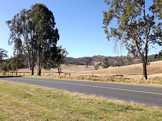
The Somerset Region is a local government area located in the West Moreton region of South East Queensland, Australia, western part of Brisbane. The region is centred on the town of Esk, which serves as the council seat. Somerset was created in 2008 from a merger of the shires of Esk and Kilcoy, and is known as the Brisbane Valley, owing to the Brisbane River which courses through the region. However, significant parts of the region lie outside the hydrological Brisbane Valley.

<span class="mw-page-title-main">Railways in South East Queensland</span>

South East Queensland has a large passenger and freight railway network centred on Brisbane, the capital city of the Australian state of Queensland. Suburban and interurban passenger services in the region are operated by Queensland Rail, which also operates long-distance trains across the state. Aurizon and Pacific National operate freight services.

<span class="mw-page-title-main">Wamuran, Queensland</span> Town in Queensland, Australia

Wamuran is a rural town and locality in the City of Moreton Bay, Queensland, Australia. In the 2021 census, the locality of Wamuran had a population of 3,374 people.

<span class="mw-page-title-main">Rocksberg</span> Suburb of City of Moreton Bay, Queensland, Australia

Rocksberg is a rural locality in the City of Moreton Bay, Queensland, Australia. In the 2021 census, Rocksberg had a population of 277 people.

Stony Creek is a rural locality in the City of Moreton Bay in Queensland, Australia. In the 2021 census, Stony Creek had a population of 245 people.

<i>Dayboro Times and Moreton Mail</i>

Dayboro Times and Moreton Mail was a weekly English language newspaper published in Dayboro, Queensland, Australia.

<span class="mw-page-title-main">Glenfern, Queensland</span> Suburb of Somerset Region, Queensland, Australia

Glenfern is a rural locality in the Somerset Region, Queensland, Australia. In the 2021 census, Glenfern had a population of 11 people.

<span class="mw-page-title-main">Winya, Queensland</span> Suburb of Somerset Region, Queensland, Australia

Winya is a rural locality in the Somerset Region, Queensland, Australia. In the 2021 census, Winya had a population of 127 people.

Beerburrum Road is a continuous 15.2-kilometre (9.4 mi) road route in the Moreton Bay and Sunshine Coast local government areas of Queensland, Australia. It is designated as part of State Route 60. It is a state-controlled district road, rated as a local road of regional significance (LRRS).

Kilcoy–Beerwah Road is a continuous 30.4-kilometre (18.9 mi) road route in the Moreton Bay and Sunshine Coast local government areas of Queensland, Australia. It is designated as part of State Route 6. It is a state-controlled regional road. It is part of a route that carries tourist traffic from the New England Highway to the Bruce Highway.

References

  1. "Jimna Single Men's Barracks (former) (entry 602685)". Queensland Heritage Register . Queensland Heritage Council. Retrieved 15 August 2015.
  2. "Kilcoy and Kilcoy Shire". Queensland Places. Centre for the Government of Queensland, University of Queensland. Archived from the original on 18 May 2015. Retrieved 17 May 2015.
  3. 1 2 Quinlan, Howard; Newland, John (2000). Australian Railway Routes 1854 - 2000. Redfern: Australian Railway Historical Society. p. 38. ISBN   0909650497.
  4. "Kilcoy Line Re-named". Chronicle and North Coast Advertiser (Qld. : 1903 - 1922) . Qld.: National Library of Australia. 1 August 1913. p. 2. Retrieved 12 August 2015.
  5. "CABOOLTURE to WAMURAN Rail Trail - Concept" (PDF). Moreton Bay Regional Council. May 2016. Archived (PDF) from the original on 27 June 2018. Retrieved 27 June 2018.
  6. "Caboolture-Wamuran Rail Trail Ready". www.sentinelnews.com.au. Archived from the original on 14 January 2022. Retrieved 14 January 2022.
  7. "ANGRMS: About". Australian Narrow Gauge Railway Museum Society. Archived from the original on 8 March 2022. Retrieved 14 March 2022.

Commons-logo.svg Media related to Kilcoy railway line at Wikimedia Commons