Neurum, Queensland

Last updated

Neurum
Queensland
Paddocks Neurum Queensland.jpg
Neurum Mountain and fields along Stanton Road, 2015
Australia Queensland location map.svg
Red pog.svg
Neurum
Coordinates 26°57′40″S152°41′55″E / 26.9611°S 152.6986°E / -26.9611; 152.6986 (Neurum (town centre)) Coordinates: 26°57′40″S152°41′55″E / 26.9611°S 152.6986°E / -26.9611; 152.6986 (Neurum (town centre))
Population142 (2016 census) [1]
 • Density4.034/km2 (10.45/sq mi)
Postcode(s) 4514
Area35.2 km2 (13.6 sq mi)
Time zone AEST (UTC+10:00)
Location
LGA(s) Moreton Bay Region
State electorate(s) Pumicestone
Federal division(s) Longman
Localities around Neurum:
Royston Stony Creek Woodford
Villeneuve Neurum Woodford
Mount Archer Mount Delaney Delaneys Creek

Neurum is a rural town and locality in the Moreton Bay Region, Queensland, Australia. [2] [3] In the 2016 census, the locality of Neurum had a population of 142 people. [1]

Contents

Geography

Neurum is 65 kilometres (40 mi) north of Brisbane, the capital of Queensland.[ citation needed ]

The northern boundary is marked by the Stanley River. The eastern boundary is naturally vegetated and elevated along a ridge which peaks at Neurum Mountain which lies within a large reserve.[ citation needed ]

History

The town takes its name from Neurum Creek, which in turn uses a word from Waka language (Dungidau dialect) meaning ''warts, sores or pock marks''. [2]

Neurum Creek Provisional School opened on 2 August 1880. On 1 January 1909 it became Neurum Creek State School. It closed circa 1942. [4]

Neurum Post Office opened on 11 December 1880 (known as Neurum Creek between 1887 and 1913) and closed in 1957. [5]

In the 2011 census, the locality of Neurum recorded a population of 168 people, 46.4% female and 53.6% male. [6] The median age of the Neurum population was 42 years, 5 years above the national median of 37. 75.3% of people living in Neurum were born in Australia. The other top responses for country of birth were England 2.4%, Fiji 1.8%, Denmark 1.8%, Kenya 1.8%, Czech Republic 1.8%. 87% of people spoke only English at home; the next most common language was 1.8% Danish. [6]

In the 2016 census, the locality of Neurum had a population of 142 people. [1]

Related Research Articles

Mount Pleasant, Queensland (Moreton Bay Region) Suburb of Moreton Bay Region, Queensland, Australia

Mount Pleasant is a rural locality in the Moreton Bay Region, Queensland, Australia. In the 2016 census, Mount Pleasant had a population of 332 people.

Ningi is a town and locality in the Moreton Bay Region, Queensland, Australia. In the 2016 census, the locality of Ningi had a population of 4,675 people. It is near Caboolture.

Dayboro, Queensland Town in Queensland, Australia

Dayboro is a rural town and locality in the Moreton Bay Region, Queensland, Australia. In the 2016 census, the locality of Dayboro had a population of 2,119 people.

Delaneys Creek, Queensland Suburb of Moreton Bay Region, Queensland, Australia

Delaneys Creek is a rural locality in the Moreton Bay Region, Queensland, Australia. In the 2016 census, Delaneys Creek had a population of 1,061 people.

Wamuran, Queensland Town in Queensland, Australia

Wamuran is a rural town and locality in the Moreton Bay Region, Queensland, Australia. In the 2016 census, Wamuran had a population of 3,196 people.

Armstrong Creek is a rural locality in the Moreton Bay Region, Queensland, Australia. In the 2016 census Armstrong Creek had a population of 325 people.

Kobble Creek Suburb of Moreton Bay Region, Queensland, Australia

Kobble Creek is a rural locality in the Moreton Bay Region, Queensland, Australia. In the 2016 census, Kobble Creek had a population of 632 people.

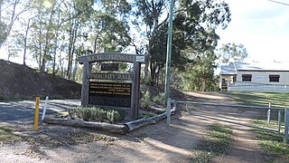
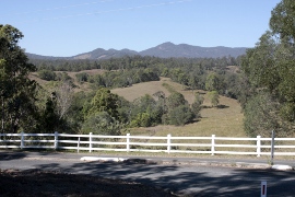
Clear Mountain is a rural locality in the Moreton Bay Region, Queensland, Australia. In the 2016 census, Clear Mountain had a population of 730 people.

Kurwongbah is a rural locality in the Moreton Bay Region, Queensland, Australia. In the 2016 census, Kurwongbah had a population of 1,430 people.

Draper is a rural residential locality in the Moreton Bay Region, Queensland, Australia. In the 2016 census Draper had a population of 676 people.

Upper Caboolture, Queensland Suburb of Moreton Bay Region, Queensland, Australia

Upper Caboolture is a rural locality in the Moreton Bay Region, Queensland, Australia. In the 2016 census, Upper Caboolture had a population of 4214 people. Formerly a rural area on the fringe of the town of Caboolture, since the 1990s the suburb has become increasingly urbanised.

Laceys Creek is a rural locality in the Moreton Bay Region, Queensland, Australia. In the 2016 census, Laceys Creek had a population of 278 people.

Moodlu, Queensland Suburb of Moreton Bay Region, Queensland, Australia

Moodlu is a rural locality in the Moreton Bay Region, Queensland, Australia. In the 2016 census, Moodlu had a population of 318 people.

Moorina is a rural locality in the Moreton Bay Region, Queensland, Australia. In the 2016 census, Moorina had a population of 413 people.

Stanmore is a rural locality in the Moreton Bay Region, Queensland, Australia. In the 2016 census Stanmore had a population of 437 people.

Stony Creek is a rural locality in the Moreton Bay Region of Queensland, Australia. In the 2016 census Stony Creek had a population of 262 people.

Toorbul is a coastal town and a locality in the Moreton Bay Region, Queensland, Australia. In the 2016 census, Toorbul had a population of 930 people.

White Patch, Queensland Town in Queensland, Australia

White Patch is a coastal town and locality of Bribie Island in the Moreton Bay Region, Queensland, Australia. In the 2016 census the locality of White Patch had a population of 142 people.

Mount Delaney is a rural locality in the Moreton Bay Region, Queensland, Australia. In the 2016 census Mount Delaney had a population of 85 people.

Rush Creek, Queensland Suburb of Moreton Bay Region, Queensland, Australia

Rush Creek is a rural locality in the Moreton Bay Region, Queensland, Australia. In the 2016 census, Rush Creek had a population of 157 people.

References

  1. 1 2 3 Australian Bureau of Statistics (27 June 2017). "Neurum (SSC)". 2016 Census QuickStats. Retrieved 20 October 2018. OOjs UI icon edit-ltr-progressive.svg
  2. 1 2 "Neurum – town in Moreton Bay Region (entry 24086)". Queensland Place Names. Queensland Government . Retrieved 7 March 2022.
  3. "Neurum – locality in Moreton Bay Region (entry 45490)". Queensland Place Names. Queensland Government . Retrieved 7 March 2022.
  4. Queensland Family History Society (2010), Queensland schools past and present (Version 1.01 ed.), Queensland Family History Society, ISBN   978-1-921171-26-0
  5. Premier Postal History. "Post Office List". Premier Postal Auctions. Archived from the original on 15 May 2014. Retrieved 10 May 2014.
  6. 1 2 Australian Bureau of Statistics (31 October 2012). "Neurum (State Suburb)". 2011 Census QuickStats. Retrieved 15 August 2015. OOjs UI icon edit-ltr-progressive.svg