Meldale, Queensland

Last updated

Meldale
Queensland
Australia Queensland location map.svg
Red pog.svg
Meldale
Meldale, Queensland
Coordinates 27°01′44″S153°03′56″E / 27.0288°S 153.0655°E / -27.0288; 153.0655 (Meldale (centre of locality))
Population230 (2021 census) [1]
 • Density34.3/km2 (88.9/sq mi)
Postcode(s) 4510
Area6.7 km2 (2.6 sq mi)
Time zone AEST (UTC+10:00)
Location
LGA(s) City of Moreton Bay
State electorate(s) Pumicestone
Federal division(s) Longman
Suburbs around Meldale:
Donnybrook Donnybrook Welsby
Donnybrook Meldale Pumicestone Passage
Toorbul Toorbul Pumicestone Passage

Meldale is a coastal rural locality in the City of Moreton Bay, Queensland, Australia. [2] In the 2021 census, Meldale had a population of 230 people. [1]

Contents

Geography

Meldale is 61.4 kilometres (38.2 mi) by road north of Brisbane, the state capital of Queensland. [3]

Meldale is bounded by Bullock Creek to the north, the Pumicestone Channel ( 27°00′57″S153°05′24″E / 27.0158°S 153.0899°E / -27.0158; 153.0899 (Pumicestone Channel) ) to the north-east (separating the mainland from Bribie Island), and Elimbah Creek to the south and east. [4]

History

The locality was named on 2 July 1983 and is through to be a combination of the surnames of two local land owners: Mellish and Daly. [2]

Demographics

In the 2011 census, Meldale recorded a population of 362 people, 43.1% female and 56.9% male. [5] The median age of the Meldale population was 45 years, 8 years above the national median of 37. 75.7% of people living in Meldale were born in Australia. The other top responses for country of birth were New Zealand 5.5%, England 4.4%, Germany 1.4%, Canada 1.1%, Fiji 1.1%. 89.6% of people spoke only English at home; the next most common languages were 0.8% French, 0.8% Vietnamese, 0.8% Mandarin. [5]

In the 2016 census, Meldale had a population of 223 people. [6]

In the 2021 census, Meldale had a population of 230 people. [1]

Education

There are no schools in Meldale. The nearest government primary school is Pumicestone State School in Caboolture to the south-west. The nearest government secondary school is Caboolture State High School, also in Caboolture. [4]

Amenities

There is a boat ramp in Way Street giving access to Elimbah Creek ( 27°02′01″S153°04′39″E / 27.0335°S 153.0775°E / -27.0335; 153.0775 (Meldale, Way Street boat ramp) ). It is managed by the Moreton Bay City Council. [7]

Related Research Articles

<span class="mw-page-title-main">Caboolture, Queensland</span> Town in Queensland, Australia

Caboolture is a town and suburb in the City of Moreton Bay, Queensland, Australia. It is located on the northern side of the Caboolture River. In the 2021 census, the suburb of Caboolture had a population of 29,534 people.

<span class="mw-page-title-main">Mount Pleasant, Queensland (Moreton Bay)</span> Suburb of City of Moreton Bay, Queensland, Australia

Mount Pleasant is a rural locality in the City of Moreton Bay, Queensland, Australia. In the 2021 census, Mount Pleasant had a population of 390 people.

Ningi is a town and locality in the City of Moreton Bay, Queensland, Australia. In the 2021 census, the locality of Ningi had a population of 5,349 people. It is near Caboolture.

Donnybrook is a coastal town and locality in the City of Moreton Bay, Queensland, Australia. In the 2021 census, the locality of Donnybrook had a population of 664 people.

<span class="mw-page-title-main">Nudgee Beach, Queensland</span> Suburb of Brisbane, Queensland, Australia

Nudgee Beach is a suburb and beach in the City of Brisbane, Queensland, Australia. In the 2021 census, Nudgee Beach had a population of 308 people.

<span class="mw-page-title-main">Delaneys Creek, Queensland</span> Suburb of City of Moreton Bay, Queensland, Australia

Delaneys Creek is a rural locality in the City of Moreton Bay, Queensland, Australia. In the 2021 census, Delaneys Creek had a population of 1,366 people.

Elimbah is a rural town and locality in the City of Moreton Bay, Queensland, Australia. In the 2021 census, the locality of Elimbah had a population of 4,290 people.

<span class="mw-page-title-main">Wamuran, Queensland</span> Town in Queensland, Australia

Wamuran is a rural town and locality in the City of Moreton Bay, Queensland, Australia. In the 2021 census, the locality of Wamuran had a population of 3,374 people.

Bellara is a suburb of Bribie Island in the City of Moreton Bay, Queensland, Australia. In the 2021 census, Bellara had a population of 3,278 people.

<span class="mw-page-title-main">Sandstone Point, Queensland</span> Suburb of City of Moreton Bay, Queensland, Australia

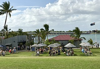
Sandstone Point is a coastal locality in the City of Moreton Bay, Queensland, Australia. In the 2021 census, Sandstone Point had a population of 4,094 people.

<span class="mw-page-title-main">Coochin Creek</span> Suburb of Sunshine Coast, Queensland, Australia

Coochin Creek is a coastal locality in the south of the Sunshine Coast Region, Queensland, Australia. The locality is named for the creek which flows through it.

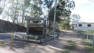
Moorina is a rural locality in the City of Moreton Bay, Queensland, Australia. In the 2021 census, Moorina had a population of 403 people.

<span class="mw-page-title-main">Rocksberg</span> Suburb of City of Moreton Bay, Queensland, Australia

Rocksberg is a rural locality in the City of Moreton Bay, Queensland, Australia. In the 2021 census, Rocksberg had a population of 277 people.

<span class="mw-page-title-main">Toorbul, Queensland</span> Town in Queensland, Australia

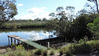
Toorbul is a coastal town and a locality in the City of Moreton Bay, Queensland, Australia. In the 2021 census, the locality of Toorbul had a population of 958 people.

<span class="mw-page-title-main">White Patch, Queensland</span> Town in Queensland, Australia

White Patch is a coastal town and locality of Bribie Island in the City of Moreton Bay, Queensland, Australia. In the 2021 census, the locality of White Patch had a population of 150 people.

<span class="mw-page-title-main">Welsby, Queensland</span> Suburb of Bribie Island, Queensland, Australia

Welsby is a coastal locality on Bribie Island in the City of Moreton Bay, Queensland, Australia. In the 2021 census, Welsby had "no people or a very low population".

<span class="mw-page-title-main">Rush Creek, Queensland</span> Suburb of City of Moreton Bay, Queensland, Australia

Rush Creek is a rural locality in the City of Moreton Bay, Queensland, Australia. In the 2021 census, Rush Creek had a population of 152 people.

Burpengary East is a coastal suburb in the City of Moreton Bay, Queensland, Australia. In the 2021 census, Burpengary East had a population of 9,654 people.

Tuan is a coastal rural town and locality in the Fraser Coast Region, Queensland, Australia. In the 2021 census, the locality of Tuan had a population of 140 people.

The Narrows is a coastal locality in the Gladstone Region, Queensland, Australia. In the 2021 census, The Narrows had "no people or a very low population".

References

  1. 1 2 3 Australian Bureau of Statistics (28 June 2022). "Meldale (SAL)". 2021 Census QuickStats. Retrieved 28 February 2023. OOjs UI icon edit-ltr-progressive.svg
  2. 1 2 "Meldale – locality in Moreton Bay Region (entry 45449)". Queensland Place Names. Queensland Government . Retrieved 16 November 2019.
  3. Google (28 May 2022). "Brisbane CBD to Meldale" (Map). Google Maps . Google. Retrieved 28 May 2022.
  4. 1 2 "Queensland Globe". State of Queensland . Retrieved 27 May 2022.
  5. 1 2 Australian Bureau of Statistics (31 October 2012). "Meldale (State Suburb)". 2011 Census QuickStats. Retrieved 26 September 2014. OOjs UI icon edit-ltr-progressive.svg
  6. Australian Bureau of Statistics (27 June 2017). "Meldale (SSC)". 2016 Census QuickStats. Retrieved 20 October 2018. OOjs UI icon edit-ltr-progressive.svg
  7. "Recreational Boating Facilities Queensland". Queensland Open Data. Queensland Government. 12 November 2020. Archived from the original on 22 November 2020. Retrieved 22 November 2020.