Mount Glorious

Last updated

Mount Glorious
Queensland
Following mountains ridge Mount Glorious Road through D'Aguilar National Park, Queensland 02.jpeg
Following the mountain's ridge on Mount Glorious Road through D'Aguilar National Park, 2016
Australia Queensland location map.svg
Red pog.svg
Mount Glorious
Mount Glorious
Coordinates 27°19′22″S152°46′57″E / 27.3227°S 152.7825°E / -27.3227; 152.7825 (Mount Glorious (centre of locality))
Population296 (2016 census) [1]
 • Density14.37/km2 (37.22/sq mi)
Established1903
Postcode(s) 4520
Area20.6 km2 (8.0 sq mi)
Time zone AEST (UTC+10:00)
Location
LGA(s) City of Moreton Bay
State electorate(s) Pine Rivers
Federal division(s) Dickson
Suburbs around Mount Glorious:
Laceys Creek Kobble Creek Samsonvale
Dundas Mount Glorious Mount Samson
Cedar Creek
England Creek Mount Nebo Highvale

Mount Glorious is a rural locality in the City of Moreton Bay, Queensland, Australia. [2] In the 2016 census, Mount Glorious had a population of 296 people. [1]

Contents

Geography

Mount Glorious is a mountain which is part of the D'Aguilar Range and is a suburb in City of Moreton Bay. It is 41.1 kilometres (25.5 mi) by road north-west of the Brisbane CBD. [3] The forest that surrounds the mountain village is part of Brisbane Forest Park and the D'Aguilar National Park.

The locality has the following mountains (from north to south):

Other mountains in the D'Aguilar Range (but not in this locality) include Mount Nebo, Mount Pleasant and Mount Mee.

History

The locality name takes its name from the mountain, which was named as the result of a random remark by Elizabeth Patrick at a 1915 picnic, when she commented on the view. [2]

Five blocks on the mountain were made available early in the 20th century, with the first block being bought by James O'Hara in 1903. [8] In 1921, a real estate map advertised 31 blocks as 'Crest Estate : the first section', being subdivisions of Portion 9, Parish of Parker. [9] [10]

The mountain was the centre of a 4.4 magnitude earthquake in November 1960. [11]

Demographics

In the 2016 census, Mount Glorious recorded a population of 296 people, 48.6% female and 51.4% male. [1] The median age of the Mount Glorious population was 49 years, 11 years above the national median of 38. 69.4% of people living in Mount Glorious were born in Australia. The other top responses for country of birth were England 9.3%, New Zealand 4.5%, Netherlands 1.0%, Italy 1.0% and India 1.0%. 88.0% of people spoke only English at home; the next most common languages were Dutch 1.0%, and Sinhalese 1.0% [1]

Education

There are no schools in Mount Glorious. The nearest government primary schools are Mount Samson State School in neighbouring Mount Samson to the north-east and Mount Nebo State School in neighbouring Mount Nebo to the south. The nearest government secondary school is Ferny Grove State High School in Ferny Grove to the south-east. [12]

Amenities

The Moreton Bay City Council operates a mobile library service which visits the Mount Glorious Hall on Mount Glorious Road. [13]

See also

Related Research Articles

<span class="mw-page-title-main">Mount Nebo (Queensland)</span> Suburb of City of Moreton Bay, Queensland, Australia

Mount Nebo is a rural locality in the City of Moreton Bay, Queensland, Australia. In the 2016 census, Mount Nebo had a population of 424 people.

<span class="mw-page-title-main">Mount Pleasant, Queensland (Moreton Bay)</span> Suburb of City of Moreton Bay, Queensland, Australia

Mount Pleasant is a rural locality in the City of Moreton Bay, Queensland, Australia. In the 2016 census, Mount Pleasant had a population of 332 people.

<span class="mw-page-title-main">D'Aguilar Range</span> Mountain range in Australia

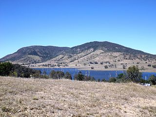
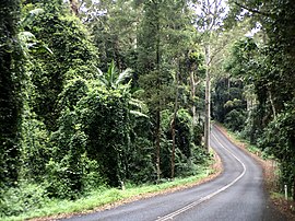
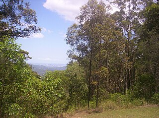
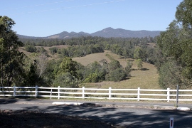
The D'Aguilar Range is a mountain range near Brisbane, Queensland, Australia. The town of Dayboro is situated on the lower foothills midway along the range and the Sunshine Coast Hinterland town of Mooloolah lies at the northernmost point of the range. Many residential areas line its eastern slopes including the town of Samford and the suburb of Ferny Hills. In the west, numerous ridges and gullies are heavily forested and designated as state forest or national park.

<span class="mw-page-title-main">Dayboro, Queensland</span> Town in Queensland, Australia

Dayboro is a rural town and locality in the City of Moreton Bay, Queensland, Australia. In the 2016 census, the locality of Dayboro had a population of 2,119 people.

<span class="mw-page-title-main">Samford, Queensland</span> Town in Queensland, Australia

Samford is a town in the City of Moreton Bay, South East Queensland, Australia. It consists of two localities, Samford Village and Samford Valley.

<span class="mw-page-title-main">Enoggera Reservoir, Queensland</span> Suburb of Brisbane, Queensland, Australia

Enoggera Reservoir is an outer north-western suburb in the City of Brisbane, Queensland, Australia. In the 2016 census, Enoggera Reservoir had a population of 25 people.

Bunya is a suburb in the City of Moreton Bay, Queensland, Australia. In the 2016 census, Bunya had a population of 1,916 people.

<span class="mw-page-title-main">Camp Mountain, Queensland</span> Suburb of City of Moreton Bay, Queensland, Australia

Camp Mountain is a rural locality in the City of Moreton Bay, Queensland, Australia. In the 2016 census, Camp Mountain had a population of 1,416 people.

<span class="mw-page-title-main">Closeburn, Queensland</span> Suburb of City of Moreton Bay, Queensland, Australia

Closeburn is a rural locality in the City of Moreton Bay, Queensland, Australia. In the 2016 census, Closeburn had a population of 594 people.

<span class="mw-page-title-main">Mount Samson, Queensland</span> Suburb of City of Moreton Bay, Queensland, Australia

Mount Samson is a rural locality in the City of Moreton Bay, Queensland, Australia. In the 2016 census, Mount Samson had a population of 594 people.

<span class="mw-page-title-main">Mount Mee, Queensland</span> Town in Queensland, Australia

Mount Mee is a rural town and locality in the City of Moreton Bay, Queensland, Australia. In the 2021 census, Mount Mee had a population of 519 people.

<span class="mw-page-title-main">Moore, Queensland</span> Town in Queensland, Australia

Moore is a rural town and locality in the Somerset Region, Queensland, Australia. In the 2016 census, the locality of Moore had a population of 296 people.

<span class="mw-page-title-main">Kobble Creek</span> Suburb of City of Moreton Bay, Queensland, Australia

Kobble Creek is a rural locality in the City of Moreton Bay, Queensland, Australia. In the 2016 census, Kobble Creek had a population of 632 people.

<span class="mw-page-title-main">Draper, Queensland</span> Suburb of City of Moreton Bay, Queensland, Australia

Draper is a rural residential locality in the City of Moreton Bay, Queensland, Australia. In the 2016 census, Draper had a population of 676 people.

<span class="mw-page-title-main">Highvale, Queensland</span> Suburb of Moreton Bay City, Queensland, Australia

Highvale is a rural residential locality in the City of Moreton Bay, Queensland, Australia. In the 2016 census, Highvale had a population of 1,766 people.

Stony Creek is a rural locality in the City of Moreton Bay in Queensland, Australia. In the 2016 census Stony Creek had a population of 262 people.

<span class="mw-page-title-main">Yugar, Queensland</span> Suburb of City of Moreton Bay, Queensland, Australia

Yugar is a rural locality in the City of Moreton Bay, Queensland, Australia. In the 2021 census, Yugar had a population of 406 people.

<span class="mw-page-title-main">Jollys Lookout, Queensland</span> Suburb of City of Moreton Bay, Queensland, Australia

Jollys Lookout is a rural locality in the City of Moreton Bay, Queensland, Australia. In the 2016 census, Jollys Lookout had a population of 76 people.

<span class="mw-page-title-main">Cedar Creek, Queensland (Moreton Bay)</span> Suburb of City of Moreton Bay, Queensland, Australia

Cedar Creek is a rural locality in the City of Moreton Bay, Queensland, Australia. In the 2016 census, Cedar Creek had a population of 745 people.

<span class="mw-page-title-main">Dundas, Queensland</span> Suburb of Somerset Region, Queensland, Australia

Dundas is a rural locality in the Somerset Region, Queensland, Australia. In the 2016 census Dundas had a population of 77 people.

References

  1. 1 2 3 4 Australian Bureau of Statistics (27 June 2017). "Mount Glorious (SSC)". 2016 Census QuickStats. Retrieved 20 October 2018. OOjs UI icon edit-ltr-progressive.svg
  2. 1 2 "Mount Glorious – locality in Moreton Bay Region (entry 45453)". Queensland Place Names. Queensland Government . Retrieved 16 November 2019.
  3. Google (28 May 2022). "Brisbane CBD to Mount Glorious" (Map). Google Maps . Google. Retrieved 28 May 2022.
  4. 1 2 3 "Mountain peaks and capes - Queensland". Queensland Open Data. Queensland Government. 12 November 2020. Archived from the original on 25 November 2020. Retrieved 25 November 2020.
  5. "Mount Samson – mountain in Moreton Bay Region (entry 29554)". Queensland Place Names. Queensland Government . Retrieved 25 November 2020.
  6. "Mount D'Aguilar – mountain in Moreton Bay Region (entry 9159)". Queensland Place Names. Queensland Government . Retrieved 25 November 2020.
  7. "Mount Glorious – mountain in Moreton Bay Region (entry 14064)". Queensland Place Names. Queensland Government . Retrieved 25 November 2020.
  8. Horton, Helen (1988). Brisbane's Back Door: The story of the D'Aguilar Range. Bowen Hills, Queensland: Boolarong Publications. p. 28. ISBN   0-86439-036-X.
  9. "Mount Glorious Crest Estate : the first section" [Map]. Collections. State Library of Queensland.
  10. "Advertising". The Brisbane Courier . No. 19, 711. Queensland, Australia. 24 March 1921. p. 12. Retrieved 30 April 2019 via National Library of Australia.
  11. Daniel Hurst (24 April 2008). "Qld earthquake risk real". Brisbane Times . Fairfax Digital. Archived from the original on 27 April 2009. Retrieved 27 April 2008.
  12. "Queensland Globe". State of Queensland . Retrieved 28 May 2022.
  13. "Mobile Library". Moreton Bay Regional Council . Archived from the original on 30 January 2018. Retrieved 30 January 2018.