Ningi is a town and locality in the City of Moreton Bay, Queensland, Australia. In the 2021 census, the locality of Ningi had a population of 5,349 people. It is near Caboolture.

Landsborough is a town and a locality in the Sunshine Coast Region, Queensland, Australia. In the 2021 census, the locality of Landsborough had a population of 4,446 people.

Woodford is a rural town and locality in the City of Moreton Bay, Queensland, Australia. In the 2021 census, the locality of Woodford had a population of 4,022 people.
Ocean View is a rural locality in the City of Moreton Bay, Queensland, Australia. In the 2021 census, Ocean View had a population of 1,022 people.

D'Aguilar is a rural town and locality in the City of Moreton Bay, Queensland, Australia. It is located northwest of the larger centre of Caboolture. In the 2021 census, the locality of D'Aguilar had a population of 1,474 people, while the town of D'Aguilar had a population of 1,341 people.

Delaneys Creek is a rural locality in the City of Moreton Bay, Queensland, Australia. In the 2021 census, Delaneys Creek had a population of 1,366 people.
King Scrub is a rural locality in the City of Moreton Bay, Queensland, Australia. In the 2021 census, King Scrub had a population of 363 people. It is located on the northern outskirts of Dayboro.
Bellthorpe is a rural locality in the City of Moreton Bay, Queensland, Australia. In the 2021 census, Bellthorpe had a population of 108 people.
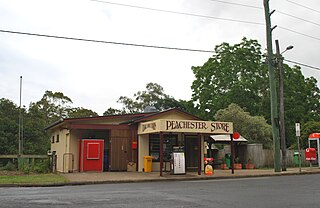
Peachester is a rural town and locality in the Sunshine Coast Region, Queensland, Australia. In the 2021 census, the locality of Peachester had a population of 1,460 people.
Kurwongbah is a rural locality in the City of Moreton Bay, Queensland, Australia. In the 2021 census, Kurwongbah had a population of 1,552 people.

Crohamhurst is a rural locality in the Sunshine Coast Region, Queensland, Australia. In the 2021 census, Crohamhurst had a population of 219 people.

Booroobin is a rural locality split between the City of Moreton Bay and the Sunshine Coast Region in Queensland, Australia. In the 2021 census, Booroobin had a population of 258 people.
Stanmore is a rural locality in the City of Moreton Bay, Queensland, Australia. In the 2021 census, Stanmore had a population of 454 people.
Stony Creek is a rural locality in the City of Moreton Bay in Queensland, Australia. In the 2021 census, Stony Creek had a population of 245 people.
Bald Knob is a rural locality in the Sunshine Coast Region, Queensland, Australia. In the 2021 census, Bald Knob had a population of 280 people.

Balmoral Ridge is a rural locality in the Sunshine Coast Region, Queensland, Australia. In the 2021 census, Balmoral Ridge had a population of 302 people.

Mount Delaney is a rural locality in the City of Moreton Bay, Queensland, Australia. In the 2021 census, Mount Delaney had a population of 80 people.

Rush Creek is a rural locality in the City of Moreton Bay, Queensland, Australia. In the 2021 census, Rush Creek had a population of 152 people.

Witta is a rural town and locality in the Sunshine Coast Region, Queensland, Australia. In the 2021 census, the locality of Witta had a population of 1,296 people.
Kilcoy–Beerwah Road is a continuous 30.4-kilometre (18.9 mi) road route in the Moreton Bay and Sunshine Coast local government areas of Queensland, Australia. It is designated as part of State Route 6. It is a state-controlled regional road. It is part of a route that carries tourist traffic from the New England Highway to the Bruce Highway.

