Mount Pleasant, Queensland (Moreton Bay)

Last updated

Mount Pleasant
Queensland
Mount Pleasant Public Hall, Mount Pleasant, 2020 01.jpg
Mount Pleasant Public Hall, 2020
Australia Queensland location map.svg
Red pog.svg
Mount Pleasant
Mount Pleasant, Queensland (Moreton Bay)
Coordinates 27°08′52″S152°46′58″E / 27.1477°S 152.7827°E / -27.1477; 152.7827 (Mount Pleasant (centre of locality))
Population332 (2016 census) [1]
 • Density8.949/km2 (23.18/sq mi)
Postcode(s) 4521
Area37.1 km2 (14.3 sq mi)
Time zone AEST (UTC+10:00)
Location
LGA(s) City of Moreton Bay
State electorate(s) Pine Rivers
Federal division(s) Dickson
Suburbs around Mount Pleasant:
Mount Byron Mount Mee Ocean View
Mount Byron Mount Pleasant King Scrub
Mount Byron Laceys Creek Dayboro

Mount Pleasant is a rural locality in the City of Moreton Bay, Queensland, Australia. [2] In the 2016 census, Mount Pleasant had a population of 332 people. [1]

Contents

Mount Pleasant is also a mountain in the north-east of the locality ( 27°09′00″S152°46′00″E / 27.15°S 152.7666667°E / -27.15; 152.7666667 (Mount Pleasant (Moreton Bay)) , height 525 metres (1,722 ft)) which is part of the D'Aguilar Range. [3]

Geography

Other mountains in the D'Aguilar Range include Mount Nebo, Mount Glorious and Mount Mee.[ citation needed ]

History

Upper North Pine Provisional School opened in late 1880. It closed following the dismissal of teacher Mr Storey, re-opening circa July 1887 with a new teacher, Mr E. Sinclair. [4] On 1 January 1909, it became Upper North Pine State School. It closed in February 1942. [5] It was on Mount Pleasant Road ( 27°10′33″S152°47′49″E / 27.1759°S 152.7970°E / -27.1759; 152.7970 (Upper North Pine State School (former)) ). [6] [7] [8] [9]

Mount Pleasant Provisional School opened on 28 August 1905. On 1 January 1909, it became Mount Pleasant State School. It closed in 1965. and closed on 1965. [5] It was at approx 259 Mount Brisbane Road ( 27°08′58″S152°46′12″E / 27.1495°S 152.7699°E / -27.1495; 152.7699 (Mount Pleasant State School (former)) ). [10] [11] [12] [9]

In April 1920, the Upper North Pine Honour Roll was unveiled in the Mount Pleasant School of Arts by Richard Warren, the Member of the Queensland Legislative Assembly for Murrumba. The roll has the names of the 26 World War I servicemen from the Mount Pleasant and Lacey Creek districts; nine of them died in the war. [13]

In the 2011 census, Mount Pleasant recorded a population of 304 people, 49% female and 51% male. [14] The median age of the Mount Pleasant population was 37 years, the same as the national median. 86.5% of people living in Mount Pleasant were born in Australia. The other top responses for country of birth were England 6.6%, New Zealand 3%, Canada 1.7%, Belgium 1%. 97.7% of people spoke only English at home. [14]

In the 2016 census, Mount Pleasant had a population of 332 people. [1]

Amenities

Mount Pleasant Public Hall, 2020 Mount Pleasant Public Hall, Mount Pleasant, 2020 03.jpg
Mount Pleasant Public Hall, 2020

Mount Pleasant Community Hall (formerly Mount Pleasant Public Hall & School of Arts) is at 352 Mount Pleasant Road ( 27°09′56″S152°47′02″E / 27.16550°S 152.78390°E / -27.16550; 152.78390 (Mount Pleasant Community Hall) ). [15]

Related Research Articles

<span class="mw-page-title-main">Petrie, Queensland</span> Suburb of Moreton Bay, Queensland, Australia

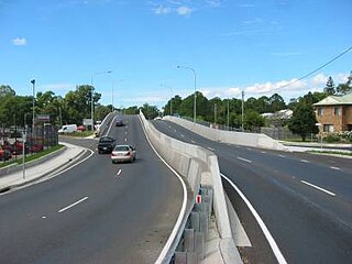
Petrie is a suburb in the City of Moreton Bay, Queensland, Australia. In the 2016 census, Petrie had a population of 8,674 people.

<span class="mw-page-title-main">Mount Nebo (Queensland)</span> Suburb of City of Moreton Bay, Queensland, Australia

Mount Nebo is a rural locality in the City of Moreton Bay, Queensland, Australia. In the 2016 census, Mount Nebo had a population of 424 people.

<span class="mw-page-title-main">D'Aguilar Range</span> Mountain range in Australia

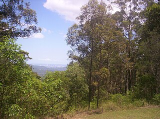
The D'Aguilar Range is a mountain range near Brisbane, Queensland, Australia. The town of Dayboro is situated on the lower foothills midway along the range and the Sunshine Coast Hinterland town of Mooloolah lies at the northernmost point of the range. Many residential areas line its eastern slopes including the town of Samford and the suburb of Ferny Hills. In the west, numerous ridges and gullies are heavily forested and designated as state forest or national park.

<span class="mw-page-title-main">Mount Glorious</span> Suburb of City of Moreton Bay, Queensland, Australia

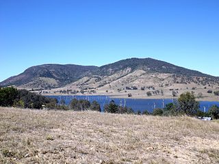
Mount Glorious is a rural locality in the City of Moreton Bay, Queensland, Australia. In the 2016 census, Mount Glorious had a population of 296 people.

<span class="mw-page-title-main">Dayboro, Queensland</span> Town in Queensland, Australia

Dayboro is a rural town and locality in the City of Moreton Bay, Queensland, Australia. In the 2016 census, the locality of Dayboro had a population of 2,119 people.

<span class="mw-page-title-main">Samford, Queensland</span> Town in Queensland, Australia

Samford is a town in the City of Moreton Bay, South East Queensland, Australia. It consists of two localities, Samford Village and Samford Valley.

<span class="mw-page-title-main">Camp Mountain, Queensland</span> Suburb of City of Moreton Bay, Queensland, Australia

Camp Mountain is a rural locality in the City of Moreton Bay, Queensland, Australia. In the 2016 census, Camp Mountain had a population of 1,416 people.

<span class="mw-page-title-main">City of Moreton Bay</span> Local government area in Queensland, Australia

The City of Moreton Bay, known until July 2023 as the Moreton Bay Region, is a local government area in the north of the Brisbane metropolitan city in South East Queensland, Australia. Established in 2008, it replaced three established local government areas, the City of Redcliffe and the Shires of Pine Rivers and Caboolture.

<span class="mw-page-title-main">Mount Mee, Queensland</span> Town in Queensland, Australia

Mount Mee is a rural town and locality in the City of Moreton Bay, Queensland, Australia. In the 2021 census, Mount Mee had a population of 519 people.

<span class="mw-page-title-main">D'Aguilar, Queensland</span> Suburb of City of Moreton Bay, Queensland, Australia

D'Aguilar is a rural town and locality in the City of Moreton Bay, Queensland, Australia. In the 2016 census, the locality of D'Aguilar had a population of 1,207 people.

King Scrub is a rural locality in the City of Moreton Bay, Queensland, Australia. In the 2016 census, King Scrub had a population of 348 people. It is located on the northern outskirts of Dayboro.

<span class="mw-page-title-main">Wamuran, Queensland</span> Town in Queensland, Australia

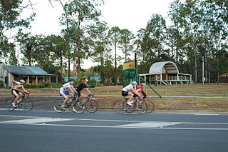
Wamuran is a rural town and locality in the City of Moreton Bay, Queensland, Australia. In the 2016 census, the locality of Wamuran had a population of 3,196 people.

<span class="mw-page-title-main">Kobble Creek</span> Suburb of City of Moreton Bay, Queensland, Australia

Kobble Creek is a rural locality in the City of Moreton Bay, Queensland, Australia. In the 2016 census, Kobble Creek had a population of 632 people.

<span class="mw-page-title-main">Rocksberg</span> Suburb of City of Moreton Bay, Queensland, Australia

Rocksberg is a rural locality in the City of Moreton Bay, Queensland, Australia. In the 2016 census, Rocksberg had a population of 300 people.

Stony Creek is a rural locality in the City of Moreton Bay in Queensland, Australia. In the 2016 census Stony Creek had a population of 262 people.

<span class="mw-page-title-main">Villeneuve, Queensland</span> Suburb of Somerset Region, Queensland, Australia

Villeneuve is a rural town and locality in the Somerset Region, Queensland, Australia. In the 2021 census, the locality of Villeneuve had a population of 193 people.

<span class="mw-page-title-main">Rush Creek, Queensland</span> Suburb of City of Moreton Bay, Queensland, Australia

Rush Creek is a rural locality in the City of Moreton Bay, Queensland, Australia. In the 2016 census, Rush Creek had a population of 157 people.

<span class="mw-page-title-main">Winya, Queensland</span> Suburb of Somerset Region, Queensland, Australia

Winya is a rural locality in the Somerset Region, Queensland, Australia. In the 2016 census, Winya had a population of 72 people.

<span class="mw-page-title-main">Woolmar, Queensland</span> Suburb of Somerset Region, Queensland, Australia

Woolmar is a rural locality in the Somerset Region, Queensland, Australia. In the 2021 census, Woolmar had a population of 565 people.

References

  1. 1 2 3 Australian Bureau of Statistics (27 June 2017). "Mount Pleasant (SSC)". 2016 Census QuickStats. Retrieved 20 October 2018. OOjs UI icon edit-ltr-progressive.svg
  2. "Mount Pleasant – locality in Moreton Bay Region (entry 45455)". Queensland Place Names. Queensland Government . Retrieved 7 March 2022.
  3. "mountain in Moreton Bay Region (entry 27099)". Queensland Place Names. Queensland Government . Retrieved 11 November 2019.
  4. "Our District". Moreton Mail . Vol. 2, no. 79. Queensland, Australia. 9 July 1887. p. 5. Retrieved 27 May 2022 via National Library of Australia.
  5. 1 2 Queensland Family History Society (2010), Queensland schools past and present (Version 1.01 ed.), Queensland Family History Society, ISBN   978-1-921171-26-0
  6. "Moreton 40 Chain map AG2 series sheet 5 north" (Map). Queensland Government. 1922. Retrieved 27 May 2022.
  7. "Moreton 40 Chain map AG2 series sheet 4 north" (Map). Queensland Government. 1928. Retrieved 27 May 2022.
  8. "Parish of Samsonvale" (Map). Queensland Government. 1944. Archived from the original on 23 February 2022. Retrieved 23 February 2022.
  9. 1 2 "Queensland Globe". State of Queensland . Retrieved 1 June 2022.
  10. "Caboolture" (Map). Queensland Government. 1932. Retrieved 1 June 2022.
  11. "Caboolture" (Map). Queensland Government. 1943. Retrieved 1 June 2022.
  12. "9443-36 Dayboro" (Map). Queensland Government. 1976. Retrieved 1 June 2022.
  13. "Upper North Pine Honour Board in Mt Pleasant Community Hall". Dayboro. 8 April 2020. Archived from the original on 9 December 2020. Retrieved 3 February 2021.
  14. 1 2 Australian Bureau of Statistics (31 October 2012). "Mount Pleasant (Moreton Bay - Qld) (State Suburb)". 2011 Census QuickStats. Retrieved 26 September 2014. OOjs UI icon edit-ltr-progressive.svg
  15. "Mt Pleasant Community Hall". Moreton Bay Regional Council . Archived from the original on 18 September 2020. Retrieved 3 February 2021.