Mount Nebo (Queensland)

Last updated

Mount Nebo
Queensland
Mount-Nebo-Queensland-Australia.JPG
Mount Nebo, Queensland
Australia Queensland location map.svg
Red pog.svg
Mount Nebo
Mount Nebo (Queensland)
Coordinates 27°22′32″S152°46′52″E / 27.3755°S 152.7811°E / -27.3755; 152.7811 (Mount Nebo (centre of locality))
Population424 (2016 census) [1]
 • Density29.44/km2 (76.3/sq mi)
Established1919
Postcode(s) 4520
Area14.4 km2 (5.6 sq mi)
Time zone AEST (UTC+10:00)
Location
LGA(s) City of Moreton Bay
State electorate(s) Pine Rivers
Federal division(s) Dickson
Suburbs around Mount Nebo:
England Creek Mount Glorious Highvale
Banks Creek Mount Nebo Highvale
Lake Manchester Lake Manchester Enoggera Reservoir

Mount Nebo is a rural locality in the City of Moreton Bay, Queensland, Australia. [2] In the 2016 census, Mount Nebo had a population of 424 people. [1]

Contents

Geography

Mount Nebo, Queensland Mount-Nebo-road-and-scenery-2.JPG
Mount Nebo, Queensland

Mount Nebo is a mountain approximately 18 kilometres (11 mi) North West of the Brisbane suburb of The Gap in Queensland, Australia. It is part of the D'Aguilar Range which includes other mountains such as Mount Pleasant, Mount Glorious and Mount Mee. The mountain is the source of Enoggera Creek.

History

The locality of Mount Nebo is named after the mountain on which it is located.

European settlement began in 1919 with the subdivision of the Highlands Estate into smaller blocks for soldiers returning from World War I. [3] For a number of years the community belonged to the Shire of Esk, but between 1932 and 1936 a redrawing of the boundaries brought Mount Nebo into the Shire of Pine Rivers. [3] The 2008 amalgamation of local councils means it now falls within the City of Moreton Bay.

Mount Nebo opened in 16 February 1931. The school had a number of temporary closures from 31 December 1934 to 11 April 1939, from 30 September 1940 to 23 October 1940, 18 August 1941 to 19 August 1946 and 5 November 1948 to 21 June 1954. [4] [5]

Demographics

In the 2011 census, Mount Nebo recorded a population of 433 people, 50.3% female and 49.7% male. [6] The median age of the Mount Nebo population was 42 years, 5 years above the national median of 37. [6] 76.6% of people living in Mount Nebo were born in Australia. The other top responses for country of birth were England 11.1%, New Zealand 3.5%, France 1.4%, South Africa 1.2%, United States of America 1.2%. 94.2% of people spoke only English at home; the next most common languages were 1.4% French, 1.2% Dhivehi, 0.7% German, 0.7% Hebrew. [6] The most common religious affiliation was "No Religion" (49.0%); the next most common responses were Catholic 14.3%, Anglican 8.5%, Uniting Church 5.1% and Buddhism 3.5%. [6]

In the 2016 census, Mount Nebo had a population of 424 people. [1]

Amenities

The Moreton Bay City Council operates a mobile library service which visits the Mount Nebo Community Hall on Mount Nebo Rd fornightly. [7]

Education

Mount Nebo State School is a government primary (Prep-6) school for boys and girls at Mount Nebo Road ( 27°23′47″S152°47′00″E / 27.3965°S 152.7834°E / -27.3965; 152.7834 (Mount Nebo State School) ). [8] [9] In 2017, the school had an enrolment of 30 students with 6 teachers (3 full-time equivalent) and 6 non-teaching staff (3 full-time equivalent). [10]

Related Research Articles

<span class="mw-page-title-main">Mount Pleasant, Queensland (Moreton Bay)</span> Suburb of City of Moreton Bay, Queensland, Australia

Mount Pleasant is a rural locality in the City of Moreton Bay, Queensland, Australia. In the 2016 census, Mount Pleasant had a population of 332 people.

<span class="mw-page-title-main">Mount Glorious</span> Suburb of City of Moreton Bay, Queensland, Australia

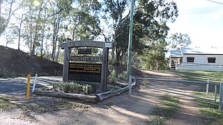
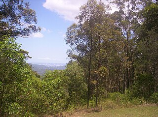
Mount Glorious is a rural locality in the City of Moreton Bay, Queensland, Australia. In the 2016 census, Mount Glorious had a population of 296 people.

<span class="mw-page-title-main">Eatons Hill, Queensland</span> Suburb of City of Moreton Bay, Queensland, Australia

Eatons Hill is a suburb in the City of Moreton Bay, Queensland, Australia. In the 2016 census, Eatons Hill had a population of 7,973 people. Its postcode is 4037.

<span class="mw-page-title-main">Dayboro, Queensland</span> Town in Queensland, Australia

Dayboro is a rural town and locality in the City of Moreton Bay, Queensland, Australia. In the 2016 census, the locality of Dayboro had a population of 2,119 people.

<span class="mw-page-title-main">Camp Mountain, Queensland</span> Suburb of City of Moreton Bay, Queensland, Australia

Camp Mountain is a rural locality in the City of Moreton Bay, Queensland, Australia. In the 2016 census, Camp Mountain had a population of 1,416 people.

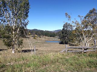
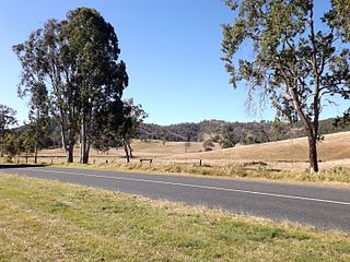
Federal is a rural locality in the Shire of Noosa, Queensland, Australia. It is located in the Sunshine Coast hinterland near the towns of Cooran and Pomona. In the 2021 census, Federal had a population of 365 people.

<span class="mw-page-title-main">Closeburn, Queensland</span> Suburb of City of Moreton Bay, Queensland, Australia

Closeburn is a rural locality in the City of Moreton Bay, Queensland, Australia. In the 2016 census, Closeburn had a population of 594 people.

<span class="mw-page-title-main">Mount Samson, Queensland</span> Suburb of City of Moreton Bay, Queensland, Australia

Mount Samson is a rural locality in the City of Moreton Bay, Queensland, Australia. In the 2016 census, Mount Samson had a population of 594 people.

<span class="mw-page-title-main">Mount Mee, Queensland</span> Town in Queensland, Australia

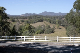
Mount Mee is a rural town and locality in the City of Moreton Bay, Queensland, Australia. In the 2021 census, Mount Mee had a population of 519 people.

<span class="mw-page-title-main">Wamuran, Queensland</span> Town in Queensland, Australia

Wamuran is a rural town and locality in the City of Moreton Bay, Queensland, Australia. In the 2016 census, the locality of Wamuran had a population of 3,196 people.

<span class="mw-page-title-main">Moore, Queensland</span> Town in Queensland, Australia

Moore is a rural town and locality in the Somerset Region, Queensland, Australia. In the 2016 census, the locality of Moore had a population of 296 people.

<span class="mw-page-title-main">Kobble Creek</span> Suburb of City of Moreton Bay, Queensland, Australia

Kobble Creek is a rural locality in the City of Moreton Bay, Queensland, Australia. In the 2016 census, Kobble Creek had a population of 632 people.

<span class="mw-page-title-main">Highvale, Queensland</span> Suburb of Moreton Bay City, Queensland, Australia

Highvale is a rural residential locality in the City of Moreton Bay, Queensland, Australia. In the 2016 census, Highvale had a population of 1,766 people.

Stony Creek is a rural locality in the City of Moreton Bay in Queensland, Australia. In the 2016 census Stony Creek had a population of 262 people.

<span class="mw-page-title-main">Wights Mountain, Queensland</span> Suburb of City of Moreton Bay, Queensland, Australia

Wights Mountain is a rural locality in the City of Moreton Bay, Queensland, Australia. In the 2016 census, Wights Mountain had a population of 793 people.

<span class="mw-page-title-main">Jollys Lookout, Queensland</span> Suburb of City of Moreton Bay, Queensland, Australia

Jollys Lookout is a rural locality in the City of Moreton Bay, Queensland, Australia. In the 2016 census, Jollys Lookout had a population of 76 people.

<span class="mw-page-title-main">Dundas, Queensland</span> Suburb of Somerset Region, Queensland, Australia

Dundas is a rural locality in the Somerset Region, Queensland, Australia. In the 2016 census Dundas had a population of 77 people.

<span class="mw-page-title-main">Mount Delaney</span> Suburb of City of Moreton Bay, Queensland, Australia

Mount Delaney is a rural locality in the City of Moreton Bay, Queensland, Australia. In the 2016 census Mount Delaney had a population of 85 people.

<span class="mw-page-title-main">Sandy Creek, Queensland</span> Suburb of Somerset Region, Queensland, Australia

Sandy Creek is a rural locality in the Somerset Region, Queensland, Australia. In the 2016 census, Sandy Creek had a population of 567 people.

<span class="mw-page-title-main">Winya, Queensland</span> Suburb of Somerset Region, Queensland, Australia

Winya is a rural locality in the Somerset Region, Queensland, Australia. In the 2016 census, Winya had a population of 72 people.

References

  1. 1 2 3 Australian Bureau of Statistics (27 June 2017). "Mount Nebo (SSC)". 2016 Census QuickStats. Retrieved 20 October 2018. OOjs UI icon edit-ltr-progressive.svg
  2. "Mount Nebo – locality in Moreton Bay Region (entry 45454)". Queensland Place Names. Queensland Government . Retrieved 7 March 2022.
  3. 1 2 Horton, Helen (1988). Brisbane's Back Door: The story of the D'Aguilar Range. Bowen Hills, Queensland: Boolarong Publications. pp. 39–41. ISBN   0-86439-036-X.
  4. "Opening and closing dates of Queensland Schools". Queensland Government . Retrieved 18 April 2019.
  5. Queensland Family History Society (2010), Queensland schools past and present (Version 1.01 ed.), Queensland Family History Society, ISBN   978-1-921171-26-0
  6. 1 2 3 4 Australian Bureau of Statistics (31 October 2012). "Mount Nebo (State Suburb)". 2011 Census QuickStats. Retrieved 17 February 2017. OOjs UI icon edit-ltr-progressive.svg
  7. "Mobile Library". Moreton Bay Regional Council . Archived from the original on 30 January 2018. Retrieved 30 January 2018.
  8. "State and non-state school details". Queensland Government. 9 July 2018. Archived from the original on 21 November 2018. Retrieved 21 November 2018.
  9. "Mount Nebo State School". Archived from the original on 23 September 2013. Retrieved 21 November 2018.
  10. "ACARA School Profile 2017". Archived from the original on 22 November 2018. Retrieved 22 November 2018.

Commons-logo.svg Media related to Mount Nebo, Queensland at Wikimedia Commons