Shire of Pine Rivers

Last updated • 5 min readFrom Wikipedia, The Free Encyclopedia

Shire of Pine Rivers
Queensland
SEQ-U-LGA-map-PRSC.png
Map of Pine Rivers Shire in South East Queensland.
Population141,141 (2006 census) [1]
 • Density182.235/km2 (471.99/sq mi)
Established1888
Area774.5 km2 (299.0 sq mi)
Council seat Strathpine
Region South East Queensland
Federal division(s) (as at 2008) Petrie, Dickson
Prsc.png
LGAs around Shire of Pine Rivers:
Esk Caboolture Moreton Bay
Esk Shire of Pine Rivers Redcliffe
Brisbane Brisbane Brisbane

The Shire of Pine Rivers was a local government area about 20 kilometres (12 mi) north of Brisbane in the Moreton Bay region of South East Queensland, Australia. The shire covered an area of 771 square kilometres (297.7 sq mi), and existed as a local government entity from 1888 until 2008, when it amalgamated with councils further north and east to form the Moreton Bay Region, renamed in July 2023 as the City of Moreton Bay. [2]

Contents

The suburbs formerly within Pine Rivers are generally regarded as part of Greater Brisbane, both in a planning context and for statistical purposes.

Geography

The Shire is named for three rivers contained within it: the Pine River, which empties into Bramble Bay, and its tributaries, the North Pine River and South Pine River. Two large artificial reservoirs, Lake Samsonvale and Lake Kurwongbah, formed its centre. The western half of the shire consisted of the sparsely populated foothills of the D'Aguilar Range, the land being mostly forested or used for grazing cattle and horses. Hays Inlet and Saltwater Creek formed the eastern boundary of the Shire, beyond which lay the City of Redcliffe.

The main population concentration was in the east and southeast of the shire—the western part, which covered 76% of the shire's land area, contained only 18,309 residents in 2006. [3] The key centres of population were Strathpine, which formed a mini-CBD for the area; Petrie and Kallangur further to the north, and Albany Creek and the Hills District closer to Brisbane's boundary. A new area based around North Lakes in the shire's north-east had also become reasonably established.

History

Area history

The area was settled by homestead farmers in the mid 19th century. Many suburbs – Lawnton, Petrie, Griffin and Joyner, for example – are named after early European settlers. The first township in the area was established at what is now Petrie in 1868, to service mail coaches between Brisbane and Gympie. The Caboolture railway line reached the shire in 1888. Another railway line to Dayboro, in the western, mountainous areas of the shire was opened in 1920, but due to lack of traffic was closed and lifted in 1955.

During the Second World War, large areas of flat land around Brendale and Strathpine were used by Allied forces as airfields and staging areas. It is estimated that around 50,000 Allied servicemen passed through the area, at a time when the civilian population was less than 5000.

Local government history

Map of Pine Division and adjacent local government areas, March 1902 Pine Division, March 1902.jpg
Map of Pine Division and adjacent local government areas, March 1902
Pine Shire Hall, Strathpine, circa 1920 Postcard of the Pine Shire Council Hall Old Shire Hall, Strathpine, circa 1920.JPG
Pine Shire Hall, Strathpine, circa 1920

Caboolture Division was created on 11 November 1879 as one of 74 divisions around Queensland under the Divisional Boards Act 1879. [4] [5] [6] It was centred on Caboolture, which was at that time a small logging town, and initially covered all of Moreton Bay and much of the Sunshine Coast. On 21 January 1888, the Pine Division split away from the Caboolture Division to become a separate local government area operating under the Divisional Boards Act 1887. [7] Its first divisional board meeting was held on 7 March 1888 at the residence of Henry Thomas Ireland at Albany Creek Mr Ireland was unanimously elected as the board chairman for the year. [7] [8]

The meetings of the divisional board were held in rented premises at Bald Hill until a meeting hall and office building (now the heritage-listed "Old Shire Hall") was constructed in Strathpine in 1889. [8] [9]

In 1897, parts of the Parishes of Samsonvale, Pine and Whiteside were included in the Pine Division. [7]

The Council Chambers built 1960 as it appeared in 2017. Note the bricked-up entrance. Pine Rivers Council Chambers 1960.jpg
The Council Chambers built 1960 as it appeared in 2017. Note the bricked-up entrance.

Following the passage of the Local Authorities Act 1902, Pine Division became the Shire of Pine on 31 March 1903. [7] [10] It underwent significant changes in 1921 and 1955, and on 23 May 1959, the Shire of Pine was renamed Shire of Pine Rivers. [10] In March 1960, Council Meetings moved from the original weatherboard Shire Hall to new brick Council Chambers.It then remained with the same name and boundaries for almost 50 years.

On 15 March 2008, under the Local Government (Reform Implementation) Act 2007 passed by the Parliament of Queensland on 10 August 2007, the Shire of Pine Rivers amalgamated with the Shire of Caboolture and the City of Redcliffe to form the Moreton Bay Region. [10] [11] The Local Government Reform Commission's reasoning was that it would unite all of Brisbane's northern suburbs beyond the Brisbane City boundary into one local government area which would, in its view, simplify and streamline planning, approvals and governance.

In July 2023, the Moreton Bay Region was renamed the City of Moreton Bay. [2]

Chairmen and mayors

William Johnston, Chairman of the Pine Shire Council, 1909 William Johnston, Chairman of the Pine Shire Council, 1909.jpg
William Johnston, Chairman of the Pine Shire Council, 1909

The chairmen and mayors of the division and the shire were: [12]

In 1993, the Local Government Act Number 70 was introduced; it included that all heads of local government councils should be known as mayors and all other elected representatives were to be known as councillors. Thus Yvonne Chapman was both the first female leader of the council and its only mayor. [12]

Other notable council members include:

Wards

In its final years, the Shire of Pine Rivers was split up into 10 divisions, each electing one councillor to the Shire Council for a four-year term. Additionally, a mayor was elected to represent the entire Shire.

Suburbs

The Shire of Pine Rivers included the following suburbs:

Urban suburbs

U1 – light industrial area
U2 – newest suburb in the Shire
U3 – earliest township in the Shire
U4 – Shire council offices and Westfield Strathpine

Rural localities

R1 – contained the shire's major landfill, and Alma Park Zoo
R2 – village and tourist centre

Population

YearPopulation % Annual
Growth
19334,604
19474,815
19546,3093.94%
19618,7614.80%
196613,3098.72%
197126,18714.50%
197645,19211.53%
198158,1895.19%
198673,7834.86%
199187,8923.56%
1996103,1923.26%
2001119,2362.93%
2006141,4143.47%

Related Research Articles

<span class="mw-page-title-main">Lawnton railway station</span> Railway station in Queensland, Australia

Lawnton railway station is located on the North Coast line in Queensland, Australia. It serves the suburb of Lawnton in the City of Moreton Bay.

<span class="mw-page-title-main">Petrie railway station</span> Railway station in Queensland, Australia

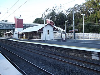
Petrie railway station is located on the North Coast line in Queensland, Australia. It serves the suburb of Petrie in the City of Moreton Bay. It opened as North Pine railway station in1888 after the nearby North Pine River and was renamed Petrie railway station in 1911.

<span class="mw-page-title-main">Petrie, Queensland</span> Suburb of Moreton Bay, Queensland, Australia

Petrie is a suburb in the City of Moreton Bay, Queensland, Australia. In the 2016 census, Petrie had a population of 8,674 people.

<span class="mw-page-title-main">D'Aguilar Range</span> Mountain range in Australia

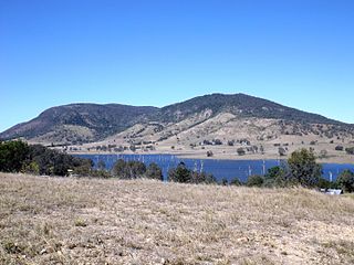
The D'Aguilar Range is a mountain range near Brisbane, Queensland, Australia. The town of Dayboro is situated on the lower foothills midway along the range and the Sunshine Coast Hinterland town of Mooloolah lies at the northernmost point of the range. Many residential areas line its eastern slopes including the town of Samford and the suburb of Ferny Hills. In the west, numerous ridges and gullies are heavily forested and designated as state forest or national park.

<span class="mw-page-title-main">Warner, Queensland</span> Suburb of City of Moreton Bay, Queensland, Australia

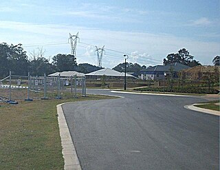
Warner is a suburb in the City of Moreton Bay, Queensland, Australia. In the 2016 census, Warner had a population of 11,411 people.

<span class="mw-page-title-main">South Pine River</span> River in Queensland, Australia

The South Pine River is a minor river in South East Queensland, Australia. It rises on the D'Aguilar Range and passes through the Samford Valley in the City of Moreton Bay local government area.

<span class="mw-page-title-main">Strathpine, Queensland</span> Suburb of City of Moreton Bay, Queensland, Australia

Strathpine is a suburb in the City of Moreton Bay, Queensland, Australia. In the 2016 census, Strathpine had a population of 9,503 people. It is home to the Pine Rivers District offices of the City of Moreton Bay, as well as many businesses. The area is home to Strathpine Centre, a medium-sized urban shopping centre.

<span class="mw-page-title-main">Pine River (Queensland)</span> River in Queensland, Australia

The Pine River is a small river in South East Queensland, Australia.

<span class="mw-page-title-main">Shire of Caboolture</span> Local government area in Queensland

The Shire of Caboolture was a local government area located in the Australian state of Queensland on the northern urban fringe of the capital, Brisbane, and south of the Sunshine Coast. The Shire covered an area of 1,224.4 square kilometres (472.7 sq mi), of which approximately one-quarter was urban, and existed as a local government entity from 1879 until 2008, when it amalgamated with the City of Redcliffe and Shire of Pine Rivers to form the Moreton Bay Region, which was renamed the City of Moreton Bay in July 2023.

<span class="mw-page-title-main">North Pine River</span> River in Queensland, Australia

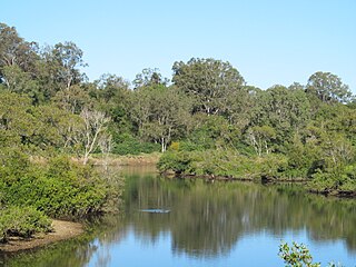
The North Pine River is a minor river in South East Queensland, Australia.

<span class="mw-page-title-main">City of Redcliffe</span> Local government area in Queensland, Australia

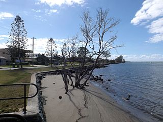
The City of Redcliffe is a former local government area in South East Queensland, Australia. In 2008 it was amalgamated with the Shires of Pine Rivers and Caboolture to create Moreton Bay Region, later renamed City of Moreton Bay. It is in the northern part of the County of Stanley, with a total area of 38.1 square kilometres (14.7 sq mi) and a population of 51,174 in the 2006 census.

<span class="mw-page-title-main">Gympie Road</span> Road in Brisbane, Australia

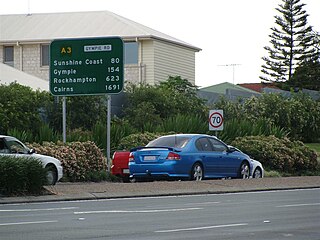
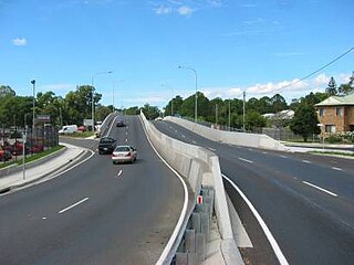
Gympie Road is a major road in the northern suburbs of Brisbane, Queensland, Australia. The road forms part of the main road route from the Brisbane Central Business District (CBD) to the northern suburbs, Sunshine Coast and east coast of Queensland.

<span class="mw-page-title-main">Lawnton, Queensland</span> Suburb of Moreton Bay, Queensland, Australia

Lawnton is a suburb in the City of Moreton Bay, Queensland, Australia. In the 2016 census, Lawnton had a population of 5,658 people.

<span class="mw-page-title-main">City of Moreton Bay</span> Local government area in Queensland, Australia

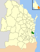
The City of Moreton Bay, known until July 2023 as the Moreton Bay Region, is a local government area in the north of the Brisbane metropolitan city in South East Queensland, Australia. Established in 2008, it replaced three established local government areas, the City of Redcliffe and the Shires of Pine Rivers and Caboolture.

<span class="mw-page-title-main">Samsonvale, Queensland</span> Suburb of City of Moreton Bay, Queensland, Australia

Samsonvale is a rural locality in the City of Moreton Bay, Queensland, Australia. In the 2016 census, Samsonvale had a population of 590 people.

<span class="mw-page-title-main">Hoop Pines, Bald Hills</span> Historic site in Queensland, Australia

The Hoop Pines are a heritage-listed pair of Araucaria cunninghamii trees at 34 Strathpine Road, Bald Hills, City of Brisbane, Queensland, Australia. They were added to the Queensland Heritage Register on 22 February 2002.

<i>Dayboro Times and Moreton Mail</i>

Dayboro Times and Moreton Mail was a weekly English language newspaper published in Dayboro, Queensland, Australia.

Brisbane–Woodford Road is the official name for a continuous 60.5-kilometre (37.6 mi) road route in the Moreton Bay local government area of Queensland, Australia. It is designated as part of State Route 58. It is a state-controlled road part regional and part district, rated as a local road of regional significance (LRRS).

There are two roads named South Pine Road to the north of Brisbane in Queensland, Australia. They are two separate roads rather than a disconnected single road. It is likely that the duplicate naming is the result of actions by two former local authorities, the Shire of Enoggera and the Shire of Pine Rivers.

References

  1. Australian Bureau of Statistics (25 October 2007). "Pine Rivers (S)". 2006 Census QuickStats. Retrieved 20 March 2018.
  2. 1 2 "New City, New Ambition, Renewed Brand". Moreton Bay City Council. Retrieved 5 August 2023.
  3. Australian Bureau of Statistics (25 October 2007). "Community Profile Series: Pine Rivers (S) Bal (Statistical Local Area)". 2006 Census of Population and Housing. Retrieved 11 October 2009.
  4. "Proclamation [Caboolture Division]". Queensland Government Gazette . 11 November 1879. p. 25:994.
  5. "Agency ID 549, Caboolture Divisional Board". Queensland State Archives . Retrieved 20 September 2013.
  6. "Caboolture Town History" . Retrieved 6 May 2008.
  7. 1 2 3 4 "Agency ID 1483, Pine Divisional Board". Queensland State Archives . Retrieved 20 September 2013.
  8. 1 2 Moore, R. P (1920), Postcard of the Pine Shire Council Hall (Old Shire Hall), Strathpine, ca. 1920, Moreton Bay Regional Council, retrieved 28 February 2014
  9. "Pine Rivers Shire Hall (former) (entry 600768)". Queensland Heritage Register . Queensland Heritage Council. Retrieved 11 July 2013.
  10. 1 2 3 "Agency ID 26, Pine Rivers Shire Council". Queensland State Archives . Retrieved 20 September 2013.
  11. "Agency ID 11038, Moreton Bay Regional Council". Queensland State Archives . Retrieved 20 September 2013.
  12. 1 2 Welch, Melva A; Moreton Bay (Qld. : Shire). Council (2008), Not pineapples, not pine trees but-- Pine Rivers : revised chronicle of local government in Pine Rivers Shire, 1888 to 2008 (Revised and updated [ed.] ed.), Pine Rivers Shire Council, ISBN   978-0-9577523-5-1
  13. "Kruger, Mr Raymond Charles (Joe)". Re-Member Database. Queensland Parliament . Retrieved 18 June 2014.

Further reading