Roma is a rural town and locality in the Maranoa Region, Queensland, Australia. It is the administrative centre of the Maranoa Region. The town was incorporated in 1867 and is named after Lady Diamantina Bowen, the wife of Sir George Bowen, the Governor of Queensland at the time. In the 2016 census, the locality of Roma had a population of 6,848 people.

Injune is a rural town and locality in the Maranoa Region, Queensland, Australia. In the 2016 census, the locality of Injune had a population of 461 people.

The Shire of Balonne is a local government area in South West Queensland, Australia, over 500 kilometres (310 mi) from the state capital, Brisbane. It covers an area of 31,104 square kilometres (12,009.3 sq mi), and has existed as a local government entity since 1879. It is headquartered in its main town, St George.

The Shire of Gayndah was a local government area located in the northern catchment of the Burnett River, Queensland, Australia. The shire covered an area of 2,709.3 square kilometres (1,046.1 sq mi), and existed as a local government area from 1866 until 2008, when it amalgamated with several other shires to form the North Burnett Region.

The Shire of Calliope was a local government area in the Capricornia region of Queensland, Australia. It was centred on the town of Calliope.

The Shire of Mount Morgan was a local government area located in the Capricornia region of Central Queensland, Queensland, Australia, about 20 kilometres (12 mi) south of the regional city of Rockhampton. The shire, roughly the region surrounding the former gold mining town of Mount Morgan, covered an area of 492.0 square kilometres (190.0 sq mi), and existed as a local government entity from 1890 until 2008, when it amalgamated with several other councils to become the Rockhampton Region.

The Shire of Emerald is a former local government area in the Central Highlands region of Queensland, Australia. On 15 March 2008 the shires of Duaringa, Emerald, Bauhinia and Peak Downs were amalgamated to form the Central Highlands Region. Its administrative centre is based around Emerald.
The Shire of Bauhinia was a local government area in Central Queensland, Queensland, Australia. The Shire, administered from the town of Springsure, covered an area of 23,649.6 square kilometres (9,131.2 sq mi), and existed as a local government entity from 1879 until 2008, when it was amalgamated with the Shires of Duaringa, Emerald and Peak Downs to form the Central Highlands Region.

The Shire of Murilla was a local government area located in the Darling Downs region of Queensland, Australia. The shire, administered from the town of Miles, covered an area of 6,075.8 square kilometres (2,345.9 sq mi), and existed as a local government entity from 1879 until 2008, when it amalgamated with the Town of Dalby and the Shires of Chinchilla, Tara and Wambo and the southern part of Taroom to form the Western Downs Region.

The Shire of Warroo was a local government area in the Darling Downs region of Queensland, Australia. In March 2008, it became part of the new Maranoa Region.

The Shire of Bendemere was a local government area in the Maranoa region of Queensland, Australia, and existed from 1911 until 2008 when it amalgamated into Maranoa Region. The Shire, administered from the town of Yuleba, covered an area of 3,926.8 square kilometres (1,516.1 sq mi), and existed as a local government entity from 1911 until 2008, when it was amalgamated with the Town of Roma and the Shires of Booringa, Bungil and Warroo to form the Maranoa Region.

The Shire of Bungil was a local government area in the Maranoa region of Queensland, Australia. It existed from 1880 to 2008.

The Shire of Booringa was a local government area in the Maranoa region of Queensland, Australia. The largest town and home of the shire administration was Mitchell. It existed from 1879 to 2008. The shire is now part of the Maranoa Region.

The Shire of Blackall was a local government area located in central Queensland around the town of Blackall. It covered an area of 16,366.8 square kilometres (6,319.3 sq mi), and existed as a local government entity from 1879 until 2008, when it amalgamated with neighbouring Shire of Tambo to form the Blackall-Tambo Region.

The Shire of Nebo was a local government area in Central Queensland, Queensland, Australia, about 80 kilometres (50 mi) south-west of the regional city of Mackay. The Shire, administered from the town of Nebo, covered an area of 10,034.6 square kilometres (3,874.4 sq mi), and existed as a local government entity from 1883 until 2008, when it was amalgamated with the Shires of Belyando and Broadsound to form the Isaac Region.

The Town of Dalby was a local government area of Queensland, Australia which managed the affairs of Dalby. It was located 85 kilometres (53 mi) north-west of Toowoomba. It was amalgamated into the Western Downs Region in 2008.

The City of Mackay was a local government area located in the Central Queensland region of Queensland, Australia, encompassing the regional city of Mackay and the surrounding region. The City was created as a municipal borough in 1869, and prior to amalgamation with the Shire of Pioneer in 1994, the City was limited to the central suburbs on the south shore of the Pioneer River. From 1994 until 2008, the City covered an area of 2,897.5 square kilometres (1,118.7 sq mi). In 2008, it amalgamated with the Shires of Mirani and Sarina to become the Mackay Regional Council.

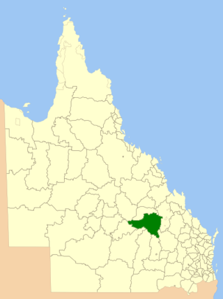
Maranoa Region is a local government area in South West Queensland, Australia. The town of Roma is the administrative headquarters of the region.
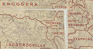
The Town of Toowong is a former local government area of Queensland, Australia, located in western Brisbane in the area around the current suburb of Toowong.
The Town of Charleville is a former local government area in the Maranoa area of Queensland, Australia. It existed from 1894 to 1960.