Related Research Articles

Thursday Island, colloquially known as TI, or in the Kawrareg dialect, Waiben or Waibene, is an island of the Torres Strait Islands, an archipelago of at least 274 small islands in the Torres Strait. TI is located approximately 39 kilometres north of Cape York Peninsula in Far North Queensland, Australia.
Horn Island, or Ngurupai/Narupai in the local language, is an island of the Torres Strait Islands archipelago located in the Torres Strait, in Queensland in Northern Australia between the Australian mainland and Papua New Guinea. It is within the locality of Horn within the Shire of Torres; the boundaries of the locality include the island itself and surrounding waters of the Torres Strait. The town of Wasaga is on the north-western coast of the island. In the 2021 census, Horn had a population of 533 people.

Bamaga is an Indigneous town and locality about 40 kilometres (25 mi) from the northern tip of Cape York in the north of Queensland, Australia. It is within the Northern Peninsula Area Region. It is one of the northernmost settlements in continental Australia and is the administrative centre for the Northern Peninsula Area Regional Council.
Somerset is a coastal locality split between the Shire of Torres and the Northern Peninsula Area Region, Queensland, Australia. In the 2021 census, Somerset had "no people or a very low population".

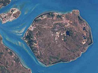
The Prince of Wales Island, or Muralag, is an island of the Torres Strait Islands archipelago at the tip of Cape York Peninsula within the Endeavour Strait of Torres Strait in Queensland, Australia. The island is situated approximately 20 km (12 mi) north of Muttee Heads which is adjacent to Bamaga and south of Thursday Island. It is within the locality of Prince Of Wales within the Shire of Torres. In the 2021 census, Prince Of Wales had a population of 62 people.

The Shire of Calliope was a local government area in the Capricornia region of Queensland, Australia. It was centred on the town of Calliope.

The Shire of Chinchilla was a local government area in the Darling Downs region of Queensland, Australia. The shire, administered from the town of Chinchilla, covered an area of 8,700.3 square kilometres (3,359.2 sq mi), and existed as a local government entity from 1912 until 2008, when it amalgamated with the Town of Dalby and the Shires of Murilla, Tara and Wambo and the southern part of Taroom to form the Western Downs Region.

The Shire of Tara was a local government area in the Darling Downs region of Queensland, Australia. The shire, administered from the town of Tara, covered an area of 11,682.3 square kilometres (4,510.6 sq mi), and existed as a local government entity from 1912 until 2008, when it amalgamated with the Town of Dalby and the Shires of Chinchilla, Murilla and Wambo and the southern part of Taroom to form the Western Downs Region.

The Shire of Bulloo is a local government area in South West Queensland, Australia.
The Shire of Belyando was a local government area in Central Queensland, Australia. The Shire, administered from the town of Clermont, covered an area of 30,281.3 square kilometres (11,691.7 sq mi), and existed as a local government entity from 1879 until 2008, when it was amalgamated with the Shires of Broadsound and Nebo to form the Isaac Region.

The Shire of Whitsunday was a local government area located in the North Queensland region of Queensland, Australia. The shire, administered from the town of Proserpine, covered an area of 2,678.3 square kilometres (1,034.1 sq mi), and existed as a local government entity from 1910 until 2008, when it amalgamated with the Shire of Bowen to form the Whitsunday Region.

The Shire of Croydon is a local government area in western Queensland, Australia. The shire, administered from the town of Croydon, covers an area of 29,498 square kilometres (11,389.2 sq mi). The council consists of a mayor plus four councillors, each of whom represents the entire Shire.

The Shire of Herberton was a local government area of Queensland. It was located on the Atherton Tableland, a plateau forming part of the Great Dividing Range west of the city of Cairns. The shire, administered from the town of Herberton, covered an area of 9,607.0 square kilometres (3,709.3 sq mi), and existed as a local government entity from 1895 until 2008, when it amalgamated with several other councils in the Tableland area to become the Tablelands Region.
The Shire of Waterford is a former local government area in the south-east of Queensland, Australia, centred on the town of Waterford. It existed between 1879 and 1948.

The Shire of Wangaratta was a local government area in the North Queensland region of Queensland, Australia.
The Town of Charleville is a former local government area in the Maranoa area of Queensland, Australia. It existed from 1894 to 1960.
The Town of Cooktown is the former local government area for Cooktown in Far North Queensland, Australia. It existed from 1876 to 1932.

The Town of Hughenden is a former local government area in North Queensland, Australia.
The Town of Clermont is a former local government area for Clermont, Queensland, Australia.

Keriri Island is a rural locality in the Torres Strait Island Region, Queensland, Australia. It consists only of the island Hammond Island whose only town is also called Hammond Island .In the 2021 census, Keriri Island had a population of 261 people.
References
- 1 2 Pugh, Theophilus Parsons (1927). Pugh's Almanac for 1927 . Retrieved 13 June 2014.