Roma is a town, locality and the administrative centre in the Maranoa Region, Queensland, Australia. The town was incorporated in 1867 and is named after Lady Diamantina Bowen, the wife of Sir George Bowen, the Governor of Queensland at the time. At the 2016 census, Roma had a population of 6,848.

Injune is a rural town and locality in the Maranoa Region, Queensland, Australia. In the 2016 census, Injune had a population of 461 people.

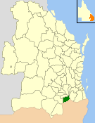
The Shire of Balonne is a local government area in South West Queensland, Australia, over 500 kilometres (310 mi) from the state capital, Brisbane. It covers an area of 31,104 square kilometres (12,009.3 sq mi), and has existed as a local government entity since 1879. It is headquartered in its main town, St George.

Wallumbilla is a town and locality in the Maranoa Region, Queensland, Australia. In the 2016 census, Wallumbilla had a population of 388 people for the locality with 191 people living in the town itself.

Mitchell is a town and locality in the Western Downs district of the Maranoa Region, Queensland, Australia. The town services the local area, a cattle and sheep farming district. In the 2016 census, Mitchell had a population of 1031 people.
The Shire of Warroo was a local government area in the Darling Downs region of Queensland, Australia. In March 2008, it became part of the new Maranoa Region.
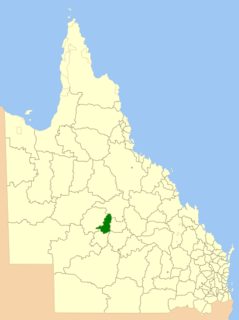
The Shire of Bendemere was a local government area in the Maranoa region of Queensland, Australia, and existed from 1911 until 2008 when it amalgamated into Maranoa Region. The Shire, administered from the town of Yuleba, covered an area of 3,926.8 square kilometres (1,516.1 sq mi), and existed as a local government entity from 1911 until 2008, when it was amalgamated with the Town of Roma and the Shires of Booringa, Bungil and Warroo to form the Maranoa Region.
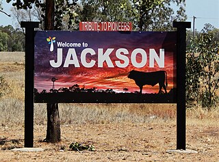
Jackson is a rural town and locality in the Maranoa Region, Queensland, Australia. In the 2016 census, Jackson had a population of 57 people.

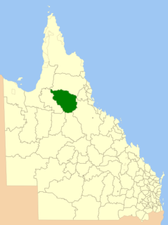
The Shire of Booringa was a local government area in the Maranoa region of Queensland, Australia. The largest town and home of the shire administration was Mitchell. It existed from 1879 to 2008. The shire is now part of the Maranoa Region.

The Shire of Murweh is a local government area in the Maranoa district, which is part of South West Queensland, Australia. The administrative centre and largest town in the shire is Charleville. In June 2018, the Shire of Murweh had a population of 4,318.
The Shire of Ilfracombe was a local government area located in central western Queensland, between the towns of Longreach and Barcaldine. Administered from the town of Ilfracombe, it covered an area of 6,575.5 square kilometres (2,538.8 sq mi), and existed as a local government entity from 1902 until 2008, when it amalgamated with the Shires of Isisford and Longreach to form the Longreach Region.
The Shire of Etheridge is a local government area in Far North Queensland, Australia in what is known as the Savannah Gulf region. Its economy is based on cattle grazing and mining.

The Shire of Clifton was a local government area in the Darling Downs region of Queensland, Australia, southwest of the regional city of Toowoomba. The shire, administered from the town of Clifton, covered an area of 867.5 square kilometres (334.9 sq mi), and existed as a local government entity from 1879 until 2008, when it amalgamated with several other councils in the Toowoomba area to form the Toowoomba Region.

The Town of Roma was a local government area in the western Downs region of Queensland, Australia. The Town of Roma covered the urban area of Roma and was completely surrounded by the neighbouring Shire of Bungil. Today it is part of the Maranoa Region. At the 2011 census the Town had a population of 6,906

Yuleba is a rural town and locality in the Maranoa Region, in the south-west of Queensland, Australia. In the 2016 census, Yuleba had a population of 207 people.

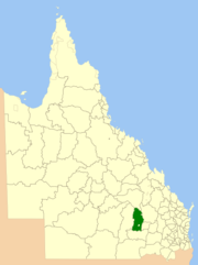
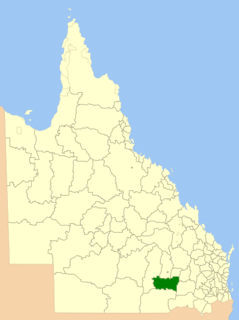
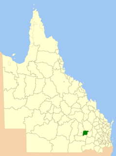
Maranoa Region is a local government area in South West Queensland, Australia. The town of Roma is the administrative headquarters of the region.
The Shire of Glengallan was a local government area south and east of the regional centre of Warwick in the Darling Downs region of Queensland. The shire, administered from Warwick, covered an area of 1,699.6 square kilometres (656.2 sq mi), and existed as a local government entity from 1879 until 1994, when it was dissolved and amalgamated with City of Warwick, Shire of Rosenthal and Shire of Allora to form the Shire of Warwick.

The Shire of Rosenthal was a local government area south and west of the regional centre of Warwick in the Darling Downs region of Queensland. The shire, administered from Rosenthal Heights, a Warwick suburb, covered an area of 1,984.1 square kilometres (766.1 sq mi), and existed as a local government entity from 1886 until 1994, when it was dissolved and amalgamated with City of Warwick, Shire of Allora and Shire of Glengallan to form the Shire of Warwick.
The Town of Cooktown is the former local government area for Cooktown in Far North Queensland, Australia. It existed from 1876 to 1932.
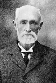
James Lalor (1829–1922) was a politician in Queensland, Australia. He was a Member of the Queensland Legislative Assembly and a Member of the Queensland Legislative Council.