Muckadilla, Queensland

Last updated

Muckadilla
Queensland
Welcome to Muckadilla sign September 2019.jpg
Welcome sign on Warrego Highway
Australia Queensland location map.svg
Red pog.svg
Muckadilla
Coordinates 26°35′11″S148°23′12″E / 26.5863°S 148.3866°E / -26.5863; 148.3866 (Muckadilla (town centre))
Population58 (2016 census locality) [1]
 • Density0.2399/km2 (0.621/sq mi)
Postcode(s) 4461
Area241.8 km2 (93.4 sq mi)
Time zone AEST (UTC+10:00)
Location
LGA(s) Maranoa Region
State electorate(s) Warrego
Federal division(s) Maranoa
Suburbs around Muckadilla:
Eurella Mount Bindango Mount Bindango
Eurella Muckadilla Mount Abundance
Eurella Mount Abundance Mount Abundance

Muckadilla is a rural town and locality in the Maranoa Region, Queensland, Australia. [2] [3] In the 2016 census, the locality of Muckadilla had a population of 58 people. [1]

Contents

Geography

Muckadilla railway station, circa 1920 StateLibQld 1 115308 Railway station at Muckadilla, Queensland, ca. 1920.jpg
Muckadilla railway station, circa 1920

The town lies in the northern part of the locality. The Western railway line passes through the locality from east to west. The town is serviced by the Muckadilla railway station immediately to the north of the town. The Warrego Highway passes from east to west through the town, mostly being parallel immediately south of the railway line. [4]

Muckadilla Creek flows from Mount Bindango to the north down to the south-east of Muckadilla to Mount Abundance, passing just west of the town. The creek becomes Cogoon River and then is a tributary of the Balonne River. [4] Colonial surveyor and explorer Thomas Mitchell followed this stream through this area in 1846, prior to european settlement.

The land is mostly 350-400m above sea level and used for grazing and cropping. Some of the slopes of the higher peaks (to 470m) in the south-west of the locality remain densely forested. [4]

History

The former Muckadilla Railway Station, now a tourist centre Muckadilla Whistle Stop September 2019.jpg
The former Muckadilla Railway Station, now a tourist centre

The name Muckadilla was first used as the creek name, which in turn is believed to be an Aboriginal word (language and dialect unknown) to mean plenty of water. [2]

Muckadilla Provisional School opened on 25 January 1886. It was proclaimed Muckadilla State School on 1 January 1909. [5] The school was mothballed on 31 December 2008, then closed on 31 December 2009. [6] [7] The school was on a 5-acre (2.0 ha) site at the southern end of Centenary Drive ( 26°35′27″S148°23′08″E / 26.5908°S 148.3855°E / -26.5908; 148.3855 (Muckadilla State School (former)) ). [8] [4] The school's website was archived. [9]

In 1889, the Queensland Government drilled a bore at Muckadilla. Although the water supply found was quite small, it was believed that it had healing properties and people flocked to Muckadilla in search of a cure. [10] Dr E.W. Kerr of Brisbane endorsed the water, claiming it had cured "obstinate rheumatism" in some of his patients. [11] The baths were popular and, in 1939, John McEwan Hunter proposed that a sanitorium should be built there to better allow people to improve their "rheumatism, arthritis, uritus, digestion, nerves and general health". [12] [13]

In the 2016 census, the locality of Muckadilla had a population of 58 people. [1]

Education

There are no schools in Muckadilla with Muckadilla State School being mothballed on 31 December 2008 and closed in 2009. The nearest government primary schools are Roma State College in Roma to the east, Mitchell State School in Mitchell to the west, and Dunkeld State School in Dunkeld to the south-west. The nearest government secondary schools are Mitchell State School (to Year 10) and Roma State College (to Year 12). [4]

Amenities

Muckadilla Hotel Motel and the Bench of Bullshit, 2019 Muckadilla Hotel Motel and the Bench of Bullshit, 2019.jpg
Muckadilla Hotel Motel and the Bench of Bullshit, 2019

The town has a hotel motel and a community hall.

Community hall at Muckadilla Muckadilla Hall September 2019.jpg
Community hall at Muckadilla

Muckadilla is one of the towns listed in the first verse of I've Been Everywhere .

Related Research Articles

<span class="mw-page-title-main">Roma, Queensland</span> Town in Queensland, Australia

Roma is a rural town and locality in the Maranoa Region, Queensland, Australia. It is the administrative centre of the Maranoa Region. The town was incorporated in 1867 and is named after Lady Diamantina Bowen, the wife of Sir George Bowen, the Governor of Queensland at the time. In the 2016 census, the locality of Roma had a population of 6,848 people.

<span class="mw-page-title-main">Injune</span> Town in Queensland, Australia

Injune is a rural town and locality in the Maranoa Region, Queensland, Australia. In the 2016 census, the locality of Injune had a population of 461 people.

<span class="mw-page-title-main">Wallumbilla, Queensland</span> Town in Queensland, Australia

Wallumbilla is a rural town and locality in the Maranoa Region, Queensland, Australia. In the 2016 census, the locality of Wallumbilla had a population of 388 people, with 191 people living in the town itself.

<span class="mw-page-title-main">Mitchell, Queensland</span> Town in Queensland, Australia

Mitchell is a rural town and locality in the Maranoa Region, Queensland, Australia. The town services the local area, a cattle and sheep farming district. In the 2016 census, the locality of Mitchell had a population of 1,031 people.

<span class="mw-page-title-main">Shire of Bungil</span> Local government area in Queensland, Australia

The Shire of Bungil was a local government area in the Maranoa region of Queensland, Australia. It existed from 1880 to 2008.

<span class="mw-page-title-main">Yuleba</span> Town in Queensland, Australia

Yuleba is a rural town and locality in the Maranoa Region, in the south-west of Queensland, Australia. In the 2021 census, the locality of Yuleba had a population of 271 people.

<span class="mw-page-title-main">Maranoa Region</span> Local government area in Queensland, Australia

Maranoa Region is a local government area in South West Queensland, Australia. The town of Roma is the administrative headquarters of the region.

<span class="mw-page-title-main">Mungallala</span> Town in Queensland, Australia

Mungallala is a rural town and locality in the Maranoa Region, Queensland, Australia. In the 2016 census, the locality of Mungallala had a population of 136 people.

<span class="mw-page-title-main">Ballaroo, Queensland</span> Suburb of Maranoa Region, Queensland, Australia

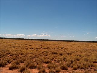
Ballaroo is a semi-arid rural locality in the Maranoa Region, Queensland, Australia. In the 2021 census, Ballaroo had a population of 51 people.

Bungeworgorai is a rural locality in the Maranoa Region, Queensland, Australia. In the 2016 census, Bungeworgorai had a population of 78 people.

<span class="mw-page-title-main">Amby, Queensland</span> Town in Queensland, Australia

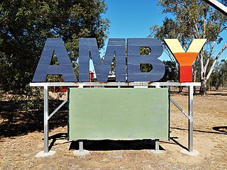
Amby is a rural town and locality in the Maranoa Region, Queensland, Australia. In the 2016 census, the locality of Amby had a population of 86 people.

<span class="mw-page-title-main">Begonia, Queensland</span> Suburb of Maranoa Region, Queensland, Australia

Begonia is a rural locality in the Maranoa Region, Queensland, Australia. In the 2016 census Begonia had a population of 50 people.

<span class="mw-page-title-main">Dunkeld, Queensland</span> Suburb of Maranoa Region, Queensland, Australia

Dunkeld is a rural locality in the Maranoa Region, Queensland, Australia. In the 2021 census, Dunkeld had a population of 49 people.

Euthulla is a rural locality in the Maranoa Region, Queensland, Australia. In the 2016 census, Euthulla had a population of 370 people.

<span class="mw-page-title-main">Hodgson, Queensland</span> Town in Queensland, Australia

Hodgson is a rural town and locality in the Maranoa Region, Queensland, Australia. In the 2016 census, the locality of Hodgson had a population of 61 people.

Wycombe is a rural locality in the Maranoa Region, Queensland, Australia. In the 2016 census, Wycombe had a population of 36 people.

Eurella is a rural locality in the Maranoa Region, Queensland, Australia. In the 2016 census, Eurella had a population of 11 people.

<span class="mw-page-title-main">Blythdale, Queensland</span> Town in Queensland, Australia

Blythdale is a rural town and locality in the Maranoa Region, Queensland, Australia. In the 2016 census, Blythdale had a population of 39 people.

<span class="mw-page-title-main">Forestvale, Queensland</span> Suburb of Maranoa Region, Queensland, Australia

Forestvale is a rural locality in the Maranoa Region, Queensland, Australia. In the 2021 census, Forestvale had a population of 47 people.

Mount Bindango is a rural locality in the Maranoa Region, Queensland, Australia. In the 2016 census Mount Bindango had a population of 33 people.

References

  1. 1 2 3 Australian Bureau of Statistics (27 June 2017). "Muckadilla (SSC)". 2016 Census QuickStats. Retrieved 20 October 2018. OOjs UI icon edit-ltr-progressive.svg
  2. 1 2 "Muckadilla – town in Maranoa Region (entry 23253)". Queensland Place Names. Queensland Government . Retrieved 28 December 2020.
  3. "Muckadilla – locality in Maranoa Region (entry 47442)". Queensland Place Names. Queensland Government . Retrieved 28 December 2020.
  4. 1 2 3 4 5 "Queensland Globe". State of Queensland . Retrieved 20 July 2022.
  5. Queensland Family History Society (2010), Queensland schools past and present (Version 1.01 ed.), Queensland Family History Society, ISBN   978-1-921171-26-0
  6. "Agency ID 5550, Muckadilla State School". Queensland State Archives . Retrieved 16 January 2017.
  7. "Queensland state school - centre closures" (PDF). Queensland Government . 20 August 2013. Archived (PDF) from the original on 20 March 2022. Retrieved 6 April 2022.
  8. "Town of Muckadilla" (Map). Queensland Government. 1984. Archived from the original on 13 April 2022. Retrieved 13 April 2022.
  9. "Muckadilla State School". 18 July 2008. Archived from the original on 18 July 2008. Retrieved 13 April 2022.
  10. "Muckadilla". Outback Now. Archived from the original on 28 February 2017. Retrieved 16 January 2017.
  11. Griggs, Peter (2013), 'Taking the waters': mineral springs, artesian bores and health tourism in Queensland, 1870-1950, Cambridge University Press, pp. 159–160, archived from the original on 7 May 2021, retrieved 16 January 2017
  12. "MUCKADILLA BATHS AND CARNARVON RANGE". Western Star And Roma Advertiser . No. 6907. Queensland, Australia. 18 November 1939. p. 2. Archived from the original on 20 July 2022. Retrieved 16 January 2017 via National Library of Australia.
  13. Griggs, Peter (2013). "'Taking the waters': mineral springs, artesian bores and health tourism in Queensland, 1870-1950" (PDF). Queensland Review . Cambridge University Press. 20 (2): 157–158, 169. Archived (PDF) from the original on 21 September 2017. Retrieved 20 July 2022.

Further reading

Commons-logo.svg Media related to Muckadilla, Queensland at Wikimedia Commons