
Surat is a rural town and locality in the Maranoa Region, Queensland, Australia. In the 2021 census, the locality of Surat had a population of 402 people.

Injune is a rural town and locality in the Maranoa Region, Queensland, Australia. In the 2021 census, the locality of Injune had a population of 429 people.
Rolleston is a rural town and locality in the Central Highlands Region, Queensland, Australia. In the 2021 census, the locality of Rolleston had a population of 132 people.

Wallumbilla is a rural town and locality in the Maranoa Region, Queensland, Australia. In the 2021 census, the locality of Wallumbilla had a population of 331 people. with 191 people living in the town itself.

Mitchell is a rural town and locality in the Maranoa Region, Queensland, Australia. The town services the local area, a cattle and sheep farming district. In the 2021 census, the locality of Mitchell had a population of 995 people.

Yuleba is a rural town and locality in the Maranoa Region, in the south-west of Queensland, Australia. In the 2021 census, the locality of Yuleba had a population of 271 people.
Glenwood is a locality split between the Fraser Coast Region and the Gympie Region in Queensland, Australia. In the 2021 census, the locality of Glenwood had a population of 2,137 people.
Pindi Pindi is a rural locality in the Mackay Region, Queensland, Australia. In the 2021 census, the locality of Pindi Pindi had a population of 86 people.

Eton is a rural town and locality in the Mackay Region, Queensland, Australia. In the 2021 census, the locality of Eton had a population of 728 people.
Bungeworgorai is a rural locality in the Maranoa Region, Queensland, Australia. In the 2021 census, Bungeworgorai had a population of 68 people.
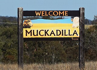
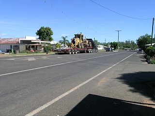
Muckadilla is a rural town and locality in the Maranoa Region, Queensland, Australia. In the 2021 census, the locality of Muckadilla had a population of 38 people.
Bloomsbury is a town and coastal locality in the Mackay Region, Queensland, Australia. In the 2021 census, the locality of Bloomsbury had a population of 539 people.
Begonia is a rural locality in the Maranoa Region, Queensland, Australia. In the 2021 census, Begonia had a population of 48 people.
Teelba is a rural locality in the Maranoa Region, Queensland, Australia. In the 2021 census, Teelba had a population of 82 people.

Orion is a rural locality in the Central Highlands Region, Queensland, Australia. In the 2021 census, Orion had a population of 87 people.
Euthulla is a rural locality in the Maranoa Region, Queensland, Australia. In the 2021 census, Euthulla had a population of 364 people.
Orange Hill is a rural locality in the Maranoa Region, Queensland, Australia. In the 2021 census, Orange Hill had a population of 179 people.
Baffle West is a rural locality in the Maranoa Region, Queensland, Australia. In the 2021 census, Baffle West had "no people or a very low population".
Simmie is a rural locality in the Maranoa Region, Queensland, Australia. In the 2021 census, Simmie had a population of 16 people.

Wellesley is a rural locality in the Maranoa Region, Queensland, Australia. In the 2021 census, Wellesley had a population of 94 people.
