Begonia, Queensland

Last updated

Begonia
Queensland
Begonia State School, 2023.jpg
Begonia State School, 2023
Australia Queensland location map.svg
Red pog.svg
Begonia
Coordinates 27°27′37″S148°16′27″E / 27.4602°S 148.2741°E / -27.4602; 148.2741 (Begonia (centre of locality))
Population50 (2016 census) [1]
 • Density0.0300/km2 (0.078/sq mi)
Postcode(s) 4487
Area1,668.5 km2 (644.2 sq mi)
Time zone AEST (UTC+10:00)
LGA(s) Maranoa Region
State electorate(s) Warrego
Federal division(s) Maranoa
Suburbs around Begonia:
Dunkeld Dunkeld Ballaroo
Bindebango Begonia Wycombe
St George St George St George

Begonia is a rural locality in the Maranoa Region, Queensland, Australia. [2] In the 2016 census Begonia had a population of 50 people. [1]

Contents

Geography

The Maranoa River flows from north-west to south-east through the locality. [3]

History

Begonia State School opened on 25 January 1970. [4]

In the 2016 census Begonia had a population of 50 people. [1]

Education

Begonia State School, aerial view, 2019 Begonia State School, aerial view, 2019.jpg
Begonia State School, aerial view, 2019

Begonia State School is a government primary (Prep-6) school for boys and girls on Begonia Road off Mitchell St George Road ( 27°29′30″S148°19′30″E / 27.4917°S 148.3249°E / -27.4917; 148.3249 (Begonia State School) ). [5] [6] In 2016, the school had an enrolment of 14 students with 3 teachers (1 full-time equivalent) and 4 non-teaching staff (1 full-time equivalent). [7] In 2018, the school had an enrolment of 13 students with 2 teachers (1 full-time equivalent) and 4 non-teaching staff (2 full-time equivalent). [8]

Related Research Articles

<span class="mw-page-title-main">Emerald, Queensland</span> Town in Queensland, Australia

Emerald is a rural town and locality in the Central Highlands Region, Queensland, Australia. In the 2021 census, the locality of Emerald had a population of 14,906 people.

<span class="mw-page-title-main">Surat, Queensland</span> Town in Queensland, Australia

Surat is a rural town and locality in the Maranoa Region, Queensland, Australia. In the 2021 census, the locality of Surat had a population of 402 people.

<span class="mw-page-title-main">Injune</span> Town in Queensland, Australia

Injune is a rural town and locality in the Maranoa Region, Queensland, Australia. In the 2016 census, the locality of Injune had a population of 461 people.

Gargett is a rural locality in the Mackay Region, Queensland, Australia. In the 2016 census Gargett had a population of 261 people.

<span class="mw-page-title-main">Wallumbilla, Queensland</span> Town in Queensland, Australia

Wallumbilla is a rural town and locality in the Maranoa Region, Queensland, Australia. In the 2016 census, the locality of Wallumbilla had a population of 388 people, with 191 people living in the town itself.

<span class="mw-page-title-main">Mitchell, Queensland</span> Town in Queensland, Australia

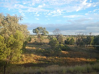
Mitchell is a rural town and locality in the Maranoa Region, Queensland, Australia. The town services the local area, a cattle and sheep farming district. In the 2016 census, the locality of Mitchell had a population of 1,031 people.

<span class="mw-page-title-main">Comet, Queensland</span> Town in Queensland, Australia

Comet is a historically-rich rural town and locality in the Central Highlands Region, Queensland, Australia. In the 2016 census, the locality of Comet had a population of 498 people.

<span class="mw-page-title-main">Mungallala</span> Town in Queensland, Australia

Mungallala is a rural town and locality in the Maranoa Region, Queensland, Australia. In the 2016 census, the locality of Mungallala had a population of 136 people.

Pindi Pindi is a rural locality in the Mackay Region, Queensland, Australia. In the 2016 census Pindi Pindi had a population of 98 people.

<span class="mw-page-title-main">Ballaroo, Queensland</span> Suburb of Maranoa Region, Queensland, Australia

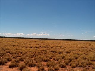
Ballaroo is a semi-arid rural locality in the Maranoa Region, Queensland, Australia. In the 2021 census, Ballaroo had a population of 51 people.

<span class="mw-page-title-main">North Eton, Queensland</span> Suburb of Mackay Region, Queensland, Australia

North Eton is a rural locality in the Mackay Region, Queensland, Australia. In the 2016 census North Eton had a population of 186 people.

<span class="mw-page-title-main">Eton, Queensland</span> Town in Queensland, Australia

Eton is a rural town and locality in the Mackay Region, Queensland, Australia. In the 2016 census, the locality of Eton had a population of 679 people.

Bloomsbury is a town and coastal locality in the Mackay Region, Queensland, Australia. In the 2016 census, the locality of Bloomsbury had a population of 598 people.

Bymount is a rural locality in the Maranoa Region, Queensland, Australia. In the 2016 census Bymount had a population of 32 people.

<span class="mw-page-title-main">Dunkeld, Queensland</span> Suburb of Maranoa Region, Queensland, Australia

Dunkeld is a rural locality in the Maranoa Region, Queensland, Australia. In the 2021 census, Dunkeld had a population of 49 people.

<span class="mw-page-title-main">Patrick Estate, Queensland</span> Suburb of Somerset Region, Queensland, Australia

Patrick Estate is a rural locality in the Somerset Region, Queensland, Australia. In the 2016 census Patrick Estate had a population of 199 people.

Teelba is a rural locality in the Maranoa Region, Queensland, Australia. In the 2016 census Teelba had a population of 44 people.

<span class="mw-page-title-main">Airville, Queensland</span> Suburb of Shire of Burdekin, Queensland, Australia

Airville is a rural locality in the Shire of Burdekin, Queensland, Australia. In the 2016 census, Airville had a population of 338 people.

Wycombe is a rural locality in the Maranoa Region, Queensland, Australia. In the 2016 census, Wycombe had a population of 36 people.

Whitsundays is an island group locality in the Whitsunday Region, Queensland, Australia. It mostly consists of the Whitsunday Group of islands off the Queensland east coast in the Coral Sea, a mix of inhabited and uninhabited islands. In the 2016 census, Whitsundays had a population of 2,269 people.

References

  1. 1 2 3 Australian Bureau of Statistics (27 June 2017). "Begonia (SSC)". 2016 Census QuickStats. Retrieved 20 October 2018. OOjs UI icon edit-ltr-progressive.svg
  2. "Begonia – locality in Maranoa Region (entry 47410)". Queensland Place Names. Queensland Government . Retrieved 27 December 2020.
  3. "Queensland Globe". State of Queensland . Retrieved 12 September 2017.
  4. Queensland Family History Society (2010), Queensland schools past and present (Version 1.01 ed.), Queensland Family History Society, ISBN   978-1-921171-26-0
  5. "State and non-state school details". Queensland Government. 9 July 2018. Archived from the original on 21 November 2018. Retrieved 21 November 2018.
  6. "Begonia State School". Begonia State School. 7 July 2022. Archived from the original on 25 March 2020. Retrieved 27 September 2023.
  7. "Annual Report 2016" (PDF). Begonia State School. Archived from the original (PDF) on 12 September 2017. Retrieved 12 September 2017.
  8. "ACARA School Profile 2018". Australian Curriculum, Assessment and Reporting Authority. Archived from the original on 27 August 2020. Retrieved 28 January 2020.