Orange Hill, Queensland

Last updated

Orange Hill
Queensland
Australia Queensland location map.svg
Red pog.svg
Orange Hill
Coordinates 26°29′29″S148°47′24″E / 26.4913°S 148.79°E / -26.4913; 148.79 (Orange Hill (centre of locality))
Population179 (SAL 2021) [1]
Postcode(s) 4455
Area35.0 km2 (13.5 sq mi)
Time zone AEST (UTC+10:00)
Location
LGA(s) Maranoa Region
State electorate(s) Warrego
Federal division(s) Maranoa
Suburbs around Orange Hill:
Euthulla Euthulla Euthulla
Euthulla Orange Hill Euthulla
Euthulla Roma Euthulla

Orange Hill is a rural locality in the Maranoa Region, Queensland, Australia. [2] In the 2021 census, Orange Hill had a population of 179 people. [3]

Contents

Geography

Bungil Creek forms the eastern boundary of the locality. The Carnarvon Highway passes through the locality from south to north. The predominant land use is for cattle grazing. [4]

History

In May 1888, local residents met with the intention to establish a school in the Northern Road area. [5] Northern Road Provisional School was in operation by November 1891. [6] It later become Northern Road State School. [7] The school closed some time after November 1939. [8] It was at 777 Carnarvon Highway ( 26°30′23″S148°47′17″E / 26.50648°S 148.78819°E / -26.50648; 148.78819 (Northern Road State School (former)) ). [9] [4] In 1951, the school building was to be relocated to Mount Abundance. [10]

The locality was officially named and bounded on 20 July 2001. [2]

Demographics

In the 2016 census, Orange Hill had a population of 201 people. [11]

In the 2021 census, Orange Hill had a population of 179 people. [3]

Education

There are no schools in Orange Hill but Roma immediately to the south has both primary and secondary schools. [4]

Related Research Articles

<span class="mw-page-title-main">Roma, Queensland</span> Town in Queensland, Australia

Roma is a rural town and locality in the Maranoa Region, Queensland, Australia. It is the administrative centre of the Maranoa Region. The town was incorporated in 1867 and is named after Lady Diamantina Bowen, the wife of Sir George Bowen, the Governor of Queensland at the time. In the 2016 census, the locality of Roma had a population of 6,848 people.

<span class="mw-page-title-main">Surat, Queensland</span> Town in Queensland, Australia

Surat is a rural town and locality in the Maranoa Region, Queensland, Australia. In the 2021 census, the locality of Surat had a population of 402 people.

<span class="mw-page-title-main">Injune</span> Town in Queensland, Australia

Injune is a rural town and locality in the Maranoa Region, Queensland, Australia. In the 2016 census, the locality of Injune had a population of 461 people.

<span class="mw-page-title-main">Wallumbilla, Queensland</span> Town in Queensland, Australia

Wallumbilla is a rural town and locality in the Maranoa Region, Queensland, Australia. In the 2016 census, the locality of Wallumbilla had a population of 388 people, with 191 people living in the town itself.

<span class="mw-page-title-main">Mitchell, Queensland</span> Town in Queensland, Australia

Mitchell is a rural town and locality in the Maranoa Region, Queensland, Australia. The town services the local area, a cattle and sheep farming district. In the 2016 census, the locality of Mitchell had a population of 1,031 people.

<span class="mw-page-title-main">Yuleba</span> Town in Queensland, Australia

Yuleba is a rural town and locality in the Maranoa Region, in the south-west of Queensland, Australia. In the 2021 census, the locality of Yuleba had a population of 271 people.

<span class="mw-page-title-main">Amby, Queensland</span> Town in Queensland, Australia

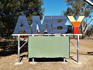
Amby is a rural town and locality in the Maranoa Region, Queensland, Australia. In the 2016 census, the locality of Amby had a population of 86 people.

<span class="mw-page-title-main">Muckadilla, Queensland</span> Suburb of Maranoa Region, Queensland, Australia

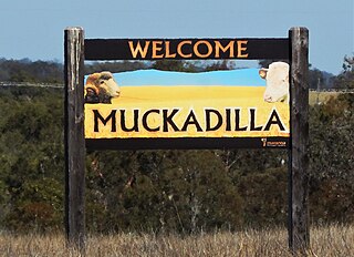
Muckadilla is a rural town and locality in the Maranoa Region, Queensland, Australia. In the 2016 census, the locality of Muckadilla had a population of 58 people.

Euthulla is a rural locality in the Maranoa Region, Queensland, Australia. In the 2016 census, Euthulla had a population of 370 people.

<span class="mw-page-title-main">Hodgson, Queensland</span> Town in Queensland, Australia

Hodgson is a rural town and locality in the Maranoa Region, Queensland, Australia. In the 2016 census, the locality of Hodgson had a population of 61 people.

Mooga is a rural locality in the Maranoa Region, Queensland, Australia. In the 2016 census Mooga had a population of 17 people.

<span class="mw-page-title-main">Mount Abundance, Queensland</span> Suburb of Maranoa Region, Queensland, Australia

Mount Abundance is a locality in the Maranoa Region, Queensland, Australia. In the 2021 census, Mount Abundance had a population of 178 people.

Tingun is a rural locality in the Maranoa Region, Queensland, Australia. In the 2016 census Tingun had a population of 157 people.

Bungil is a locality in the Maranoa Region, Queensland, Australia. In the 2021 census, Bungil had a population of 69 people.

Dargal Road is a rural locality in the Maranoa Region, Queensland, Australia. In the 2016 census, Dargal Road had a population of 152 people.

Mount Hutton is a rural locality in the Maranoa Region, Queensland, Australia. In the 2021 census, Mount Hutton had a population of 32 people.

<span class="mw-page-title-main">Forestvale, Queensland</span> Suburb of Maranoa Region, Queensland, Australia

Forestvale is a rural locality in the Maranoa Region, Queensland, Australia. In the 2021 census, Forestvale had a population of 47 people.

<span class="mw-page-title-main">Noorindoo, Queensland</span> Suburb of Maranoa Region, Queensland, Australia

Noorindoo is a rural locality in the Maranoa Region, Queensland, Australia. In the 2021 census, Noorindoo had a population of 71 people.

Mount Bindango is a rural locality in the Maranoa Region, Queensland, Australia. In the 2016 census Mount Bindango had a population of 33 people.

Roma–Condamine Road is a continuous 115-kilometre (71 mi) road route in the Maranoa and Western Downs local government areas of Queensland, Australia. It is a state-controlled regional road, rated as a local road of regional significance (LRRS).

References

  1. Australian Bureau of Statistics (28 June 2022). "Orange Hill (suburb and locality)". Australian Census 2021 QuickStats. Retrieved 28 June 2022.  OOjs UI icon edit-ltr-progressive.svg
  2. 1 2 "Orange Hill – locality in Maranoa Region (entry 47448)". Queensland Place Names. Queensland Government . Retrieved 26 November 2018.
  3. 1 2 Australian Bureau of Statistics (28 June 2022). "Orange Hill (SAL)". 2021 Census QuickStats. Retrieved 28 February 2023. OOjs UI icon edit-ltr-progressive.svg
  4. 1 2 3 "Queensland Globe". State of Queensland . Retrieved 25 December 2023.
  5. "Advertising". Western Star and Roma Advertiser . No. 971. Queensland, Australia. 19 May 1888. p. 3. Archived from the original on 23 December 2023. Retrieved 6 November 2023 via National Library of Australia.
  6. "Family Notices". Western Star and Roma Advertiser . No. 1330. Queensland, Australia. 11 November 1891. p. 3. Archived from the original on 23 December 2023. Retrieved 6 November 2023 via National Library of Australia.
  7. "Advertising". Western Star and Roma Advertiser . No. 5705. Queensland, Australia. 8 December 1923. p. 3. Archived from the original on 23 December 2023. Retrieved 6 November 2023 via National Library of Australia.
  8. "SCHOOLS LONG VACATION". Western Star and Roma Advertiser . No. 6915. Queensland, Australia. 16 December 1939. p. 2. Archived from the original on 23 December 2023. Retrieved 6 November 2023 via National Library of Australia.
  9. "Parish of Euthulla" (Map). Queensland Government. 1931. Archived from the original on 5 November 2023. Retrieved 6 November 2023.
  10. "TOWN TALK". Western Star . No. 6393. Queensland, Australia. 23 February 1951. p. 1. Archived from the original on 9 November 2023. Retrieved 6 November 2023 via National Library of Australia.
  11. Australian Bureau of Statistics (27 June 2017). "Orange Hill (SSC)". 2016 Census QuickStats. Retrieved 20 October 2018. OOjs UI icon edit-ltr-progressive.svg