Ballaroo, Queensland

Last updated

Ballaroo
Queensland
St. George fields - panoramio.jpg
Ballaroo landscape
Australia Queensland location map.svg
Red pog.svg
Ballaroo
Coordinates 27°06′52″S148°37′20″E / 27.1144°S 148.6222°E / -27.1144; 148.6222 (Ballaroo (centre of locality))
Population51 (SAL 2021) [1]
Postcode(s) 4455
Area1,786.5 km2 (689.8 sq mi)
Time zone AEST (UTC+10:00)
Location
LGA(s) Maranoa Region
State electorate(s) Warrego
Federal division(s) Maranoa
Suburbs around Ballaroo:
Dunkeld Mount Abundance Tingun
Dunkeld Ballaroo Oberina
Begonia Wycombe Weribone
Wellesley

Ballaroo is a semi-arid rural locality in the Maranoa Region, Queensland, Australia. [2] In the 2021 census, Ballaroo had a population of 51 people. [3]

Contents

Geography

The Cogoon River (Muckadilla Creek) flows, most often with little flow, through the locality from the north (Mount Abundance) to the south-east (Weribone) where it becomes a tributary of the Balonne River. [4]

Mount First View is in the centre of the locality ( 27°05′15″S148°33′26″E / 27.0875°S 148.5572°E / -27.0875; 148.5572 (Mount First View) ) rising to 326 metres (1,070 ft) above sea level. [5] It was named on 3 May 1846 by the New South Wales Surveyor General, Sir Thomas Livingstone Mitchell. [6]

History

The colonial surveyor-general Thomas Mitchell and party followed the Cogoon River from the Balonne to Mount Abundance, when passing through this area in 1846. [7]

Demographics

In the 2016 census, Ballaroo had a population of 41 people. [8]

In the 2021 census, Ballaroo had a population of 51 people. [3]

Education

There are no schools in Ballaroo. The nearest government primary schools are Dunkeld State School in neighbouring Dunkeld to the west, Begonia State School in neighbouring Begonia to the south-west and Roma State College in Roma to the north-west. The nearest government secondary school is Roma State College in Roma, but it is so distant that distance education and boarding school would be other options. [4]

Related Research Articles

<span class="mw-page-title-main">Surat, Queensland</span> Town in Queensland, Australia

Surat is a rural town and locality in the Maranoa Region, Queensland, Australia. In the 2021 census, the locality of Surat had a population of 402 people.

<span class="mw-page-title-main">Wallumbilla, Queensland</span> Town in Queensland, Australia

Wallumbilla is a rural town and locality in the Maranoa Region, Queensland, Australia. In the 2016 census, the locality of Wallumbilla had a population of 388 people, with 191 people living in the town itself.

<span class="mw-page-title-main">Thallon, Queensland</span> Town in Queensland, Australia

Thallon is a town and a locality in the Shire of Balonne, Queensland, Australia. In the 2021 census, the locality of Thallon had a population of 231 people.

<span class="mw-page-title-main">Amby, Queensland</span> Town in Queensland, Australia

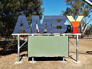
Amby is a rural town and locality in the Maranoa Region, Queensland, Australia. In the 2016 census, the locality of Amby had a population of 86 people.

<span class="mw-page-title-main">Muckadilla, Queensland</span> Suburb of Maranoa Region, Queensland, Australia

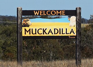
Muckadilla is a rural town and locality in the Maranoa Region, Queensland, Australia. In the 2016 census, the locality of Muckadilla had a population of 58 people.

<span class="mw-page-title-main">Begonia, Queensland</span> Suburb of Maranoa Region, Queensland, Australia

Begonia is a rural locality in the Maranoa Region, Queensland, Australia. In the 2016 census Begonia had a population of 50 people.

<span class="mw-page-title-main">Dunkeld, Queensland</span> Suburb of Maranoa Region, Queensland, Australia

Dunkeld is a rural locality in the Maranoa Region, Queensland, Australia. In the 2021 census, Dunkeld had a population of 49 people.

Wallumbilla North is a rural locality in the Maranoa Region, Queensland, Australia. In the 2016 census, Wallumbilla North had a population of 147 people.

<span class="mw-page-title-main">Mount Abundance, Queensland</span> Suburb of Maranoa Region, Queensland, Australia

Mount Abundance is a locality in the Maranoa Region, Queensland, Australia. In the 2021 census, Mount Abundance had a population of 178 people.

Wycombe is a rural locality in the Maranoa Region, Queensland, Australia. In the 2016 census, Wycombe had a population of 36 people.

<span class="mw-page-title-main">Warkon</span> Suburb of Maranoa Region, Queensland, Australia

Warkon is a rural locality in the Maranoa Region, Queensland, Australia. In the 2016 census, Warkon had a population of 33 people.

Orange Hill is a rural locality in the Maranoa Region, Queensland, Australia. In the 2021 census, Orange Hill had a population of 179 people.

Bungil is a locality in the Maranoa Region, Queensland, Australia. In the 2021 census, Bungil had a population of 69 people.

Dargal Road is a rural locality in the Maranoa Region, Queensland, Australia. In the 2016 census, Dargal Road had a population of 152 people.

Eurella is a rural locality in the Maranoa Region, Queensland, Australia. In the 2016 census, Eurella had a population of 11 people.

Mount Hutton is a rural locality in the Maranoa Region, Queensland, Australia. In the 2021 census, Mount Hutton had a population of 32 people.

<span class="mw-page-title-main">Forestvale, Queensland</span> Suburb of Maranoa Region, Queensland, Australia

Forestvale is a rural locality in the Maranoa Region, Queensland, Australia. In the 2021 census, Forestvale had a population of 47 people.

<span class="mw-page-title-main">Noorindoo, Queensland</span> Suburb of Maranoa Region, Queensland, Australia

Noorindoo is a rural locality in the Maranoa Region, Queensland, Australia. In the 2021 census, Noorindoo had a population of 71 people.

Kilmorey Falls is a rural locality in the Maranoa Region, Queensland, Australia. In the 2016 census Kilmorey Falls had a population of 0 people.

Mount Bindango is a rural locality in the Maranoa Region, Queensland, Australia. In the 2016 census Mount Bindango had a population of 33 people.

References

  1. Australian Bureau of Statistics (28 June 2022). "Ballaroo (suburb and locality)". Australian Census 2021 QuickStats. Retrieved 28 June 2022.  OOjs UI icon edit-ltr-progressive.svg
  2. "Ballaroo – locality in Maranoa Region (entry 47408)". Queensland Place Names. Queensland Government . Retrieved 30 July 2017.
  3. 1 2 Australian Bureau of Statistics (28 June 2022). "Ballaroo (SAL)". 2021 Census QuickStats. Retrieved 28 February 2023. OOjs UI icon edit-ltr-progressive.svg
  4. 1 2 "Queensland Globe". State of Queensland . Retrieved 25 August 2023.
  5. "Mountain peaks and capes - Queensland". Queensland Open Data. Queensland Government. 12 November 2020. Archived from the original on 25 November 2020. Retrieved 25 November 2020.
  6. "Mount First View – mountain in Maranoa Regional (entry 12479)". Queensland Place Names. Queensland Government . Retrieved 8 March 2023.
  7. Taylor, Robert B (1 January 1956). "Early settlement in the Surat-Mount Abundance area". Royal Historical Society of Queensland: 1240. Archived from the original on 21 June 2020. Retrieved 25 August 2023 via University of Queensland.{{cite journal}}: Cite journal requires |journal= (help)
  8. Australian Bureau of Statistics (27 June 2017). "Ballaroo (SSC)". 2016 Census QuickStats. Retrieved 20 October 2018. OOjs UI icon edit-ltr-progressive.svg