Westgrove, Queensland

Last updated

Westgrove
Queensland
Australia Queensland location map.svg
Red pog.svg
Westgrove
Coordinates 25°26′12″S148°26′56″E / 25.4366°S 148.4488°E / -25.4366; 148.4488 (Westgrove (centre of locality))
Population4 (SAL 2021) [1]
Postcode(s) 4454
Area453.3 km2 (175.0 sq mi)
Time zone AEST (UTC+10:00)
Location
LGA(s) Maranoa Region
State electorate(s) Warrego
Federal division(s) Maranoa
Suburbs around Westgrove:
Mount Howe Carnarvon Park Upper Dawson
Mount Howe Westgrove Upper Dawson
Womblebank Hutton Creek Baffle West

Westgrove is a rural locality in the Maranoa Region, Queensland, Australia. [2] In the 2021 census, Westgrove had a population of 4 people. [3]

Contents

Geography

The Great Dividing Range bounds the locality to the west. [4]

Sardine Creek rises in the north of the locality and flows south and then east, exiting the locality to Upper Dawson where it becomes a tributary of the Dawson River. [4]

Most of the southern part of the locality is within the Forrest State Forest. Apart from this protected area, the surface land use is grazing on native vegetation. [5]

There are gas fields belong the surface and gas is actively being extracted from within the locality. [6] [7]

History

The locality takes its name from an early pastoral run in the district which appears on the 1870s Gregory's Map of Queensland. [2]

Yellowbank Junction State School opened on 29 January 1991 and closed on 14 December 2001. [8] [9] It was probably associated with the development of the Yellowbank Gas Plant. [6] [10]

Demographics

In the 2016 census, Westgrove had a population of 3 people. [11]

In the 2021 census, Westgrove had a population of 4 people. [3]

Education

There are no schools in Westgrove. The nearest government primary and secondary school is Injune State School (to Year 10) in Injune to the south. There are no nearby schools offering education to Year 12; the options are distance education and boarding school. [12]

Related Research Articles

<span class="mw-page-title-main">Injune</span> Town in Queensland, Australia

Injune is a rural town and locality in the Maranoa Region, Queensland, Australia. In the 2016 census, the locality of Injune had a population of 461 people.
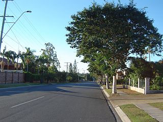
<span class="mw-page-title-main">Tuchekoi, Queensland</span> Suburb of Gympie Region, Queensland, Australia

Tuchekoi is a rural locality in the Gympie Region, Queensland, Australia. In the 2021 census, Tuchekoi had a population of 199 people.

<span class="mw-page-title-main">Ballaroo, Queensland</span> Suburb of Maranoa Region, Queensland, Australia

Ballaroo is a semi-arid rural locality in the Maranoa Region, Queensland, Australia. In the 2021 census, Ballaroo had a population of 51 people.

<span class="mw-page-title-main">Whichello, Queensland</span> Suburb of Toowoomba Region, Queensland, Australia

Whichello is a rural locality in the Toowoomba Region, Queensland, Australia. In the 2021 census, Whichello had a population of 31 people.
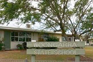
<span class="mw-page-title-main">Ventnor, Queensland</span> Suburb of North Burnett Region, Queensland, Australia

Ventnor is a rural locality in the North Burnett Region, Queensland, Australia. In the 2021 census, Ventnor had a population of 13 people.

<span class="mw-page-title-main">Dunkeld, Queensland</span> Suburb of Maranoa Region, Queensland, Australia

Dunkeld is a rural locality in the Maranoa Region, Queensland, Australia. In the 2021 census, Dunkeld had a population of 49 people.

<span class="mw-page-title-main">Mount Abundance, Queensland</span> Suburb of Maranoa Region, Queensland, Australia

Mount Abundance is a locality in the Maranoa Region, Queensland, Australia. In the 2021 census, Mount Abundance had a population of 178 people.

<span class="mw-page-title-main">Victoria Hill, Queensland</span> Suburb of Southern Downs Region, Queensland, Australia

Victoria Hill is a rural locality spit between the Southern Downs Region and the Toowoomba Region, both in Queensland, Australia. In the 2021 census, Victoria Hill had a population of 48 people.

Redford is a locality split between the Maranoa Region and the Shire of Murweh, both in Queensland, Australia. In the 2016 census, Redford had a population of 7 people.

Tyrconnel is a rural locality split between the Maranoa Region and the Shire of Murweh, both in Queensland, Australia. In the 2021 census, Tyrconnel had a population of 17 people.

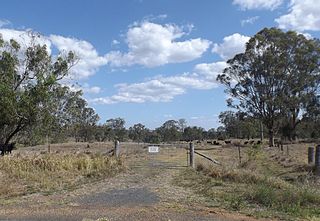
Baffle West is a rural locality in the Maranoa Region, Queensland, Australia. In the 2016 census, Baffle West had a population of 10 people.

<span class="mw-page-title-main">Dalwogon, Queensland</span> Suburb of Western Downs Region, Queensland, Australia

Dalwogon is a rural locality in the Western Downs Region, Queensland, Australia. In the 2021 census, Dalwogon had a population of 53 people.

Mungallala South is a rural locality in the Maranoa Region, Queensland, Australia. In the 2021 census, Mungallala South had a population of 38 people.

Mount Hutton is a rural locality in the Maranoa Region, Queensland, Australia. In the 2021 census, Mount Hutton had a population of 32 people.

Simmie is a rural locality in the Maranoa Region, Queensland, Australia. In the 2021 census, Simmie had a population of 16 people.

<span class="mw-page-title-main">Forestvale, Queensland</span> Suburb of Maranoa Region, Queensland, Australia

Forestvale is a rural locality in the Maranoa Region, Queensland, Australia. In the 2021 census, Forestvale had a population of 47 people.

Mount Moffatt is a rural locality in the Maranoa Region, Queensland, Australia. In the 2021 census, Mount Moffatt had a population of 14 people.

Jackson South is a rural locality in the Maranoa Region, Queensland, Australia. In the 2021 census, Jackson South had a population of 17 people.

Wallumbilla South is a rural locality in the Maranoa Region, Queensland, Australia. In the 2021 census, Wallumbilla South had a population of 80 people.

<span class="mw-page-title-main">Noorindoo, Queensland</span> Suburb of Maranoa Region, Queensland, Australia

Noorindoo is a rural locality in the Maranoa Region, Queensland, Australia. In the 2021 census, Noorindoo had a population of 71 people.

References

  1. Australian Bureau of Statistics (28 June 2022). "Westgrove (suburb and locality)". Australian Census 2021 QuickStats. Retrieved 28 June 2022.  OOjs UI icon edit-ltr-progressive.svg
  2. 1 2 "Westgrove – locality in Maranoa Region (entry 47468)". Queensland Place Names. Queensland Government . Retrieved 2 November 2019.
  3. 1 2 Australian Bureau of Statistics (28 June 2022). "Westgrove (SAL)". 2021 Census QuickStats. Retrieved 28 February 2023. OOjs UI icon edit-ltr-progressive.svg
  4. 1 2 "Layers: Locality; Mountains and ranges; Contours; Watercourses". Queensland Globe. Queensland Government. Archived from the original on 19 December 2017. Retrieved 13 March 2024.
  5. "Layers: Locality; Protected areas and forests; Land use". Queensland Globe. Queensland Government. Archived from the original on 19 December 2017. Retrieved 13 March 2024.
  6. 1 2 "Denison South". Denison Gas. Archived from the original on 5 March 2024. Retrieved 12 March 2024.
  7. "Layers: Locality; Production permits". Queensland Globe. Queensland Government. Archived from the original on 19 December 2017. Retrieved 13 March 2024.
  8. Queensland Family History Society (2010), Queensland schools past and present (Version 1.01 ed.), Queensland Family History Society, ISBN   978-1-921171-26-0
  9. "Queensland state school - centre closures" (PDF). Queensland Government . 20 August 2013. Archived (PDF) from the original on 20 March 2022. Retrieved 7 April 2022.
  10. "Denison Gas". Denison Gas (Map). Archived from the original on 5 March 2024. Retrieved 13 March 2024.
  11. Australian Bureau of Statistics (27 June 2017). "Westgrove (SSC)". 2016 Census QuickStats. Retrieved 20 October 2018. OOjs UI icon edit-ltr-progressive.svg
  12. "Layers: Locality; Schools and school catchments". Queensland Globe. Queensland Government. Archived from the original on 19 December 2017. Retrieved 12 March 2024.