Mount Abundance, Queensland

Last updated

Map all coordinates using: OpenStreetMap
Mount Abundance
Queensland
StateLibQld 1 296143 Mount Abundance, ca. 1896.jpg
Mount Abundance, circa 1896
Australia Queensland location map.svg
Red pog.svg
Mount Abundance
Coordinates 26°46′56″S148°30′33″E / 26.7822°S 148.5091°E / -26.7822; 148.5091 (Mount Abundance (centre of locality))
Population178 (SAL 2021) [1]
Postcode(s) 4455
Area1,656.8 km2 (639.7 sq mi)
Time zone AEST (UTC+10:00)
Location
LGA(s) Maranoa Region
State electorate(s) Warrego
Federal division(s) Maranoa
Suburbs around Mount Abundance:
Muckadilla Mount Bindango
Hodgson
Bungeworgorai
Bungil
Eurella Mount Abundance Tingun
Dunkeld Ballaroo Tingun

Mount Abundance is a locality in the Maranoa Region, Queensland, Australia. [2] In the 2021 census, Mount Abundance had a population of 178 people. [3]

Contents

Geography

The Warrego Highway enters the locality from the north-east (Bungeworgorai), and forms the northern boundary of the locality, exiting to the north-west (Muckadilla). [4] The Western railway line runs immediately parallel and north of the highway, with the locality served by (from west to east):

The locality has the following mountains (from north to south):

The land use is a mixture of crop growing and grazing on native vegetation. [12]

History

The name comes from the name of the mountain, which in turned was named by Surveyor-General Thomas Mitchell on 7 May 1846 because of the "abundance of pasture" in the area. [2]

The Mount Abundance run was taken up in 1847 by Allan MacPherson, a young squatter from New South Wales. MacPherson had come to Queensland seeking new pastures, and had followed the route of Sir Thomas Mitchell into the Mount Abundance area. Mitchell had named Mount Abundance in 1846 during his expedition to find a route from New South Wales to the Gulf of Carpentaria. Following constant conflicts with local Indigenous people, MacPherson decided Mount Abundance was a dangerous place and in late 1849, MacPherson withdrew his sheep from Mount Abundance, leaving it as a cattle station, and returned to England. In 1856 MacPherson briefly visited Australia at which time he disposed of his pastoral interests, including the sale of Mount Abundance to Stephen Spencer. [13]

Prussian explorer, Ludwig Leichhardt was last seen on the 3rd of April, 1848 at Cogoon Run, an outlying part of Mount Abundance on his ill-fated 1848 expedition from the Condamine River to the Swan River before his party disappeared without a trace.

Spencer and his family are considered to have been the first European family to settle in the area. It is recorded that when they arrived at the station, it was found to be run down, and the buildings damaged by fire. Rough huts provided temporary quarters until Spencer built a new homestead, and Mount Abundance station is described as the focal point for the district during this period. Spencer ran a supply store, and the station formed a depot for European explorers heading into the western districts. A post office was opened at the homestead in September 1861. Augustus Charles Gregory arrived at Mount Abundance in 1862, and selected a locality for the township which become known as Roma, proclaimed in September that year. The post office at Mount Abundance homestead closed at the end of 1863 when the Roma post office opened. [13]

On 17 May 1927, 57 allotments of Mount Abundance land, south-west of Roma, were advertised for lease by the Lands Department. Each lease carried a condition that a certain area had to be cultivated with wheat within a specified period. A map advertised the offer which ran from the 17 to 31 May 1927. [14] [15] Mount Abundance Homestead and its remaining farmland still exists and is listed on the Queensland Heritage Register, but what remains in now within the present-day neighbouring locality of Bungil. [12] [13]

Mount Abundance State School opened on 20 August 1951. [16] It closed on 13 December 1985. [17]

Demographics

In the 2016 census, Mount Abundance had a population of 194 people. [18]

In the 2021 census, Mount Abundance had a population of 178 people. [3]

Education

There are no schools in Mount Abundance. The nearest government primary schools are Roma State College in Roma to the north-east and Dunkeld State School in neighbouring Dunkeld to the south-west. The nearest government secondary school is Roma State College in Roma, but it might be too distant for a daily commute from the some parts of Mount Abundance, so distance education and boarding school are other options. [19]

Related Research Articles

<span class="mw-page-title-main">Roma, Queensland</span> Town in Queensland, Australia

Roma is a rural town and locality in the Maranoa Region, Queensland, Australia. It is the administrative centre of the Maranoa Region. The town was incorporated in 1867 and is named after Lady Diamantina Bowen, the wife of Sir George Bowen, the Governor of Queensland at the time. In the 2016 census, the locality of Roma had a population of 6,848 people.

<span class="mw-page-title-main">Injune</span> Town in Queensland, Australia

Injune is a rural town and locality in the Maranoa Region, Queensland, Australia. In the 2016 census, the locality of Injune had a population of 461 people.

<span class="mw-page-title-main">Wallumbilla, Queensland</span> Town in Queensland, Australia

Wallumbilla is a rural town and locality in the Maranoa Region, Queensland, Australia. In the 2016 census, the locality of Wallumbilla had a population of 388 people, with 191 people living in the town itself.

<span class="mw-page-title-main">Mitchell, Queensland</span> Town in Queensland, Australia

Mitchell is a rural town and locality in the Maranoa Region, Queensland, Australia. The town services the local area, a cattle and sheep farming district. In the 2016 census, the locality of Mitchell had a population of 1,031 people.

<span class="mw-page-title-main">Shire of Bungil</span> Local government area in Queensland, Australia

The Shire of Bungil was a local government area in the Maranoa region of Queensland, Australia. It existed from 1880 to 2008.

<span class="mw-page-title-main">Maranoa Region</span> Local government area in Queensland, Australia

Maranoa Region is a local government area in South West Queensland, Australia. The town of Roma is the administrative headquarters of the region.

<span class="mw-page-title-main">Ballaroo, Queensland</span> Suburb of Maranoa Region, Queensland, Australia

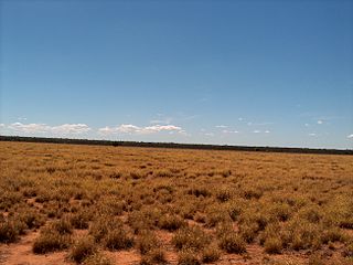
Ballaroo is a semi-arid rural locality in the Maranoa Region, Queensland, Australia. In the 2021 census, Ballaroo had a population of 51 people.

<span class="mw-page-title-main">Mount Abundance Homestead</span> Historic site in Queensland, Australia

Mount Abundance Homestead is a heritage-listed homestead on the Warrego Highway, Bungil near Roma, Maranoa Region, Queensland, Australia. It was built from c. 1860 to 1923. It was added to the Queensland Heritage Register on 21 October 1992.

Bungeworgorai is a rural locality in the Maranoa Region, Queensland, Australia. In the 2016 census, Bungeworgorai had a population of 78 people.

<span class="mw-page-title-main">Amby, Queensland</span> Town in Queensland, Australia

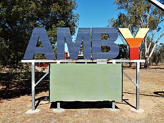
Amby is a rural town and locality in the Maranoa Region, Queensland, Australia. In the 2016 census, the locality of Amby had a population of 86 people.

<span class="mw-page-title-main">Muckadilla, Queensland</span> Suburb of Maranoa Region, Queensland, Australia

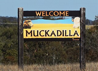
Muckadilla is a rural town and locality in the Maranoa Region, Queensland, Australia. In the 2016 census, the locality of Muckadilla had a population of 58 people.

Euthulla is a rural locality in the Maranoa Region, Queensland, Australia. In the 2016 census, Euthulla had a population of 370 people.

<span class="mw-page-title-main">Hodgson, Queensland</span> Town in Queensland, Australia

Hodgson is a rural town and locality in the Maranoa Region, Queensland, Australia. In the 2016 census, the locality of Hodgson had a population of 61 people.

Orange Hill is a rural locality in the Maranoa Region, Queensland, Australia. In the 2021 census, Orange Hill had a population of 179 people.

Bungil is a locality in the Maranoa Region, Queensland, Australia. In the 2021 census, Bungil had a population of 69 people.

Eurella is a rural locality in the Maranoa Region, Queensland, Australia. In the 2016 census, Eurella had a population of 11 people.

<span class="mw-page-title-main">Blythdale, Queensland</span> Town in Queensland, Australia

Blythdale is a rural town and locality in the Maranoa Region, Queensland, Australia. In the 2016 census, Blythdale had a population of 39 people.

Mount Howe is a rural locality in the Maranoa Region, Queensland, Australia. In the 2016 census Mount Howe had a population of 3 people.

Kilmorey Falls is a rural locality in the Maranoa Region, Queensland, Australia. In the 2016 census Kilmorey Falls had a population of 0 people.

Mount Bindango is a rural locality in the Maranoa Region, Queensland, Australia. In the 2016 census Mount Bindango had a population of 33 people.

References

  1. Australian Bureau of Statistics (28 June 2022). "Mount Abundance (suburb and locality)". Australian Census 2021 QuickStats. Retrieved 28 June 2022.  OOjs UI icon edit-ltr-progressive.svg
  2. 1 2 "Mount Abundance – locality in Maranoa Region (entry 47437)". Queensland Place Names. Queensland Government . Retrieved 30 December 2017.
  3. 1 2 Australian Bureau of Statistics (28 June 2022). "Mount Abundance (SAL)". 2021 Census QuickStats. Retrieved 28 February 2023. OOjs UI icon edit-ltr-progressive.svg
  4. Google (1 October 2021). "Mount Abundance, Queensland" (Map). Google Maps . Google. Retrieved 1 October 2021.
  5. 1 2 3 "Railway stations and sidings - Queensland". Queensland Open Data. Queensland Government. 2 October 2020. Archived from the original on 5 October 2020. Retrieved 5 October 2020.
  6. "Brinsop – rail station - feature no longer exists in Maranoa Regional (entry 4553)". Queensland Place Names. Queensland Government . Retrieved 1 October 2023.
  7. 1 2 3 4 "Mountain peaks and capes - Queensland". Queensland Open Data. Queensland Government. 12 November 2020. Archived from the original on 25 November 2020. Retrieved 25 November 2020.
  8. "Mount Abundance – mountain in Maranoa Region (entry 54)". Queensland Place Names. Queensland Government . Retrieved 25 November 2020.
  9. "One Tree Hill – mountain in Maranoa Region (entry 25432)". Queensland Place Names. Queensland Government . Retrieved 25 November 2020.
  10. "Mount Redcap – mountain in Maranoa Region (entry 28253)". Queensland Place Names. Queensland Government . Retrieved 25 November 2020.
  11. "Mount Inviting – mountain in Maranoa Region (entry 16763)". Queensland Place Names. Queensland Government . Retrieved 25 November 2020.
  12. 1 2 "Queensland Globe". State of Queensland . Retrieved 7 December 2023.
  13. 1 2 3 "Mount Abundance Homestead (entry 600371)". Queensland Heritage Register . Queensland Heritage Council. Retrieved 1 August 2014.
  14. "Sketch map of portions 27 to 38 parish of Norman, portions 1 to 38 parish of Spowers, portions 13 to 22 parish of Stirling, and portions 5, 6, 7, 9 to 19 and 21 parish of Waldegrave, county of Waldegrave Roma land agents district, shire of Bungil" (1927) [Map]. Collections. State Library of Queensland.
  15. "MOUNT ABUNDANCE". Cairns Post . Vol. 69, no. 7904. Queensland, Australia. 21 May 1927. p. 5. Archived from the original on 7 December 2023. Retrieved 21 May 2019 via National Library of Australia.
  16. "MOUNT ABUNDANCE SCHOOL OPENED". Western Star . No. 6419. Queensland, Australia. 24 August 1951. p. 1. Archived from the original on 7 December 2023. Retrieved 7 December 2023 via National Library of Australia.
  17. Queensland Family History Society (2010), Queensland schools past and present (Version 1.01 ed.), Queensland Family History Society, ISBN   978-1-921171-26-0
  18. Australian Bureau of Statistics (27 June 2017). "Mount Abundance (SSC)". 2016 Census QuickStats. Retrieved 20 October 2018. OOjs UI icon edit-ltr-progressive.svg
  19. "Layers: Locality; Schools and school catchments". Queensland Globe. Queensland Government. Archived from the original on 19 December 2017. Retrieved 7 December 2023.