Simmie, Queensland

Last updated

Simmie
Queensland
Australia Queensland location map.svg
Red pog.svg
Simmie
Coordinates 25°43′49″S148°36′22″E / 25.7302°S 148.6061°E / -25.7302; 148.6061 (Simmie (centre of locality))
Population16 (2021 census) [1]
 • Density0.0915/km2 (0.237/sq mi)
Postcode(s) 4454
Area174.8 km2 (67.5 sq mi)
Time zone AEST (UTC+10:00)
Location
LGA(s) Maranoa Region
State electorate(s) Warrego
Federal division(s) Maranoa
Suburbs around Simmie:
Hutton Creek Baffle West Baffle West
Hutton Creek Simmie Beilba
Injune Injune Highland Plains

Simmie is a rural locality in the Maranoa Region, Queensland, Australia. [2] In the 2021 census, Simmie had a population of 16 people. [1]

Contents

Geography

The Carnarvon Highway runs through the locality from north (Baffle West) to south (Injune). [3] [4]

Hutton Creek (the watercourse) enters the locality from the west (Hutton Creek, the locality) and flows south-east through the locality, forming part of the south-eastern boundary of the locality, before becoming a tributary of Injune Creek. [4]

The land use is grazing on native vegetation. [4]

History

The locality takes its name from the parish, which in turn was likely named after pastoralist George Simmie, one of the lessees of Injune pastoral run in 1866. [2]

Demographics

In the 2016 census, Simmie had a population of 8 people. [5]

In the 2021 census, Simmie had a population of 16 people. [1]

Economy

There are a number of homesteads in the locality: [6]

Education

There are no schools in Simmie. The nearest government primary and secondary school (to Year 10) is Injune State School in neighbouring Injune to the south. There are no nearby schools providing secondary education to Year 12; the options are distance education and boarding school. [7]

Related Research Articles

<span class="mw-page-title-main">Injune</span> Town in Queensland, Australia

Injune is a rural town and locality in the Maranoa Region, Queensland, Australia. In the 2016 census, the locality of Injune had a population of 461 people.

<span class="mw-page-title-main">Mitchell, Queensland</span> Town in Queensland, Australia

Mitchell is a rural town and locality in the Maranoa Region, Queensland, Australia. The town services the local area, a cattle and sheep farming district. In the 2021 census, the locality of Mitchell had a population of 995 people.
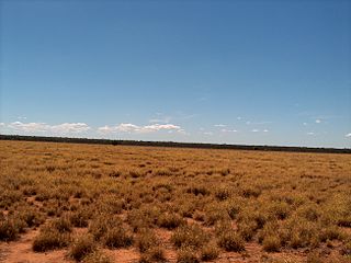
<span class="mw-page-title-main">Glenmorgan, Queensland</span> Town in Queensland, Australia

Glenmorgan is a rural town in the Western Downs Region and a locality split between the Western Downs Region and the Maranoa Region, Queensland, Australia. In the 2016 census the locality of Glenmorgan had a population of 148 people.

<span class="mw-page-title-main">Amby, Queensland</span> Town in Queensland, Australia

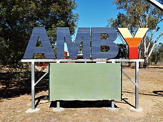
Amby is a rural town and locality in the Maranoa Region, Queensland, Australia. In the 2016 census, the locality of Amby had a population of 86 people.

Euthulla is a rural locality in the Maranoa Region, Queensland, Australia. In the 2021 census, Euthulla had a population of 364 people.

Gunnewin is a rural locality in the Maranoa Region, Queensland, Australia. In the 2021 census, Gunnewin had a population of 55 people.

<span class="mw-page-title-main">Mount Abundance, Queensland</span> Suburb of Maranoa Region, Queensland, Australia

Mount Abundance is a locality in the Maranoa Region, Queensland, Australia. In the 2021 census, Mount Abundance had a population of 178 people.

Womalilla is a rural town and locality in the Maranoa Region, Queensland, Australia. In the 2016 census, the locality of Womalilla had a population of 39 people.

{Use DMY dates|date=January 2018}}

Redford is a locality split between the Maranoa Region and the Shire of Murweh, both in Queensland, Australia. In the 2021 census, Redford had a population of 18 people.

Baffle West is a rural locality in the Maranoa Region, Queensland, Australia. In the 2021 census, Baffle West had "no people or a very low population".

Bungil is a locality in the Maranoa Region, Queensland, Australia. In the 2021 census, Bungil had a population of 69 people.

Eurella is a rural locality in the Maranoa Region, Queensland, Australia. In the 2021 census, Eurella had a population of 45 people.

<span class="mw-page-title-main">Blythdale, Queensland</span> Town in Queensland, Australia

Blythdale is a rural town and locality in the Maranoa Region, Queensland, Australia. In the 2016 census, Blythdale had a population of 39 people.

Mount Hutton is a rural locality in the Maranoa Region, Queensland, Australia. In the 2021 census, Mount Hutton had a population of 32 people.

<span class="mw-page-title-main">Forestvale, Queensland</span> Suburb of Maranoa Region, Queensland, Australia

Forestvale is a rural locality in the Maranoa Region, Queensland, Australia. In the 2021 census, Forestvale had a population of 47 people.

Mount Howe is a rural locality in the Maranoa Region, Queensland, Australia. In the 2021 census, Mount Howe had a population of 20 people.

Yuleba North is a rural locality in the Maranoa Region, Queensland, Australia. In the 2021 census, Yuleba North had a population of 26 people.

Kilmorey Falls is a rural locality in the Maranoa Region, Queensland, Australia. In the 2021 census, Kilmorey Falls had a population of 23 people.

Mount Bindango is a rural locality in the Maranoa Region, Queensland, Australia. In the 2021 census, Mount Bindango had a population of 26 people.

References

  1. 1 2 3 Australian Bureau of Statistics (28 June 2022). "Simmie (SAL)". 2021 Census QuickStats. Retrieved 28 February 2023. OOjs UI icon edit-ltr-progressive.svg
  2. 1 2 "Simmie – locality in Maranoa Region (entry 47454)". Queensland Place Names. Queensland Government . Retrieved 2 November 2019.
  3. Google (1 October 2021). "Simmie, Queensland" (Map). Google Maps . Google. Retrieved 1 October 2021.
  4. 1 2 3 "Queensland Globe". State of Queensland . Retrieved 5 January 2024.
  5. Australian Bureau of Statistics (27 June 2017). "Simmie (SSC)". 2016 Census QuickStats. Retrieved 20 October 2018. OOjs UI icon edit-ltr-progressive.svg
  6. "Homesteads - Queensland". Queensland Open Data. Queensland Government. 18 November 2020. Archived from the original on 24 November 2020. Retrieved 24 November 2020.
  7. "Layers: Locality; Schools and school catchments". Queensland Globe. Queensland Government. Archived from the original on 19 December 2017. Retrieved 5 January 2024.