Mount Bindango, Queensland

Last updated

Map all coordinates using: OpenStreetMap  
Download coordinates as: KML
Mount Bindango
Queensland
Australia Queensland location map.svg
Red pog.svg
Mount Bindango
Coordinates 26°30′18″S148°28′49″E / 26.505°S 148.4802°E / -26.505; 148.4802 (Mount Bindango (centre of locality)) Coordinates: 26°30′18″S148°28′49″E / 26.505°S 148.4802°E / -26.505; 148.4802 (Mount Bindango (centre of locality))
Population33 (2016 census) [1]
 • Density0.1027/km2 (0.266/sq mi)
Postcode(s) 4455
Elevation340–570 m (1,115–1,870 ft)
Area321.2 km2 (124.0 sq mi)
Time zone AEST (UTC+10:00)
Location
LGA(s) Maranoa Region
State electorate(s) Warrego
Federal division(s) Maranoa
Suburbs around Mount Bindango:
Walhallow Orallo Bungeworgorai
Eurella Mount Bindango Bungeworgorai
Muckadilla Mount Abundance Hodgson

Mount Bindango is a rural locality in the Maranoa Region, Queensland, Australia. [2] In the 2016 census Mount Bindango had a population of 33 people. [1]

Contents

Geography

The Warrego Highway forms the southern boundary of the locality, entering the locality from Hodgson/Mount Abundance to the east and exiting to Muckadilla in the south-west. The Western railway line runs parallel and immediately north of the highway. [3]

Brinsop was a neighbourhood ( 26°35′00″S148°28′00″E / 26.5833°S 148.4666°E / -26.5833; 148.4666 (Brinsop) ) that developed around the now-abandoned Brinsop railway station ( 26°35′20″S148°28′21″E / 26.5889°S 148.4724°E / -26.5889; 148.4724 (Brinsop railway station (former)) ) on the Western railway line in the south-west of the locality. [4] [3] [5] The abandoned Bindango railway station was also on the Western railway line ( 26°34′57″S148°32′41″E / 26.5825°S 148.5447°E / -26.5825; 148.5447 (Bindango railway station (former)) ) on the southern boundary of the locality. [6] [5] [7]

Ona Ona was a neighbourhood ( 26°32′00″S148°35′00″E / 26.5333°S 148.5833°E / -26.5333; 148.5833 (Ona Ona) ). that developed around the Ona Ona railway station on the now-closed Injune railway line. [8]

There are two named peaks, close together in the north-west of the locality:

The land use is agricultural, mostly grazing on native vegetation, and there are a number of homesteads in the locality:

History

The locality takes its name from the mountain, which was named on 11 May 1846 by the Surveyor-General of New South Wales, Thomas Mitchell, based on the name given to him by Aboriginal informants. [2] [9] Mount Bindyego was also named by Mitchell on the same day based on the name provided by Aboriginal informants. [10]

The name Brinsop comes from the village of Brinsop in Herefordshire, England, [13] which possibly means brown valley (brun/hop). [4]

The name Ona Ona was assigned on 29 April 1915 by the Queensland Railways Department, an Aboriginal phrase, meaning boxtree flat. [8]

At about 5.30 a.m. on Friday 6 November 1987, Cunnamulla-bound Westlander train 3V02 was derailed at the nearby Bindango railway siding between Hodgson and Muckadilla, approximately 25 kilometres (16 mi) west of Roma. An infant was burnt to death in the resulting fire. Investigations revealed that the points had been deliberately changed from the main railway line to divert the train into the siding. The police offered a reward of $50,000 for information leading to the person responsible. [14]

In the 2016 census Mount Bindango had a population of 33 people. [1]

Education

There are no schools in Mount Bindango. Roma State College in Roma to the east is the nearest primary and secondary school. [3]

Related Research Articles

<span class="mw-page-title-main">Roma, Queensland</span> Town in Queensland, Australia

Roma is a rural town and locality in the Maranoa Region, Queensland, Australia. It is the administrative centre of the Maranoa Region. The town was incorporated in 1867 and is named after Lady Diamantina Bowen, the wife of Sir George Bowen, the Governor of Queensland at the time. In the 2016 census, the locality of Roma had a population of 6,848 people.

<span class="mw-page-title-main">Wallumbilla, Queensland</span> Town in Queensland, Australia

Wallumbilla is a rural town and locality in the Maranoa Region, Queensland, Australia. In the 2016 census, the locality of Wallumbilla had a population of 388 people, with 191 people living in the town itself.

<span class="mw-page-title-main">Mitchell, Queensland</span> Town in Queensland, Australia

Mitchell is a rural town and locality in the Maranoa Region, Queensland, Australia. The town services the local area, a cattle and sheep farming district. In the 2016 census, the locality of Mitchell had a population of 1,031 people.

<span class="mw-page-title-main">Ninderry, Queensland</span> Town in Queensland, Australia

Ninderry is a rural town and locality in the Sunshine Coast Region, Queensland, Australia. In the 2016 census, the locality of Ninderry had a population of 1,087 people.

<span class="mw-page-title-main">Yuleba</span> Town in Queensland, Australia

Yuleba is a rural town and locality in the Maranoa Region, in the south-west of Queensland, Australia. In the 2016 census, Yuleba had a population of 207 people.

<span class="mw-page-title-main">Comet, Queensland</span> Town in Queensland, Australia

Comet is a historical rich rural town and locality in the Central Highlands Region, Queensland, Australia. In the 2016 census, the locality of Comet had a population of 498 people.

<span class="mw-page-title-main">Mungallala</span> Town in Queensland, Australia

Mungallala is a rural town and locality in the Maranoa Region, Queensland, Australia. In the 2016 census, the locality of Mungallala had a population of 136 people.

Ballaroo is a semi-arid rural locality in the Maranoa Region, Queensland, Australia. In the 2016 census, Ballaroo had a population of 41 people.

Bungeworgorai is a rural locality in the Maranoa Region, Queensland, Australia. In the 2016 census, Bungeworgorai had a population of 78 people.

<span class="mw-page-title-main">Amby, Queensland</span> Town in Queensland, Australia

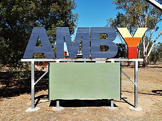
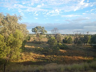
Amby is a rural town and locality in the Maranoa Region, Queensland, Australia. In the 2016 census, the locality of Amby had a population of 86 people.

<span class="mw-page-title-main">Muckadilla, Queensland</span> Suburb of Maranoa Region, Queensland, Australia

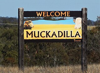
Muckadilla is a rural town and locality in the Maranoa Region, Queensland, Australia. In the 2016 census, the locality of Muckadilla had a population of 58 people.

Euthulla is a rural locality in the Maranoa Region, Queensland, Australia. In the 2016 census, Euthulla had a population of 370 people.

Gunnewin is a rural locality in the Maranoa Region, Queensland, Australia. In the 2016 census Gunnewin had a population of 59 people.

<span class="mw-page-title-main">Hodgson, Queensland</span> Town in Queensland, Australia

Hodgson is a rural town and locality in the Maranoa Region, Queensland, Australia. In the 2016 census, the locality of Hodgson had a population of 61 people.

Womalilla is a rural town and locality in the Maranoa Region, Queensland, Australia. In the 2016 census, the locality of Womalilla had a population of 39 people.

<span class="mw-page-title-main">Peeramon</span> Town in Queensland, Australia

Peeramon is a rural town and locality in the Tablelands Region, Queensland, Australia. In the 2016 census, the locality of Peeramon had a population of 628 people.

Eurella is a rural locality in the Maranoa Region, Queensland, Australia. In the 2016 census, Eurella had a population of 11 people.

Blythdale is a rural town and locality in the Maranoa Region, Queensland, Australia. In the 2016 census, Blythdale had a population of 39 people.

Mount Moffatt is a rural locality in the Maranoa Region, Queensland, Australia. In the 2016 census, Mount Moffatt had a population of 0 people.

Mount Howe is a rural locality in the Maranoa Region, Queensland, Australia. In the 2016 census Mount Howe had a population of 3 people.

References

  1. 1 2 3 Australian Bureau of Statistics (27 June 2017). "Mount Bindango (SSC)". 2016 Census QuickStats. Retrieved 20 October 2018. OOjs UI icon edit-ltr-progressive.svg
  2. 1 2 "Mount Bindango – locality in Maranoa Region (entry 47438)". Queensland Place Names. Queensland Government . Retrieved 2 December 2020.
  3. 1 2 3 "Queensland Globe". State of Queensland . Retrieved 2 December 2020.
  4. 1 2 "Brinsop – locality unbounded in Maranoa Regional (entry 4553)". Queensland Place Names. Queensland Government . Retrieved 2 December 2020.
  5. 1 2 "Mount Abundance Wheat and Sheep Lands" (Map). Queensland Government. 1927. Archived from the original on 2 December 2020. Retrieved 2 December 2020.
  6. "Bindango – railway station in the Maranoa Region (entry 2658)". Queensland Place Names. Queensland Government . Retrieved 2 December 2020.
  7. "Railway stations and sidings - Queensland". Queensland Open Data. Queensland Government. 2 October 2020. Archived from the original on 5 October 2020. Retrieved 5 October 2020.
  8. 1 2 "Ona Ona – locality unbounded in Maranoa Regional (entry 39303)". Queensland Place Names. Queensland Government . Retrieved 2 December 2020.
  9. 1 2 "Mount Bindango – mountain in Maranoa Regional (entry 2660)". Queensland Place Names. Queensland Government . Retrieved 2 December 2020.
  10. 1 2 "Mount Bindyego – mountain in Maranoa Regional (entry 2671)". Queensland Place Names. Queensland Government . Retrieved 2 December 2020.
  11. 1 2 3 4 5 6 7 "Homesteads - Queensland". Queensland Open Data. Queensland Government. 18 November 2020. Archived from the original on 24 November 2020. Retrieved 24 November 2020.
  12. "Building areas - Queensland". Queensland Open Data. Queensland Government. 17 November 2020. Archived from the original on 17 November 2020. Retrieved 17 November 2020.
  13. "SKETCHER". The Queenslander . No. 2454. Queensland, Australia. 28 March 1914. p. 8. Archived from the original on 2 December 2020. Retrieved 2 December 2020 via National Library of Australia.
  14. "Derailment of the Westlander train: $50,000 Reward" (PDF). Queensland Police . September 2018. Archived (PDF) from the original on 2 December 2020. Retrieved 2 December 2020.