Teelba, Queensland

Last updated

Teelba
Queensland
Australia Queensland location map.svg
Red pog.svg
Teelba
Coordinates 27°30′12″S149°22′09″E / 27.5033°S 149.3691°E / -27.5033; 149.3691 (Teelba (centre of locality))
Population82 (2021 census) [1]
 • Density0.0798/km2 (0.2066/sq mi)
Postcode(s) 4423
Area1,027.9 km2 (396.9 sq mi)
Time zone AEST (UTC+10:00)
LGA(s) Maranoa Region
State electorate(s) Warrego
Federal division(s) Maranoa
Suburbs around Teelba:
Parknook Glenmorgan Glenmorgan
Parknook Teelba Coomrith
St George Flinton Flinton

Teelba is a rural locality in the Maranoa Region, Queensland, Australia. [2] In the 2021 census, Teelba had a population of 82 people. [1]

Contents

Geography

Teelba is a watershed. In the north of the locality, Murilla Creek flows north into the Condamine River drainage basin, while in the south the Teelba Creek flows south into the Moonie River drainage basin. [3]

History

Teelba Creek State School opened on 5 July 1965, but was renamed Teelba State School on 24 September 1965. [4]

Demographics

In the 2016 census, Teelba had a population of 44 people. [5]

In the 2021 census, Teelba had a population of 82 people. [1]

Education

Teelba State School is a government primary (Prep-6) school for boys and girls at Teelba Road just north of the crossing of Teelba Creek. ( 27°32′04″S149°23′38″E / 27.5345°S 149.3939°E / -27.5345; 149.3939 (Teelba State School) ). [6] [7] In 2016, the school had an enrolment of 23 students with 3 teachers (2 full-time equivalent) and 5 non-teaching staff (2 full-time equivalent). [8] In 2018, the school had an enrolment of 25 students with 3 teachers (2 full-time equivalent) and 5 non-teaching staff (2 full-time equivalent). [9]

Related Research Articles

<span class="mw-page-title-main">Sarina, Queensland</span> Town in Queensland, Australia

Sarina is a rural town and coastal locality in the Mackay Region, Queensland, Australia. In the 2021 census, the locality of Sarina had a population of 5,619 people.

<span class="mw-page-title-main">Surat, Queensland</span> Town in Queensland, Australia

Surat is a rural town and locality in the Maranoa Region, Queensland, Australia. In the 2021 census, the locality of Surat had a population of 402 people.

<span class="mw-page-title-main">Wallumbilla, Queensland</span> Town in Queensland, Australia

Wallumbilla is a rural town and locality in the Maranoa Region, Queensland, Australia. In the 2016 census, the locality of Wallumbilla had a population of 388 people, with 191 people living in the town itself.

Clarke Creek is a locality in the Isaac Region, Queensland, Australia. It is situated between Mackay and Rockhampton on the Old Bruce Highway. In the 2021 census, Clarke Creek had a population of 32 people.

<span class="mw-page-title-main">Yuleba</span> Town in Queensland, Australia

Yuleba is a rural town and locality in the Maranoa Region, in the south-west of Queensland, Australia. In the 2021 census, the locality of Yuleba had a population of 271 people.

<span class="mw-page-title-main">Pilton, Queensland</span> Town in Queensland, Australia

Pilton is a rural town and locality in the Toowoomba Region, Queensland, Australia. It is south of the city of Toowoomba. In the 2021 census, the locality of Pilton had a population of 71 people.

Bakers Creek is a rural town and coastal locality in the Mackay Region, Queensland, Australia. In the 2021 census, the locality of Bakers Creek had a population of 1,590 people.

<span class="mw-page-title-main">Karara, Queensland</span> Town in Queensland, Australia

Karara is a rural town and locality in the Southern Downs Region, Queensland, Australia. In the 2016 census, the locality of Karara had a population of 123 people.

<span class="mw-page-title-main">Meandarra</span> Town in Queensland, Australia

Meandarra is a rural town and locality in the Western Downs Region, Queensland, Australia. In the 2016 census the locality of Meandarra had a population of 262 people.

<span class="mw-page-title-main">Glenmorgan, Queensland</span> Town in Queensland, Australia

Glenmorgan is a rural town in the Western Downs Region and a locality split between the Western Downs Region and the Maranoa Region, Queensland, Australia. In the 2016 census the locality of Glenmorgan had a population of 148 people.

Alligator Creek is a coastal rural locality in the Mackay Region, Queensland, Australia. In the 2021 census, Alligator Creek had a population of 897 people.

<span class="mw-page-title-main">Lower Tenthill, Queensland</span> Suburb of Lockyer Valley Region, Queensland, Australia

Lower Tenthill is a rural locality in the Lockyer Valley Region, Queensland, Australia. In the 2021 census, Lower Tenthill had a population of 236 people.

<span class="mw-page-title-main">Gogango</span> Town in Queensland, Australia

Gogango is a rural town and locality in the Rockhampton Region, Queensland, Australia. In the 2016 census the locality of Gogango had a population of 111 people.

<span class="mw-page-title-main">North Eton, Queensland</span> Suburb of Mackay Region, Queensland, Australia

North Eton is a rural locality in the Mackay Region, Queensland, Australia. In the 2021 census, North Eton had a population of 189 people.

<span class="mw-page-title-main">Bungunya, Queensland</span> Suburb of Goondiwindi Region, Queensland, Australia

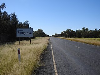
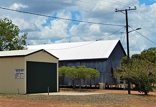
Bungunya is a rural town and locality in the Goondiwindi Region, Queensland, Australia. The locality is on the border of Queensland and New South Wales. In the 2016 census, Bungunya had a population of 75 people.

Lundavra is a rural locality in the Goondiwindi Region, Queensland, Australia. In the 2021 census, Lundavra had a population of 56 people.

<span class="mw-page-title-main">Begonia, Queensland</span> Suburb of Maranoa Region, Queensland, Australia

Begonia is a rural locality in the Maranoa Region, Queensland, Australia. In the 2021 census, Begonia had a population of 48 people.

Bymount is a rural locality in the Maranoa Region, Queensland, Australia. In the 2021 census, Bymount had a population of 47 people.

<span class="mw-page-title-main">Dunkeld, Queensland</span> Suburb of Maranoa Region, Queensland, Australia

Dunkeld is a rural locality in the Maranoa Region, Queensland, Australia. In the 2021 census, Dunkeld had a population of 49 people.

Piturie is an outback locality in the Shire of Boulia, Queensland, Australia. It is on the Queensland border with the Northern Territory. In the 2021 census, Piturie had a population of 57 people.

References

  1. 1 2 3 Australian Bureau of Statistics (28 June 2022). "Teelba (SAL)". 2021 Census QuickStats. Retrieved 28 February 2023. OOjs UI icon edit-ltr-progressive.svg
  2. "Teelba – locality in Maranoa Region (entry 50011)". Queensland Place Names. Queensland Government . Retrieved 28 December 2020.
  3. "Queensland Globe". State of Queensland . Retrieved 14 September 2017.
  4. Queensland Family History Society (2010), Queensland schools past and present (Version 1.01 ed.), Queensland Family History Society, ISBN   978-1-921171-26-0
  5. Australian Bureau of Statistics (27 June 2017). "Teelba (SSC)". 2016 Census QuickStats. Retrieved 20 October 2018. OOjs UI icon edit-ltr-progressive.svg
  6. "State and non-state school details". Queensland Government. 9 July 2018. Archived from the original on 21 November 2018. Retrieved 21 November 2018.
  7. "Teelba State School" . Retrieved 21 November 2018.
  8. "Annual Report 2016" (PDF). Teelba State School. Archived (PDF) from the original on 14 September 2017. Retrieved 14 September 2017.
  9. "ACARA School Profile 2018". Australian Curriculum, Assessment and Reporting Authority . Retrieved 28 January 2020.