Mount Hutton, Queensland

Last updated

Mount Hutton
Queensland
Australia Queensland location map.svg
Red pog.svg
Mount Hutton
Coordinates 25°54′32″S148°20′48″E / 25.9088°S 148.3466°E / -25.9088; 148.3466 (Mount Hutton (centre of locality))
Population32 (2021 census) [1]
 • Density0.0819/km2 (0.212/sq mi)
Postcode(s) 4454
Area390.9 km2 (150.9 sq mi)
Time zone AEST (UTC+10:00)
Location
LGA(s) Maranoa Region
State electorate(s) Warrego
Federal division(s) Maranoa
Suburbs around Mount Hutton:
Womblebank Hutton Creek Hutton Creek
Kilmorey Falls Mount Hutton Injune
Kilmorey Falls Cornwall Gunnewin

Mount Hutton is a rural locality in the Maranoa Region, Queensland, Australia. [2] In the 2021 census, Mount Hutton had a population of 32 people. [1]

Contents

Geography

The locality lies east of the Great Dividing Range with the eponymous mountain, Mount Hutton, in the north-east of the locality ( 25°51′06″S148°20′23″E / 25.8517°S 148.3398°E / -25.8517; 148.3398 (Mount Hutton) ) rising to 940 metres (3,080 ft) above sea level. [3] [4] [5]

The land use is grazing on native vegetation. [5]

History

In May 1916, the Queensland Government purchased the leasehold of the Mount Hutton pastoral property for £73,500, which included 10,243 cattle and 260 horses. The government's intention was to subdivide the property for closer settlement. [6] [7]

Following World War I in 1919, the subdivision of blocks occurred with about half being available to soldier settlers and others being open to any purchasers. [8] The open blocks attracted little interest but returned soldiers took up the soldier settlement blocks. Like many other soldier settlements in Queensland, the scheme was mostly a failure. The land was not suitable for the government's proposed use for dairying and crop growing due to receiving lower levels of rainfall than claimed, the soldiers had insufficient capital to develop their land, the blocks of land were too small to provide the income needed by a family, there was insufficient timber available for building houses, and so on. [9] [10]

Mount Hutton East Provisional School opened on 13 February 1922 and closed on circa 1924. [11]

Demographics

In the 2016 census, Mount Hutton had a population of 34 people. [12]

In the 2021 census, Mount Hutton had a population of 32 people. [1]

Education

There are no schools in Mount Hutton. The nearest government school is Injune State School in neighbouring Injune to the east which provides primary and secondary schooling to Year 10. There are no schools providing schooling to Year 12 nearby; the options are distance education and boarding school. [13]

Related Research Articles

<span class="mw-page-title-main">Injune</span> Town in Queensland, Australia

Injune is a rural town and locality in the Maranoa Region, Queensland, Australia. In the 2021 census, the locality of Injune had a population of 429 people.

<span class="mw-page-title-main">Maranoa Region</span> Local government area in Queensland, Australia

Maranoa Region is a local government area in South West Queensland, Australia. The town of Roma is the administrative headquarters of the region.

<span class="mw-page-title-main">Ballaroo, Queensland</span> Suburb of Maranoa Region, Queensland, Australia

Ballaroo is a semi-arid rural locality in the Maranoa Region, Queensland, Australia. In the 2021 census, Ballaroo had a population of 51 people.

<span class="mw-page-title-main">Muckadilla, Queensland</span> Town in Queensland, Australia

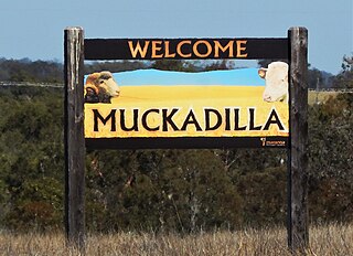
Muckadilla is a rural town and locality in the Maranoa Region, Queensland, Australia. In the 2021 census, the locality of Muckadilla had a population of 38 people.

Euthulla is a rural locality in the Maranoa Region, Queensland, Australia. In the 2021 census, Euthulla had a population of 364 people.

<span class="mw-page-title-main">Hodgson, Queensland</span> Town in Queensland, Australia

Hodgson is a rural town and locality in the Maranoa Region, Queensland, Australia. In the 2021 census, the locality of Hodgson had a population of 95 people.

<span class="mw-page-title-main">Mount Abundance, Queensland</span> Suburb of Maranoa Region, Queensland, Australia

Mount Abundance is a locality in the Maranoa Region, Queensland, Australia. In the 2021 census, Mount Abundance had a population of 178 people.

Westgrove is a rural locality in the Maranoa Region, Queensland, Australia. In the 2021 census, Westgrove had a population of 4 people.

Tyrconnel is a rural locality split between the Maranoa Region and the Shire of Murweh, both in Queensland, Australia. In the 2021 census, Tyrconnel had a population of 17 people.

Baffle West is a rural locality in the Maranoa Region, Queensland, Australia. In the 2021 census, Baffle West had "no people or a very low population".

Bungil is a locality in the Maranoa Region, Queensland, Australia. In the 2021 census, Bungil had a population of 69 people.

Dargal Road is a rural locality in the Maranoa Region, Queensland, Australia. In the 2021 census, Dargal Road had a population of 198 people.

Simmie is a rural locality in the Maranoa Region, Queensland, Australia. In the 2021 census, Simmie had a population of 16 people.

<span class="mw-page-title-main">Forestvale, Queensland</span> Suburb of Maranoa Region, Queensland, Australia

Forestvale is a rural locality in the Maranoa Region, Queensland, Australia. In the 2021 census, Forestvale had a population of 47 people.

Mount Moffatt is a rural locality in the Maranoa Region, Queensland, Australia. In the 2021 census, Mount Moffatt had a population of 14 people.

Mount Howe is a rural locality in the Maranoa Region, Queensland, Australia. In the 2021 census, Mount Howe had a population of 20 people.

Yuleba North is a rural locality in the Maranoa Region, Queensland, Australia. In the 2021 census, Yuleba North had a population of 26 people.

<span class="mw-page-title-main">Noorindoo, Queensland</span> Suburb of Maranoa Region, Queensland, Australia

Noorindoo is a rural locality in the Maranoa Region, Queensland, Australia. In the 2021 census, Noorindoo had a population of 71 people.

Kilmorey Falls is a rural locality in the Maranoa Region, Queensland, Australia. In the 2021 census, Kilmorey Falls had a population of 23 people.

Mount Bindango is a rural locality in the Maranoa Region, Queensland, Australia. In the 2021 census, Mount Bindango had a population of 26 people.

References

  1. 1 2 3 Australian Bureau of Statistics (28 June 2022). "Mount Hutton (SAL)". 2021 Census QuickStats. Retrieved 28 February 2023. OOjs UI icon edit-ltr-progressive.svg
  2. "Mount Hutton – locality in Maranoa Region (entry 47440)". Queensland Place Names. Queensland Government . Retrieved 2 November 2019.
  3. "Mountain peaks and capes - Queensland". Queensland Open Data. Queensland Government. 12 November 2020. Archived from the original on 25 November 2020. Retrieved 25 November 2020.
  4. "Mount Hutton – mountain in Maranoa Region (entry 16547)". Queensland Place Names. Queensland Government . Retrieved 25 November 2020.
  5. 1 2 "Queensland Globe". State of Queensland . Retrieved 8 December 2023.
  6. "BRISBANE NEWS". Queensland Times . Vol. LVII, no. 9551. Queensland, Australia. 26 May 1916. p. 5 (DAILY.). Retrieved 9 December 2023 via National Library of Australia.
  7. "Metropolitan Notes". The Western Champion and General Advertiser for the Central-Western Districts . Vol. XXXVII, no. 1272. Queensland, Australia. 3 June 1916. p. 6. Retrieved 9 December 2023 via National Library of Australia.
  8. "Struck Water". The Week . Vol. LXXXVII, no. 2, 248. Queensland, Australia. 24 January 1919. p. 17. Retrieved 9 December 2023 via National Library of Australia.
  9. Johnson, Murray David (24 October 2002), Honour denied : a study of soldier settlement in Queensland, 1916-1929, The University of Queensland, School of History, Philosophy, Religion and Classics, pp. 193–207, retrieved 9 December 2023
  10. "Mount Hutton Land Scheme Soldier Settlement". Monument Australia. Archived from the original on 22 April 2022. Retrieved 9 December 2023.
  11. Queensland Family History Society (2010), Queensland schools past and present (Version 1.01 ed.), Queensland Family History Society, ISBN   978-1-921171-26-0
  12. Australian Bureau of Statistics (27 June 2017). "Mount Hutton (SSC)". 2016 Census QuickStats. Retrieved 20 October 2018. OOjs UI icon edit-ltr-progressive.svg
  13. "Layers: Locality; Schools and school catchments". Queensland Globe. Queensland Government. Archived from the original on 19 December 2017. Retrieved 8 December 2023.